This page is not an official page of the app or its developer, but an independent editorial publication created for informational and commentary purposes. Unless expressly stated otherwise, neither the app nor its developer is affiliated with, endorsed by, sponsored by, authorized by, or otherwise officially connected with MWM, Apple, Google Play, the app publisher, or the app's developer, and nothing on this page implies that the app was developed using MWM's services. Any trademarks, logos, screenshots, and other content remain the property of their respective owners.

Mappe Catasto e ziopino
Navigate updated cadastral maps, locate ancestral parcels via GPS, and get instant legal guidance from our AI consultant—the essential tool for remote property management and real estate professionals.
Downloads
53K+User Rating
Total Ratings
200Publisher
Category
NavigationLocales
1Latest Version
1.3Size
38.0 MBFirst Released
Jun 25, 2018Expert Land Management in the Palm of Your Hand
Navigate the complexities of the Italian Land Registry (Catasto) with professional-grade tools designed for property owners, investors, and technical experts.
24/7 AI Property Consultant
Get instant answers to complex legal and technical questions regarding Italian property regulations and work methods through our AI expert, Ziopino.
Real-Time Boundary Tracking
Identify parcel boundaries on-site with precision GPS. Overlay official cadastral maps on Google or Bing Maps to see exactly where you stand.
The following screenshots and description are sourced directly from the app's official store listing and are the property of the app developer.
App Store
Screenshots
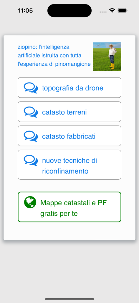
Menu interface of Mappe Catasto e ziopino app showing AI consultation options for Italian land registry and drone topography
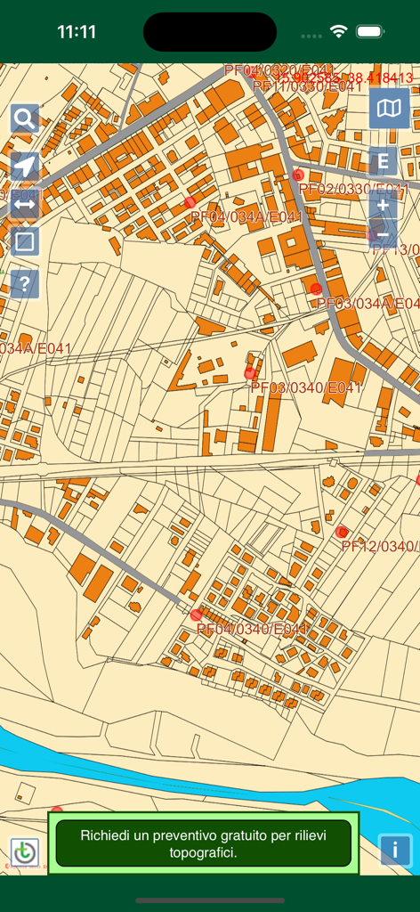
Detailed view of the Italian cadastral map showing land parcels buildings and fiducial points
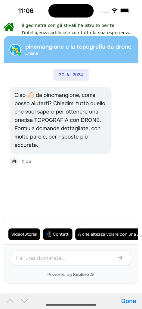
Chat interface of the Mappe Catasto app featuring an AI assistant for drone topography consulting
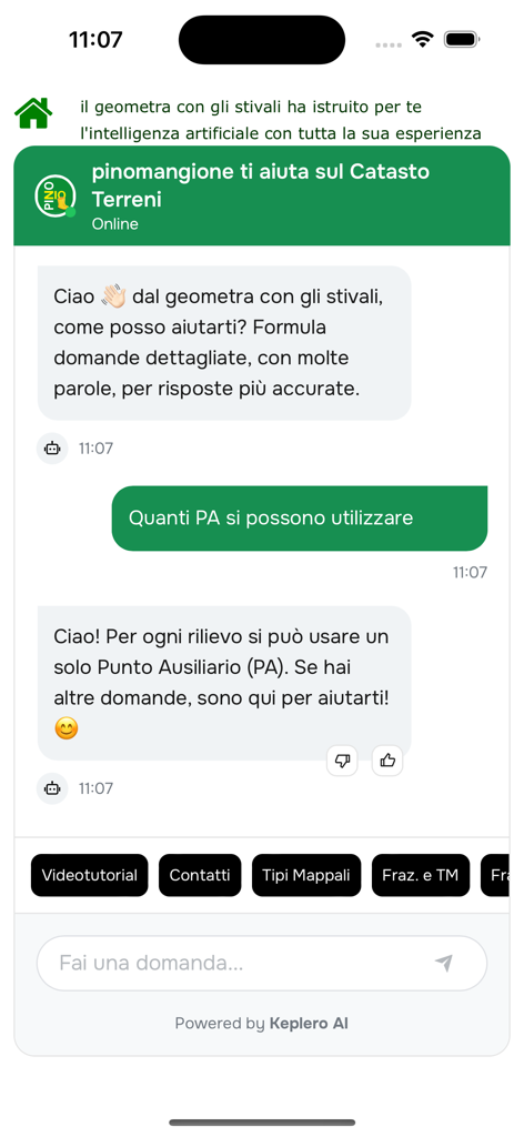
Interface of the Ziopino AI assistant answering questions about Italian land registry regulations.
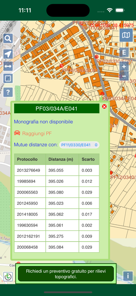
Interface of the Mappe Catasto app showing an Italian land registry map and a table of distances for specific fiducial points.
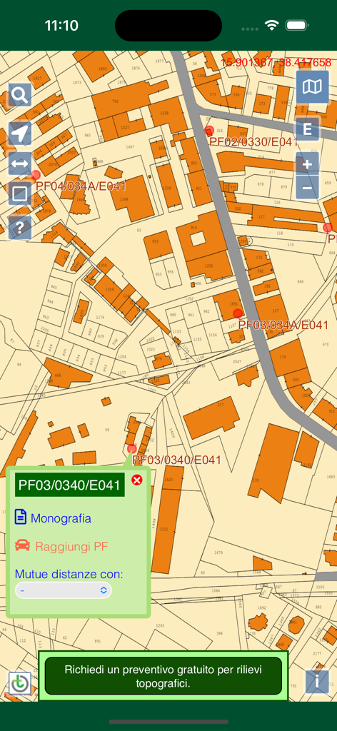
Interface of the Mappe Catasto app showing Italian land registry parcels and fiducial points on a digital map
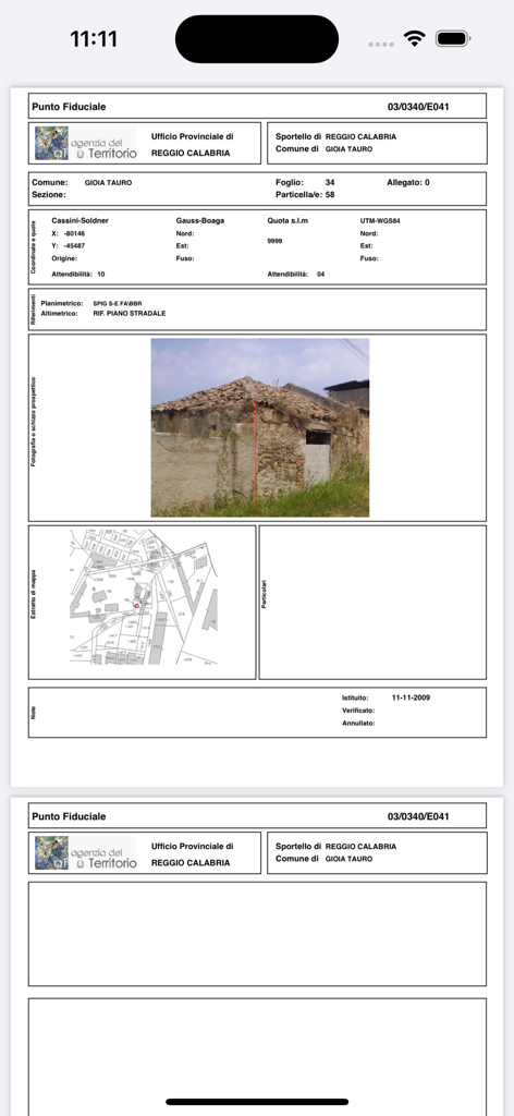
Detailed Italian land registry document showing property photo and cadastral map
Description
Download
More Like This
Top-ranked apps in the same category

Google Maps
Google LLC

Waze Navigation & Live Traffic
waze

AMap Global
AutoNavi Information Technology Co. Ltd.

百度地图-路线规划,出行必备
Beijing Baidu Netcom Science & Technology Co.,Ltd

Moovit: Bus & Transit Tracker
Moovit App Global LTD

Transit • Subway & Bus Times
9280-0366 Quebec inc.

ParkMobile: Park. Pay. Go.
Parkmobile USA, Inc

腾讯地图-路线规划,导航地铁打车出行
Shenzhen Tencent Computer Systems Company Limited

Île-de-France Mobilités
Ile de France Mobilites
This page is not an official page of the app or its developer, but an independent editorial publication created for informational and commentary purposes. Unless expressly stated otherwise, neither the app nor its developer is affiliated with, endorsed by, sponsored by, authorized by, or otherwise officially connected with MWM, Apple, Google Play, the app publisher, or the app's developer, and nothing on this page implies that the app was developed using MWM's services. Any trademarks, logos, screenshots, and other content remain the property of their respective owners.