This page is not an official page of the app or its developer, but an independent editorial publication created for informational and commentary purposes. Unless expressly stated otherwise, neither the app nor its developer is affiliated with, endorsed by, sponsored by, authorized by, or otherwise officially connected with MWM, Apple, Google Play, the app publisher, or the app's developer, and nothing on this page implies that the app was developed using MWM's services. Any trademarks, logos, screenshots, and other content remain the property of their respective owners.

Marine Traffic: Ship Tracker
The world's most powerful maritime intelligence tool for professionals and yacht owners. Track over 500,000 vessels with live satellite positioning, precise port schedules, and hyper-local nautical weather.
Downloads
25K+User Rating
Total Ratings
0Publisher
Category
NavigationLocales
1Latest Version
2.1.5Size
271.9 MBFirst Released
May 5, 2025Professional-Grade Maritime Intelligence
Harness the power of real-time AIS data with global tracking for over 500,000 vessels, designed for maritime professionals and affluent enthusiasts who require absolute precision.
Real-Time Global AIS Tracking
Access up-to-the-minute positions for cargo ships, cruise liners, and yachts worldwide with satellite-grade accuracy.
Advanced Navigation & Weather
Monitor active routes and cross-reference marine weather forecasts to ensure safe and efficient voyage planning.
The following screenshots and description are sourced directly from the app's official store listing and are the property of the app developer.
App Store
Screenshots
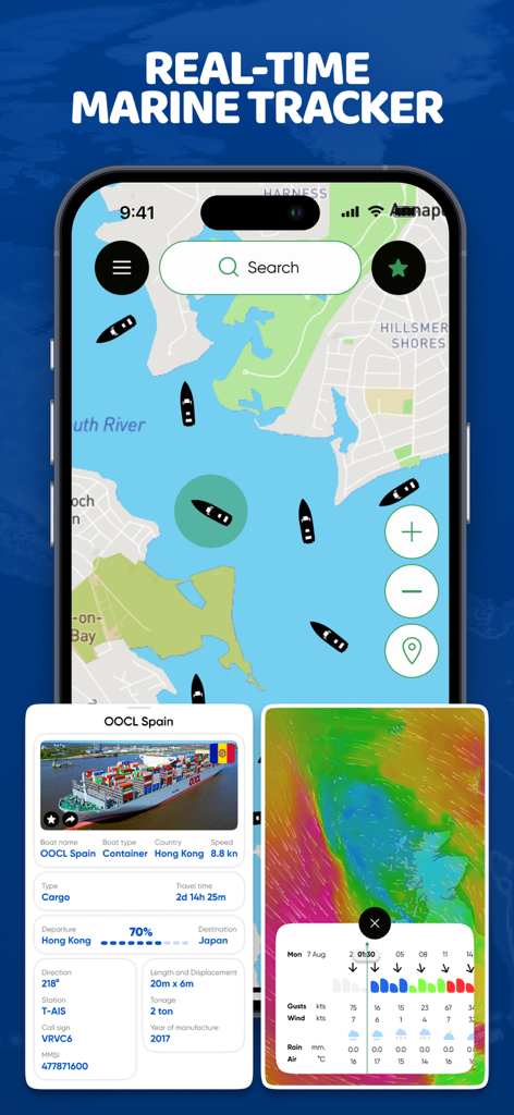
A smartphone displaying a real-time marine map with ship tracking data and weather overlays
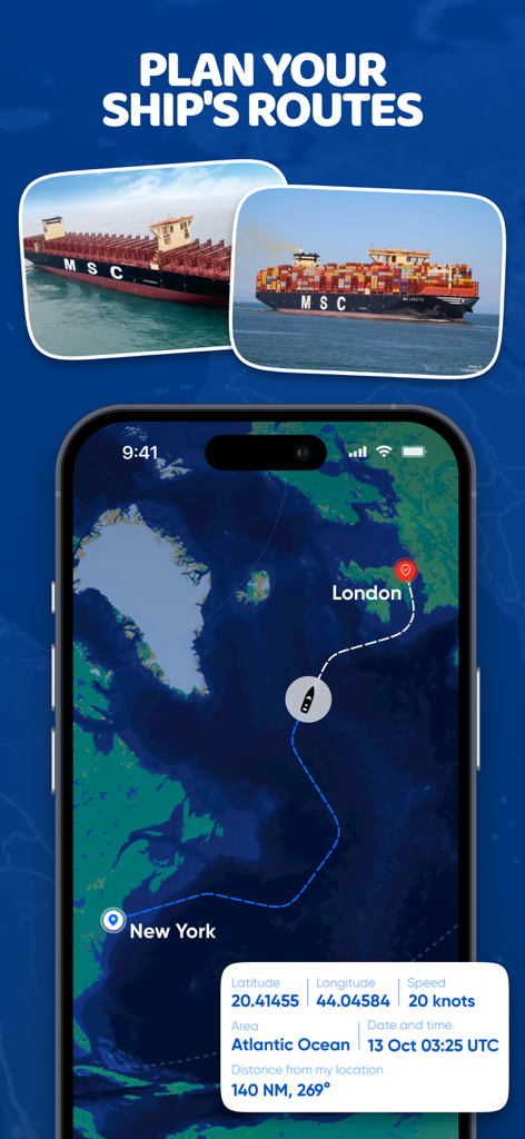
Mobile app interface showing a ship's navigation route from New York to London with real-time tracking data like speed and coordinates.
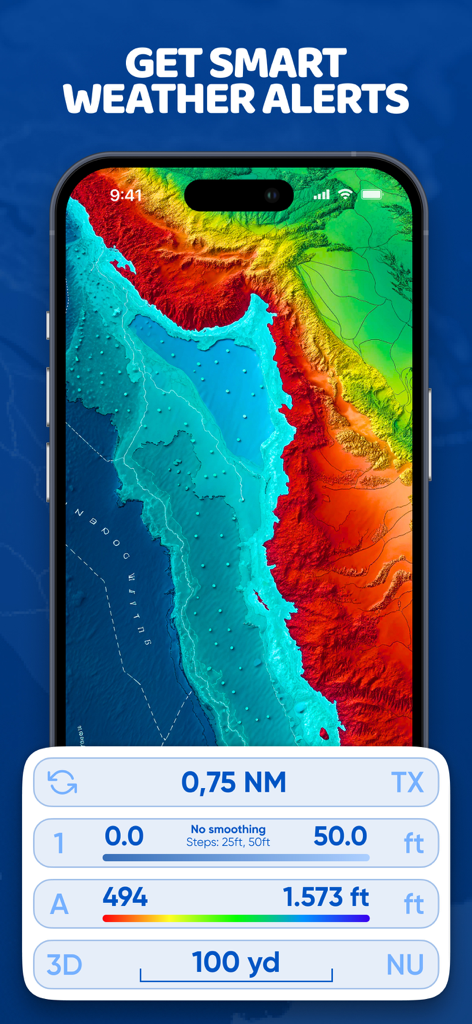
A colorful marine topographic map on a smartphone with weather alert text and nautical measurement data
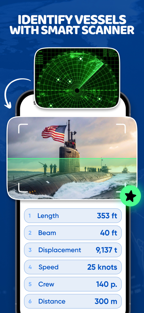
Marine Traffic app interface showing a smart scanner identifying a submarine with vessel specifications like length and speed
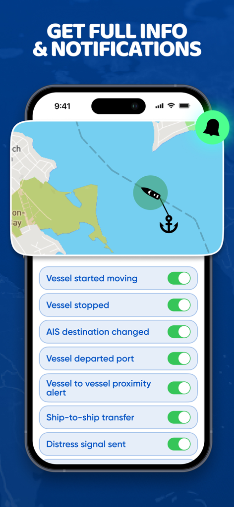
Vessel tracking notifications and map interface in the Marine Traffic app
Description
Download
More Like This
Apps with similar features and user experience

Ship Info
Oleksiy Koldunov

Ship Tracker
Rocketech sp. z o.o.

Boat Watch - Ship Tracking
Pocket Mariner Ltd.

MarineRadar・Vessel Finder
Lascade LLC

Marine Traffic :Ship Tracker
Kathy Spencer

MyShipTracking
Nativity

Boat Beacon
Pocket Mariner Ltd.

Boat Watch Pro
Pocket Mariner Ltd.

Ship Finder
pinkfroot limited
This page is not an official page of the app or its developer, but an independent editorial publication created for informational and commentary purposes. Unless expressly stated otherwise, neither the app nor its developer is affiliated with, endorsed by, sponsored by, authorized by, or otherwise officially connected with MWM, Apple, Google Play, the app publisher, or the app's developer, and nothing on this page implies that the app was developed using MWM's services. Any trademarks, logos, screenshots, and other content remain the property of their respective owners.