This page is not an official page of the app or its developer, but an independent editorial publication created for informational and commentary purposes. Unless expressly stated otherwise, neither the app nor its developer is affiliated with, endorsed by, sponsored by, authorized by, or otherwise officially connected with MWM, Apple, Google Play, the app publisher, or the app's developer, and nothing on this page implies that the app was developed using MWM's services. Any trademarks, logos, screenshots, and other content remain the property of their respective owners.

MGP Tsunamis
Protect your family and stay informed with authoritative flood zone maps, live earthquake alerts, and essential prevention guides directly from the Peruvian Navy’s Tsunami Warning Center.
Downloads
23K+User Rating
Total Ratings
0Publisher
Category
NewsLocales
1Latest Version
9.2.21Size
80.3 MBFirst Released
Jan 14, 2016Protect Your Loved Ones with Official Data
MGP Tsunamis provides authoritative, real-time insights from the Peruvian Navy, allowing you to monitor coastal risks and coordinate safety from anywhere in the world.
Instant Seismic Reports
Stay ahead of danger with real-time updates on local and international earthquakes directly from the National Tsunami Warning Center.
Visual Flood Zone Mapping
Clearly identify high-risk areas using color-coded inundation charts to help your family or team find safe ground immediately.
The following screenshots and description are sourced directly from the app's official store listing and are the property of the app developer.
App Store
Screenshots
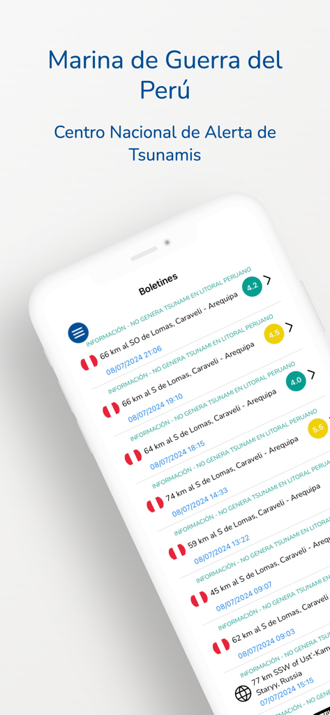
A mobile phone screen displaying a list of official seismic bulletins from the Peruvian Navy National Tsunami Warning Center
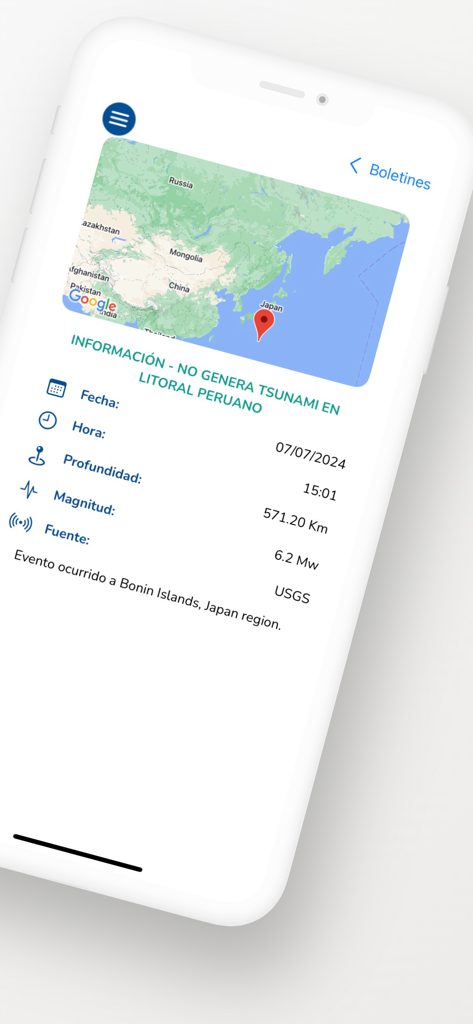
A seismic report on the MGP Tsunamis app showing earthquake data for Japan and its impact on the Peruvian coast.
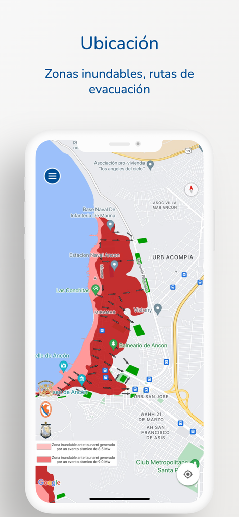
MGP Tsunamis app displaying coastal flood zones and evacuation routes on a map
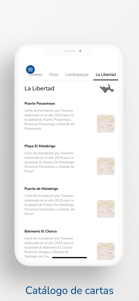
List of tsunami flood zone maps for the La Libertad region in Peru.
Description
Download
More Like This
Top-ranked apps in the same category

X
X Corp.

REDDIT, INC.

Substack
Substack Inc.

NYTimes: US and Global News
The New York Times Company

Nextdoor: Neighborhood Network
Nextdoor.com, Inc.

CrimeRadar Dispatch Audio
Scoopz Inc.

NewsBreak: Local News & Alerts
Particle Media Inc.

Ground News
Snapwise Inc.

Google News
Google LLC
This page is not an official page of the app or its developer, but an independent editorial publication created for informational and commentary purposes. Unless expressly stated otherwise, neither the app nor its developer is affiliated with, endorsed by, sponsored by, authorized by, or otherwise officially connected with MWM, Apple, Google Play, the app publisher, or the app's developer, and nothing on this page implies that the app was developed using MWM's services. Any trademarks, logos, screenshots, and other content remain the property of their respective owners.