This page is not an official page of the app or its developer, but an independent editorial publication created for informational and commentary purposes. Unless expressly stated otherwise, neither the app nor its developer is affiliated with, endorsed by, sponsored by, authorized by, or otherwise officially connected with MWM, Apple, Google Play, the app publisher, or the app's developer, and nothing on this page implies that the app was developed using MWM's services. Any trademarks, logos, screenshots, and other content remain the property of their respective owners.

MilGPS PRO
Master the terrain with 10-digit precision, 3D offline maps, and mission-ready tools. Built for operators, SAR teams, and backcountry explorers who leave nothing to chance.
Downloads
0User Rating
Total Ratings
0Publisher
Category
NavigationLocales
1Latest Version
2.0Size
26.3 MBFirst Released
Mar 13, 2026Mission-Ready Tactical Navigation
Professional-grade tools for elite operators, backcountry hunters, and SAR teams who demand absolute precision and reliability when operating off the grid.
Battle-Tested Grid Precision
Switch instantly between 10-digit MGRS, UTM, and USNG coordinates. Achieve pinpoint accuracy for mission coordination, land navigation drills, or marking remote hunting caches.
True Offline Autonomy
Download high-resolution topographic and satellite maps for 100% offline use. With local data storage and zero cloud tracking, your movements remain private and functional in any environment.
The following screenshots and description are sourced directly from the app's official store listing and are the property of the app developer.
App Store
Screenshots
MilGPS PRO app splash screen featuring tactical grid background and green map pins
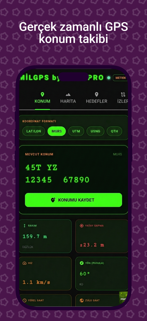
MilGPS PRO app interface displaying precise MGRS coordinates and real-time tactical navigation data like altitude and speed
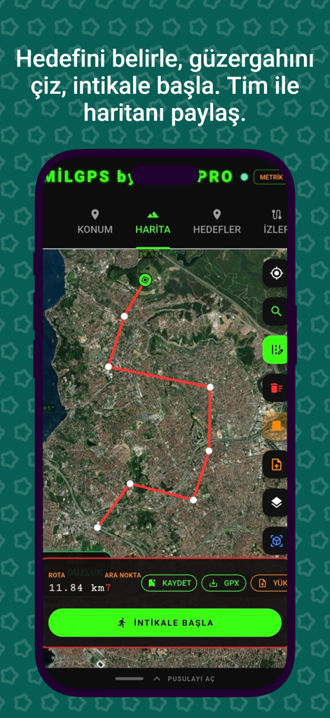
MilGPS PRO app interface showing a planned red route on a satellite map for tactical navigation.
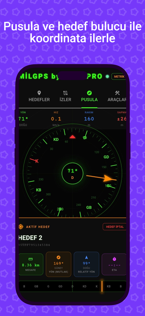
MilGPS PRO app screenshot showing a tactical digital compass with heading altitude and target distance data for military navigation
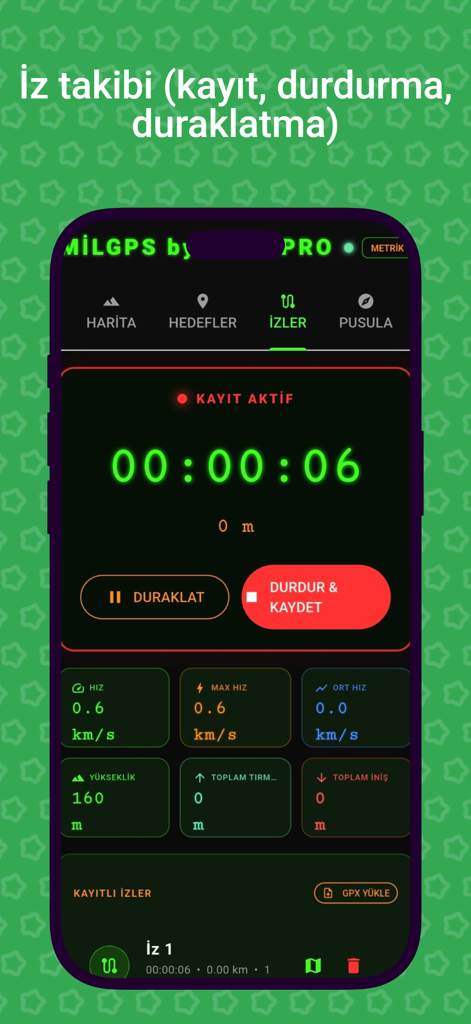
A screenshot of the MilGPS PRO app's tracking interface showing real-time navigation data including timer, speed, and altitude.
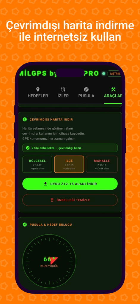
MilGPS PRO tactical navigation interface showing offline map download options and a digital compass
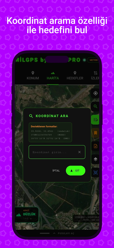
MilGPS PRO app interface showing the coordinate search feature for military and tactical navigation.
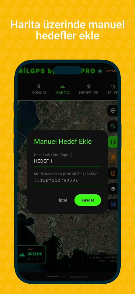
MilGPS PRO app interface showing the manual target entry screen with MGRS coordinates over a satellite map
Description
Download
More Like This
Top-ranked apps in the same category

Google Maps
Google LLC

AMap Global
AutoNavi Information Technology Co. Ltd.

Waze Navigation & Live Traffic
waze

百度地图-路线规划,出行必备
Beijing Baidu Netcom Science & Technology Co.,Ltd

Moovit: Bus & Transit Tracker
Moovit App Global LTD

腾讯地图-路线规划,导航地铁打车出行
Shenzhen Tencent Computer Systems Company Limited

ParkMobile: Park. Pay. Go.
Parkmobile USA, Inc

Transit • Subway & Bus Times
9280-0366 Quebec inc.

MapXplorer: Map Radar Navigate
GOLDLAB APPLICATIONS YAZILIM VE BILISIM ANONIM SIRKETI
This page is not an official page of the app or its developer, but an independent editorial publication created for informational and commentary purposes. Unless expressly stated otherwise, neither the app nor its developer is affiliated with, endorsed by, sponsored by, authorized by, or otherwise officially connected with MWM, Apple, Google Play, the app publisher, or the app's developer, and nothing on this page implies that the app was developed using MWM's services. Any trademarks, logos, screenshots, and other content remain the property of their respective owners.