This page is not an official page of the app or its developer, but an independent editorial publication created for informational and commentary purposes. Unless expressly stated otherwise, neither the app nor its developer is affiliated with, endorsed by, sponsored by, authorized by, or otherwise officially connected with MWM, Apple, Google Play, the app publisher, or the app's developer, and nothing on this page implies that the app was developed using MWM's services. Any trademarks, logos, screenshots, and other content remain the property of their respective owners.

My Altitude and Elevation GPS
Track altitude and coordinates with professional-grade accuracy using UTM, MGRS, and Apple Watch integration. Perfect for hikers, professionals, and explorers who need reliable data where cell service fails.
Downloads
267K+User Rating
Total Ratings
2K+Publisher
Category
NavigationLocales
14Latest Version
6.50Size
72.8 MBFirst Released
Feb 15, 2018Precision Navigation for the Modern Explorer
From professional land surveying to backcountry hiking, master any terrain with high-accuracy elevation data and specialized GPS tools designed for the rugged outdoors.
Hyper-Accurate Elevation Tracking
Monitor your altitude with peak precision using professional coordinate formats like UTM and MGRS, ensuring you always know your exact position on any topographical map.
Smart Geo-Tagged Documentation
Capture photos with embedded location data to scout perfect campsites or document professional field sites, with full support for GPX and KML data exports.
The following screenshots and description are sourced directly from the app's official store listing and are the property of the app developer.
App Store
Screenshots
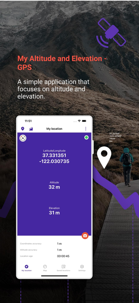
Interface of the My Altitude and Elevation GPS app showing latitude longitude and altitude data over a mountain landscape
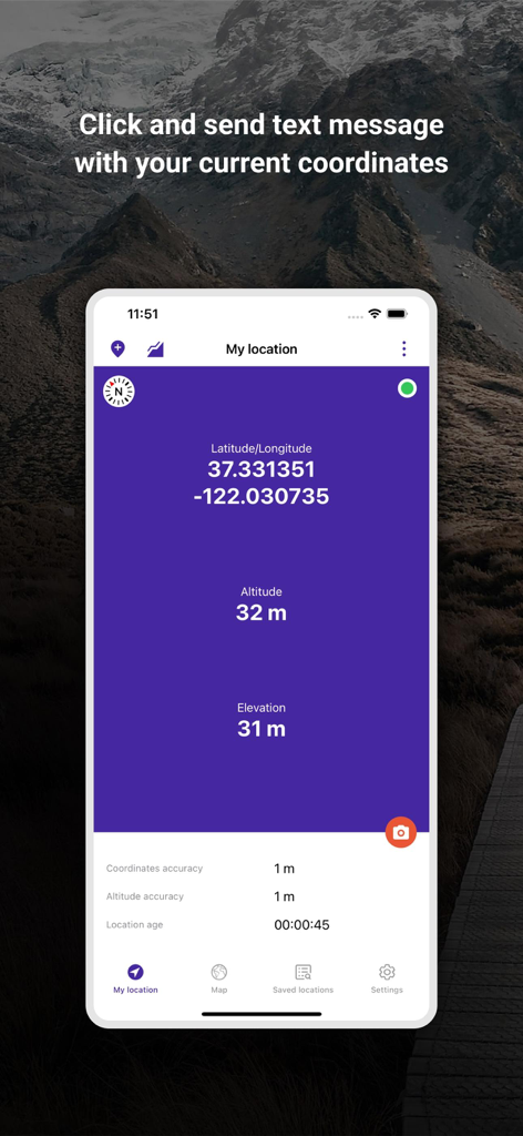
My Altitude and Elevation GPS app interface showing latitude longitude and altitude coordinates
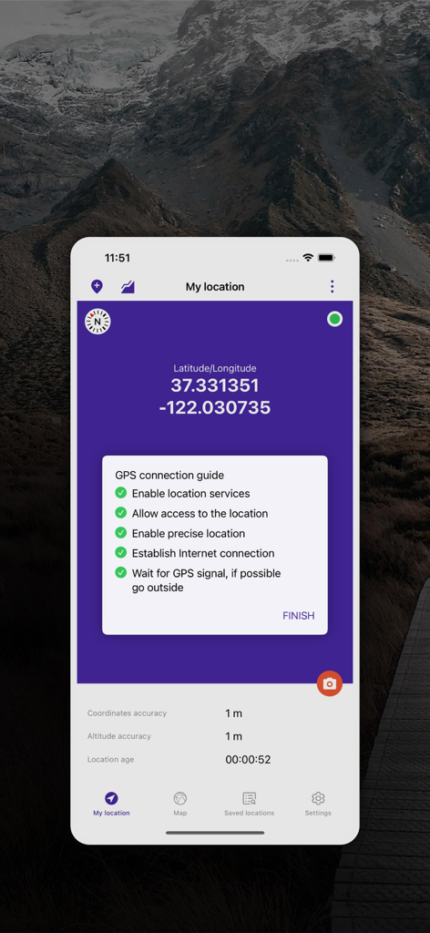
My Altitude and Elevation GPS app screen showing latitude and longitude with location accuracy data
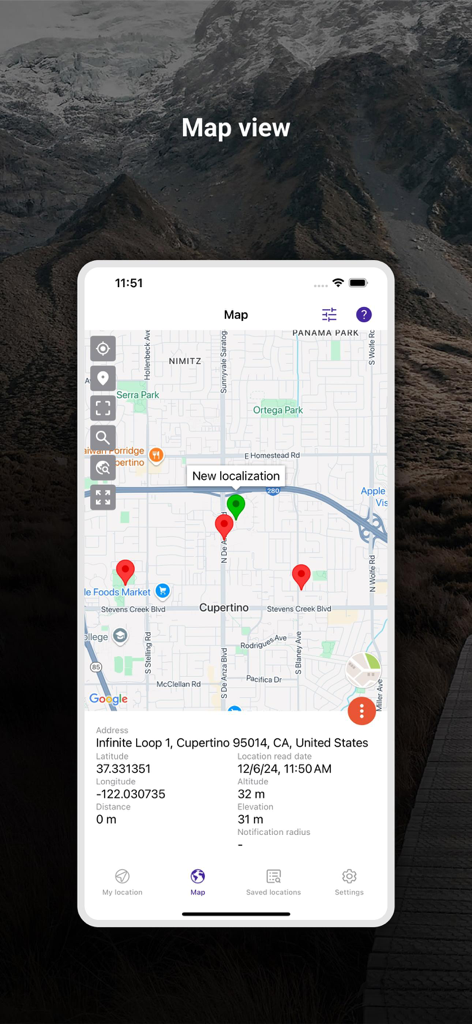
Map view of the My Altitude and Elevation GPS app showing pins and detailed location coordinates
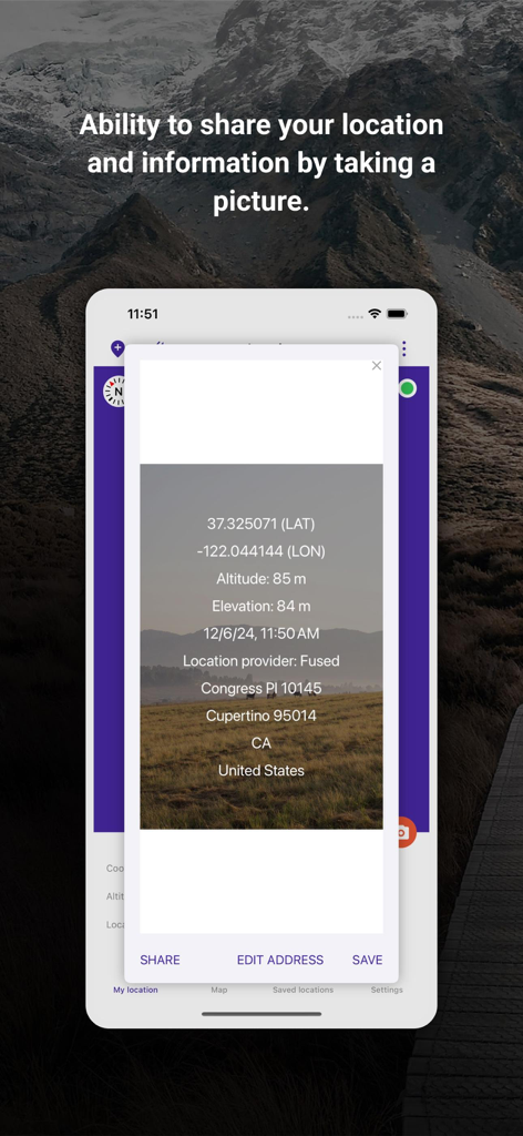
My Altitude app screenshot showing a photo with overlaid GPS coordinates and elevation data for sharing.
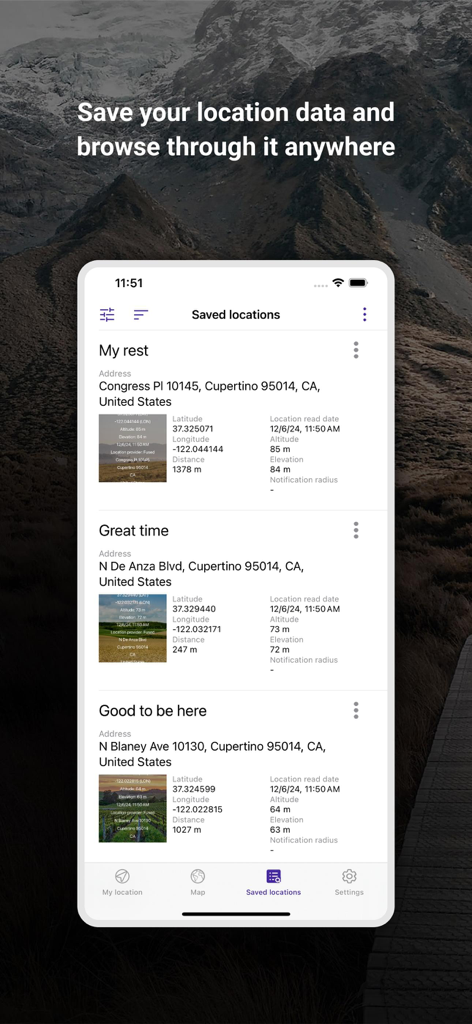
Saved locations list in My Altitude and Elevation GPS app showing coordinates and altitude data
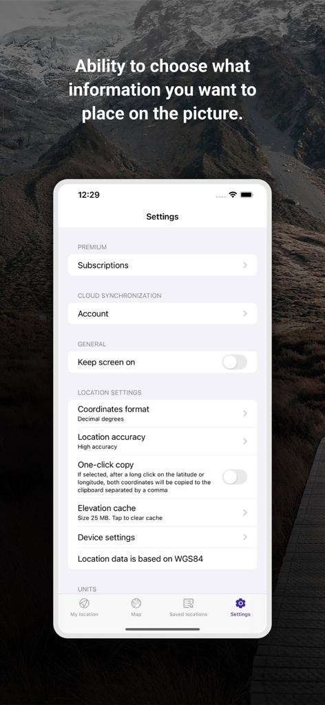
Settings screen of the My Altitude and Elevation GPS app showing coordinate formats and location accuracy options
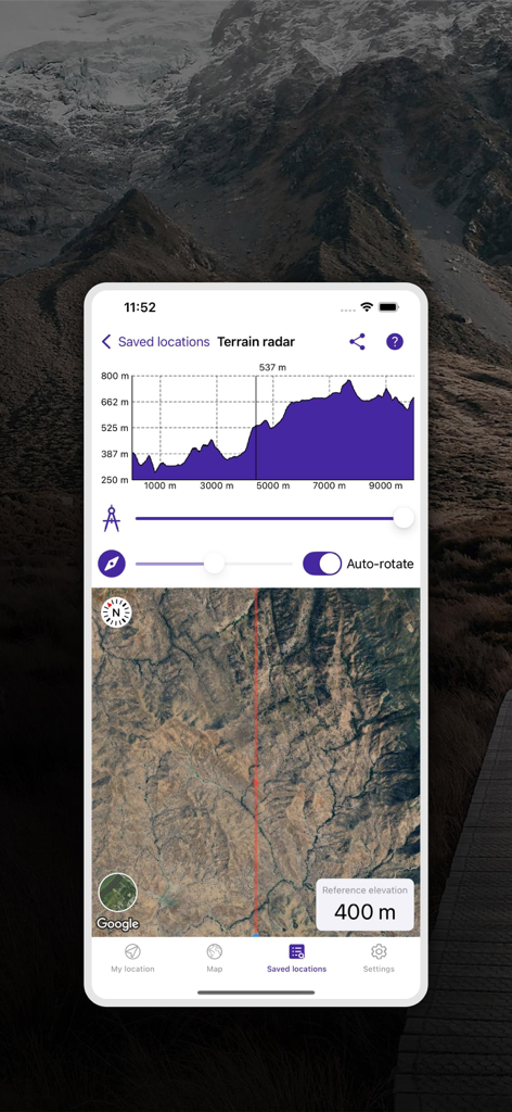
Terrain radar feature showing elevation profile graph and satellite map view
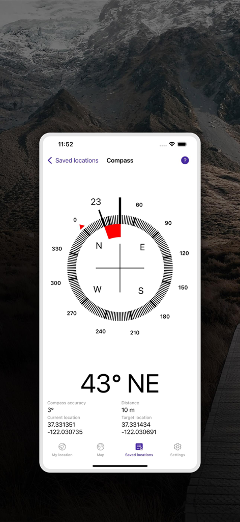
Digital compass interface showing bearing and GPS coordinates for navigation.
Description
Download
More Like This
Top-ranked apps in the same category

Google Maps
Google LLC

Waze Navigation & Live Traffic
waze

AMap Global
AutoNavi Information Technology Co. Ltd.

百度地图-路线规划,出行必备
Beijing Baidu Netcom Science & Technology Co.,Ltd

Moovit: Bus & Transit Tracker
Moovit App Global LTD

Transit • Subway & Bus Times
9280-0366 Quebec inc.

ParkMobile: Park. Pay. Go.
Parkmobile USA, Inc

腾讯地图-路线规划,导航地铁打车出行
Shenzhen Tencent Computer Systems Company Limited

Île-de-France Mobilités
Ile de France Mobilites
This page is not an official page of the app or its developer, but an independent editorial publication created for informational and commentary purposes. Unless expressly stated otherwise, neither the app nor its developer is affiliated with, endorsed by, sponsored by, authorized by, or otherwise officially connected with MWM, Apple, Google Play, the app publisher, or the app's developer, and nothing on this page implies that the app was developed using MWM's services. Any trademarks, logos, screenshots, and other content remain the property of their respective owners.