This page is not an official page of the app or its developer, but an independent editorial publication created for informational and commentary purposes. Unless expressly stated otherwise, neither the app nor its developer is affiliated with, endorsed by, sponsored by, authorized by, or otherwise officially connected with MWM, Apple, Google Play, the app publisher, or the app's developer, and nothing on this page implies that the app was developed using MWM's services. Any trademarks, logos, screenshots, and other content remain the property of their respective owners.

MyMapHK
The essential tool for the prepared traveler. Access official Lands Department geospatial data, offline topographic maps, and over 120 types of public facility layers for unparalleled local accuracy.
Downloads
157K+User Rating
Total Ratings
300Publisher
Category
NavigationLocales
3Latest Version
1.90.0Size
150.2 MBFirst Released
Jun 29, 2014Navigate Hong Kong with Official Precision
The ultimate toolkit for the prepared explorer, combining authoritative government maps with powerful offline capabilities for seamless urban and outdoor journeys.
Official Offline Topography
Access the Lands Department's iB20000 topographic maps without an internet connection, ensuring safety on trails and avoiding international roaming fees.
120+ Facility Data Layers
Overlay specialized data to find government offices, healthcare, and public infrastructure that general consumer apps often miss.
The following screenshots and description are sourced directly from the app's official store listing and are the property of the app developer.
App Store
Screenshots
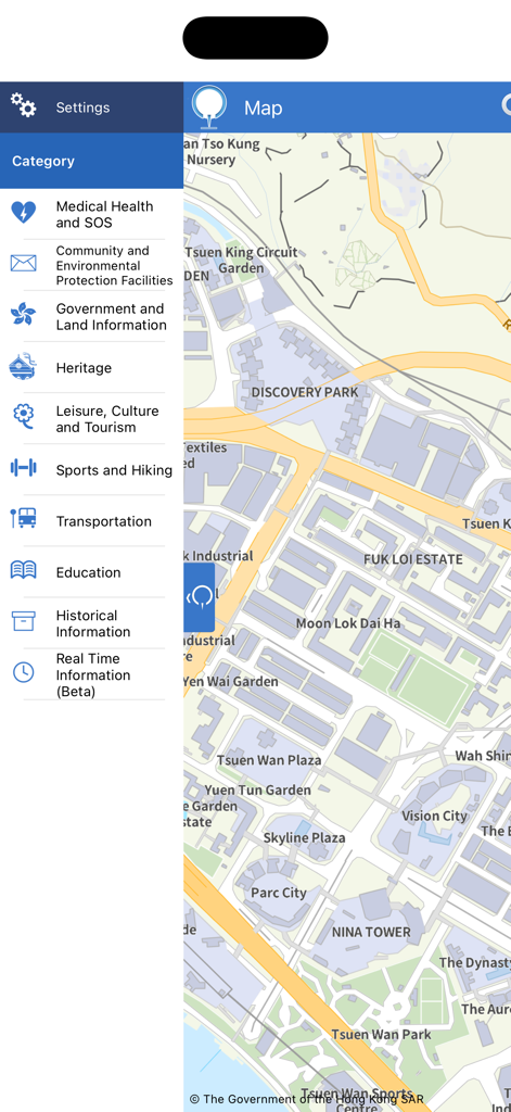
Screenshot of MyMapHK app displaying a map of Hong Kong with a side menu listing various facility categories like transportation and sports
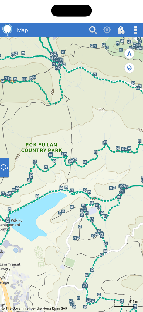
Official topographic map of Pok Fu Lam Country Park showing hiking trails and facility icons
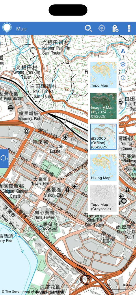
Interface of MyMapHK app showing map layer options including topographic imagery and hiking maps for Hong Kong.
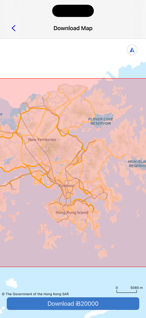
MyMapHK app screen showing the official iB20000 offline topographic map download interface for Hong Kong.
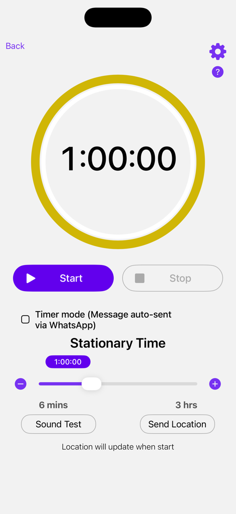
Interface of the MyMapHK app showing the stationary time timer and location sharing options.
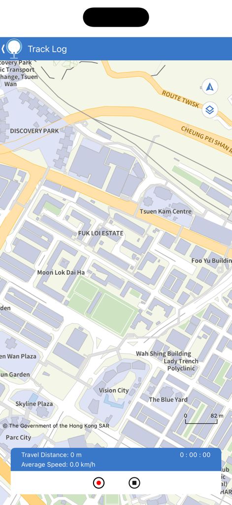
Screenshot of the MyMapHK app showing the Track Log feature on a detailed map of Hong Kong urban areas
Description
Download
More Like This
Top-ranked apps in the same category

Google Maps
Google LLC

Waze Navigation & Live Traffic
waze

AMap Global
AutoNavi Information Technology Co. Ltd.

百度地图-路线规划,出行必备
Beijing Baidu Netcom Science & Technology Co.,Ltd

Moovit: Bus & Transit Tracker
Moovit App Global LTD

Transit • Subway & Bus Times
9280-0366 Quebec inc.

ParkMobile: Park. Pay. Go.
Parkmobile USA, Inc

腾讯地图-路线规划,导航地铁打车出行
Shenzhen Tencent Computer Systems Company Limited

Île-de-France Mobilités
Ile de France Mobilites
This page is not an official page of the app or its developer, but an independent editorial publication created for informational and commentary purposes. Unless expressly stated otherwise, neither the app nor its developer is affiliated with, endorsed by, sponsored by, authorized by, or otherwise officially connected with MWM, Apple, Google Play, the app publisher, or the app's developer, and nothing on this page implies that the app was developed using MWM's services. Any trademarks, logos, screenshots, and other content remain the property of their respective owners.