This page is not an official page of the app or its developer, but an independent editorial publication created for informational and commentary purposes. Unless expressly stated otherwise, neither the app nor its developer is affiliated with, endorsed by, sponsored by, authorized by, or otherwise officially connected with MWM, Apple, Google Play, the app publisher, or the app's developer, and nothing on this page implies that the app was developed using MWM's services. Any trademarks, logos, screenshots, and other content remain the property of their respective owners.

Offline Maps: GPS Tracker GPX
Master the backcountry with unlimited offline maps and precision GPX tracking. Designed for serious explorers who demand technical reliability, zero ads, and total privacy on every trail.
Downloads
64K+User Rating
Total Ratings
200Publisher
Category
NavigationLocales
16Latest Version
3.4.0Size
24.8 MBFirst Released
Jan 24, 2021Engineered for the Off-Grid Explorer
Experience true autonomy in the wild with unlimited offline maps, professional-grade GPX tracking, and advanced technical data—all with zero subscriptions or hidden costs.
Unlimited Offline Reliability
Download entire regions for offline use without limits. Navigate confidently in backcountry 'dead zones' where cellular service and data don't exist.
Subscription-Free Freedom
Escape subscription fatigue. Get full access to background tracking, waypoints, and exports with no ads, no in-app purchases, and no monthly fees.
The following screenshots and description are sourced directly from the app's official store listing and are the property of the app developer.
App Store
Screenshots
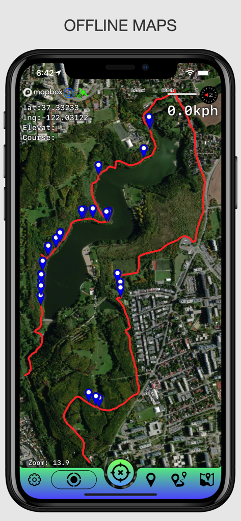
Satellite map view showing a recorded GPX track and waypoints in the Offline Maps GPS Tracker app
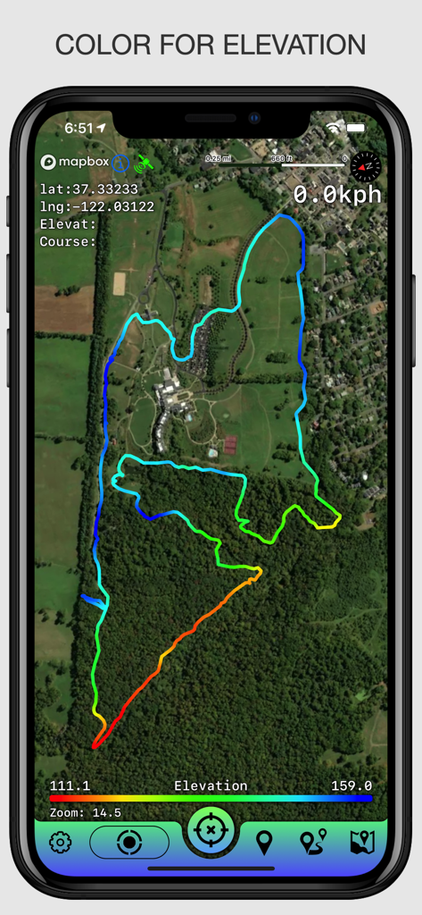
GPS tracker app showing a color coded elevation track on a satellite map
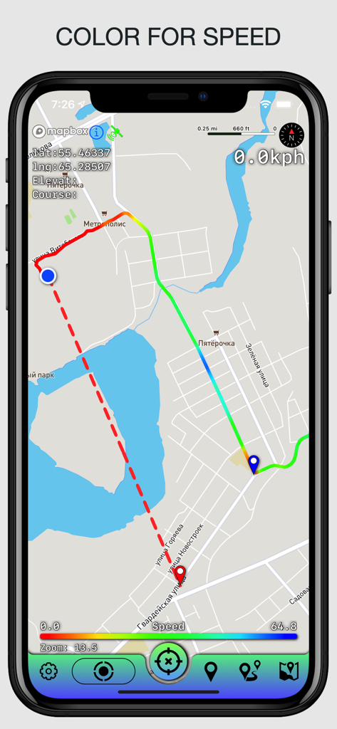
A mobile app interface displaying a GPS track on a map with a color-coded gradient representing different movement speeds.
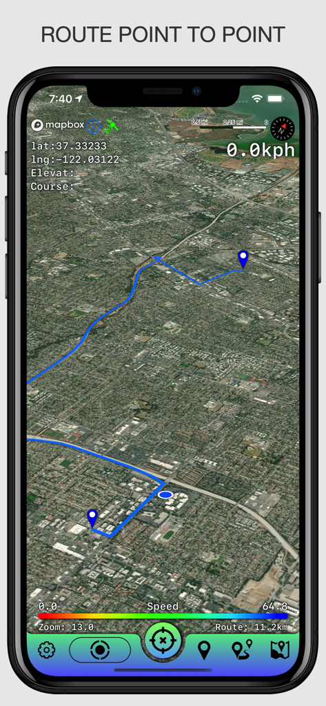
Satellite map view showing a blue route line between two points with GPS coordinates and speed data.
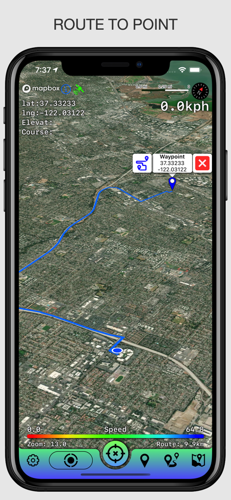
Satellite map view showing a navigation route to a specific waypoint with coordinates.
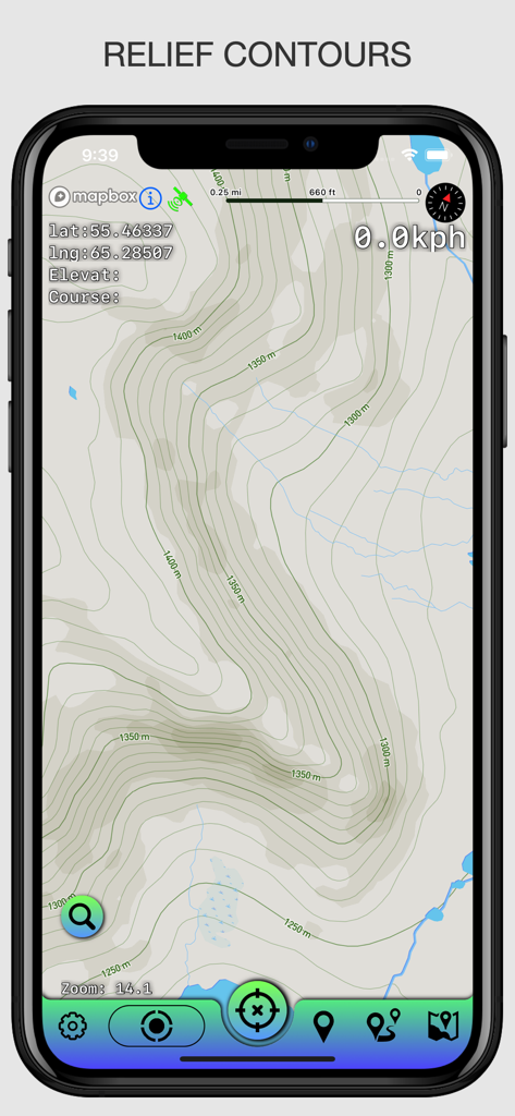
Topographical map display showing relief contours and GPS coordinates on a smartphone.
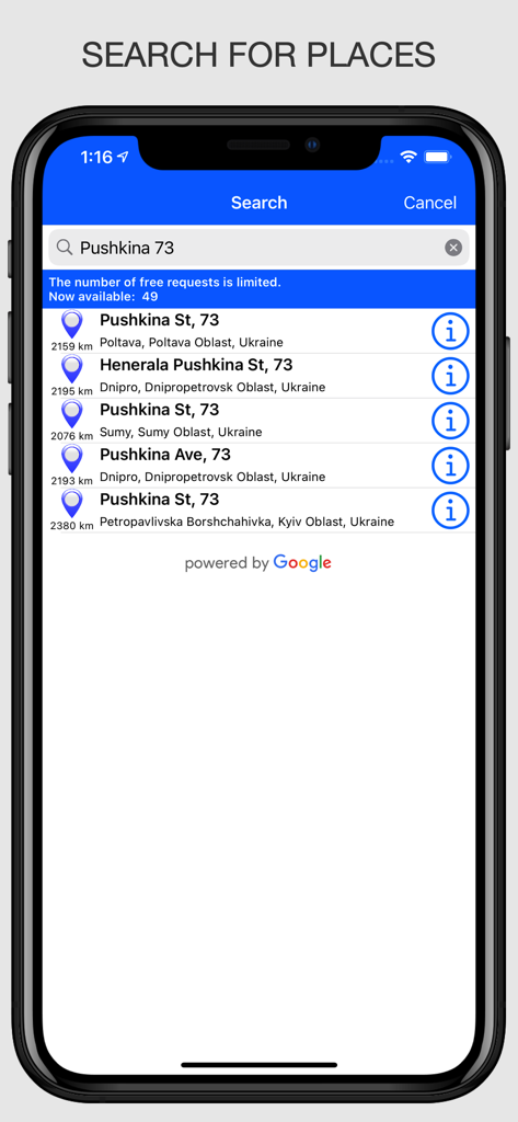
Mobile interface showing the search for places feature in the Offline Maps app
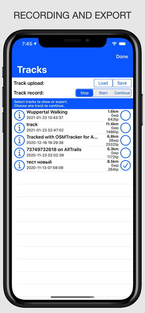
Interface showing a list of recorded GPS tracks with options to start stop and export GPX files in the Offline Maps app
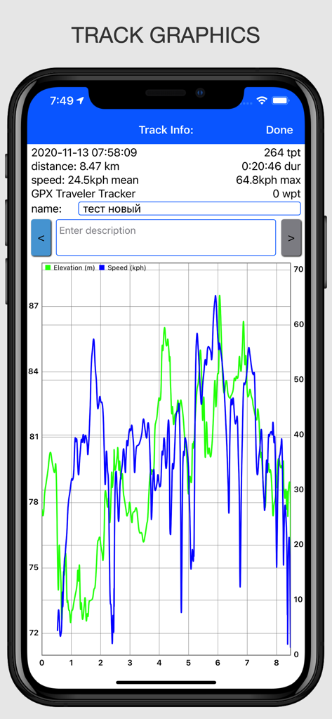
GPS tracker app showing track graphics for speed and elevation over distance
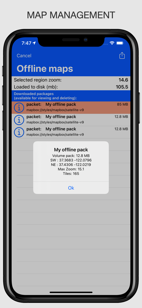
Interface showing the management and technical details of downloaded offline map packages in the app
Description
Download
More Like This
Top-ranked apps in the same category

Google Maps
Google LLC

Waze Navigation & Live Traffic
waze

AMap Global
AutoNavi Information Technology Co. Ltd.

百度地图-路线规划,出行必备
Beijing Baidu Netcom Science & Technology Co.,Ltd

Moovit: Bus & Transit Tracker
Moovit App Global LTD

Transit • Subway & Bus Times
9280-0366 Quebec inc.

ParkMobile: Park. Pay. Go.
Parkmobile USA, Inc

腾讯地图-路线规划,导航地铁打车出行
Shenzhen Tencent Computer Systems Company Limited

Île-de-France Mobilités
Ile de France Mobilites
This page is not an official page of the app or its developer, but an independent editorial publication created for informational and commentary purposes. Unless expressly stated otherwise, neither the app nor its developer is affiliated with, endorsed by, sponsored by, authorized by, or otherwise officially connected with MWM, Apple, Google Play, the app publisher, or the app's developer, and nothing on this page implies that the app was developed using MWM's services. Any trademarks, logos, screenshots, and other content remain the property of their respective owners.