This page is not an official page of the app or its developer, but an independent editorial publication created for informational and commentary purposes. Unless expressly stated otherwise, neither the app nor its developer is affiliated with, endorsed by, sponsored by, authorized by, or otherwise officially connected with MWM, Apple, Google Play, the app publisher, or the app's developer, and nothing on this page implies that the app was developed using MWM's services. Any trademarks, logos, screenshots, and other content remain the property of their respective owners.

OilTrails
The ultimate lease locator for energy professionals. Search by API or legal description, access offline GPS for remote lease roads, and check past precipitation to avoid mud and stay on schedule.
Downloads
41K+User Rating
Total Ratings
300Publisher
Category
NavigationLocales
1Latest Version
2.3.027Size
118.2 MBFirst Released
Sep 15, 2016Precision Tools for the Oilfield Professional
Navigate the 'last mile' of lease roads, access critical well data, and monitor site conditions—all from a single, field-tested interface designed for the energy sector.
Offline-Ready Site Navigation
Navigate remote lease roads without cell service using turn-by-turn GPS that continues to function even in the deepest dead zones.
Search by API or Legal Land
Stop guessing locations. Find your next job site instantly by entering API numbers, operator names, or legal land descriptions across 13 states.
The following screenshots and description are sourced directly from the app's official store listing and are the property of the app developer.
App Store
Screenshots
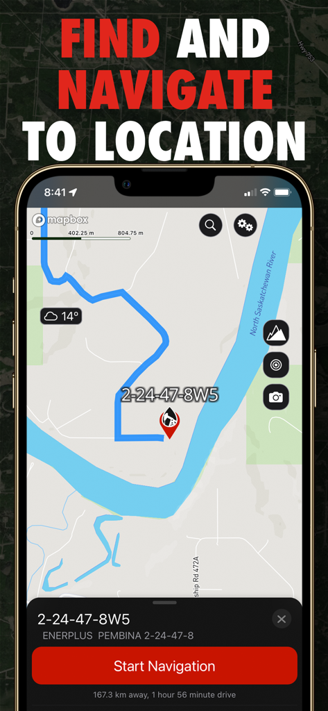
Navigation screen of the OilTrails app showing a route to an oil well site with a start navigation button
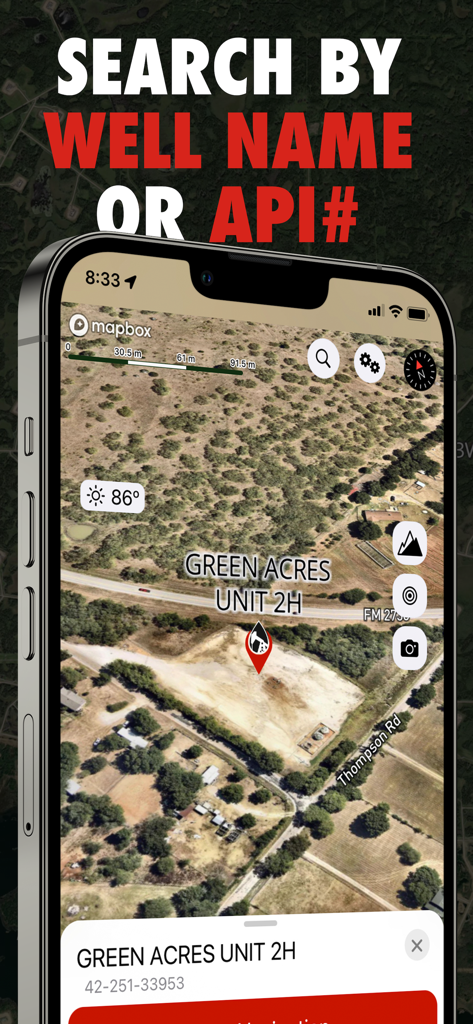
OilTrails app screen showing a satellite map location for Green Acres Unit 2H with search by well name or API number feature
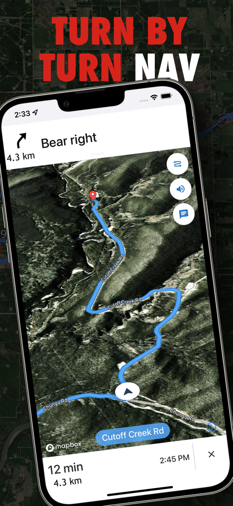
A screenshot of the OilTrails app showing turn-by-turn navigation on a satellite map for oil and gas field locations.
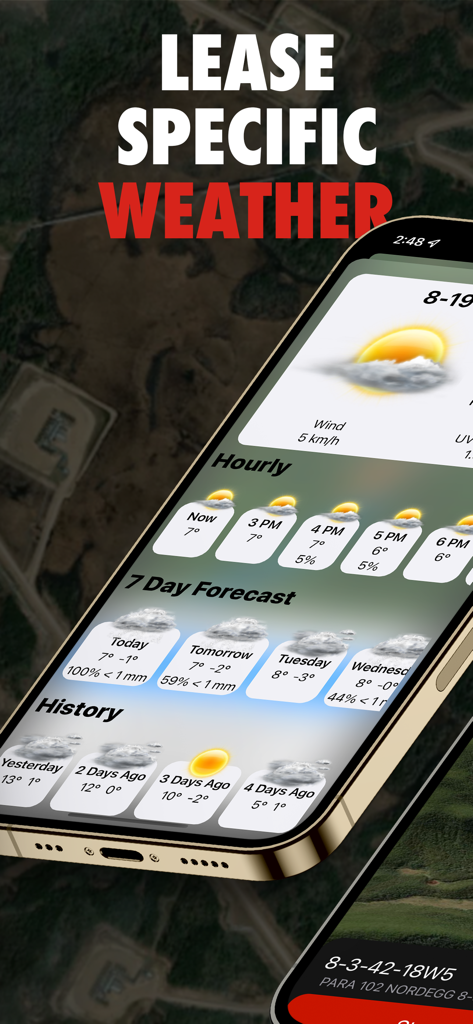
OilTrails mobile app interface showing lease specific weather forecasts and precipitation history for oil field operations
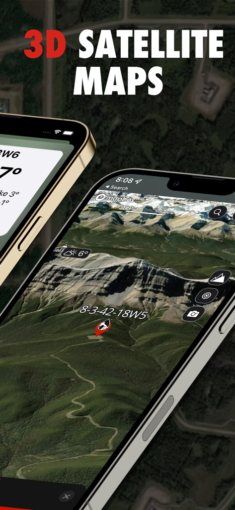
OilTrails app interface showing 3D satellite maps of oil well locations
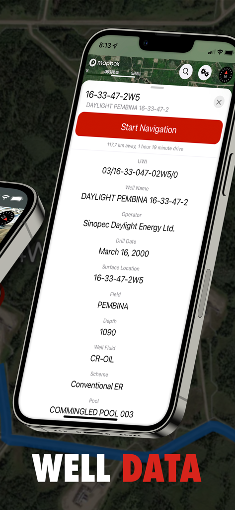
OilTrails app screen displaying detailed oil well information including operator drill date and field data
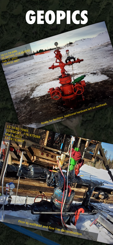
OilTrails app interface displaying geotagged photos of oil wellheads with GPS coordinates and status notes
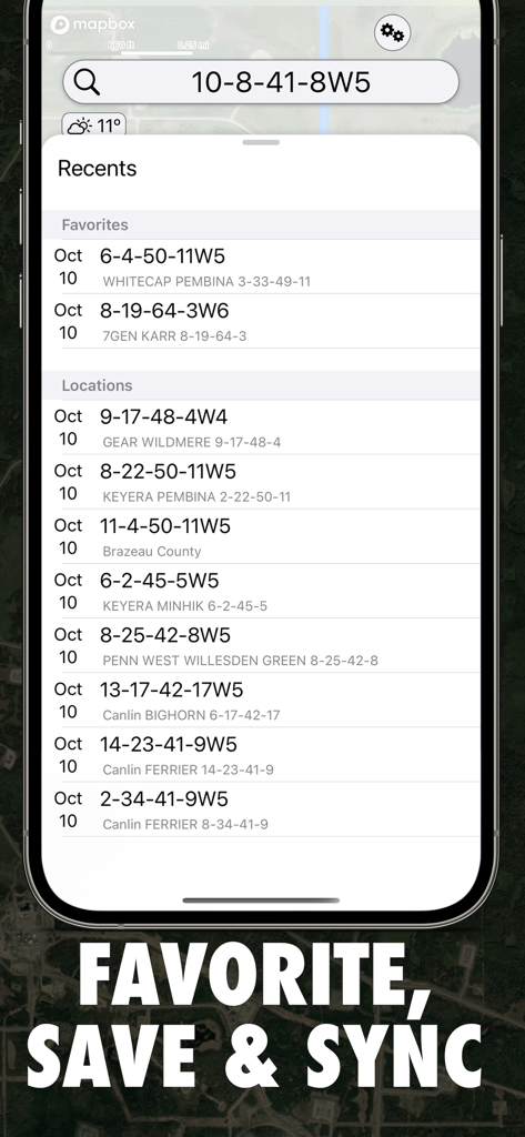
OilTrails app interface showing favorite and recent oilfield locations with legal land descriptions
Description
Download
More Like This
Apps with similar features and user experience


This page is not an official page of the app or its developer, but an independent editorial publication created for informational and commentary purposes. Unless expressly stated otherwise, neither the app nor its developer is affiliated with, endorsed by, sponsored by, authorized by, or otherwise officially connected with MWM, Apple, Google Play, the app publisher, or the app's developer, and nothing on this page implies that the app was developed using MWM's services. Any trademarks, logos, screenshots, and other content remain the property of their respective owners.