This page is not an official page of the app or its developer, but an independent editorial publication created for informational and commentary purposes. Unless expressly stated otherwise, neither the app nor its developer is affiliated with, endorsed by, sponsored by, authorized by, or otherwise officially connected with MWM, Apple, Google Play, the app publisher, or the app's developer, and nothing on this page implies that the app was developed using MWM's services. Any trademarks, logos, screenshots, and other content remain the property of their respective owners.

Wellsite Navigator
Stop getting lost where the pavement ends. Navigate proprietary lease roads, search by API or lease name, and work entirely offline with the industry's most reliable mapping tool.
Downloads
172K+User Rating
Total Ratings
600Publisher
Category
NavigationLocales
1Latest Version
3.34.3Size
124.2 MBFirst Released
Jan 22, 2013Built for the Oil Patch
The trusted navigation tool for over 150,000 oilfield professionals. Reach your destination efficiently with proprietary road data and industry-specific search tools designed for the field.
Proprietary Lease Road Maps
Navigate tens of thousands of miles of private dirt and gravel roads that standard GPS apps miss, ensuring you reach the right well pad every time.
Reliable Offline Navigation
Work confidently in remote 'dead zones.' Download your maps and use full turn-by-turn guidance in airplane mode without needing any cell service.
The following screenshots and description are sourced directly from the app's official store listing and are the property of the app developer.
App Store
Screenshots
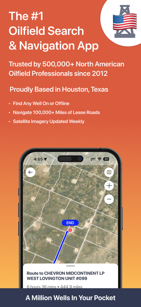
Wellsite Navigator app displaying a satellite map and route to an oil well site.
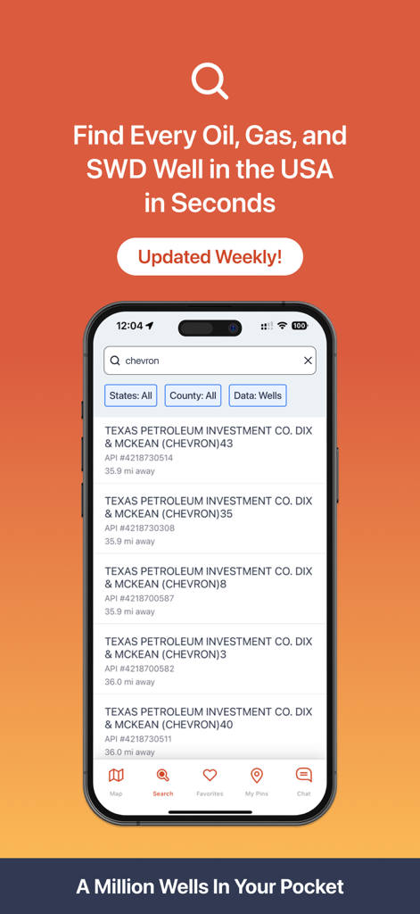
Wellsite Navigator app showing search results for oil and gas wells with API numbers
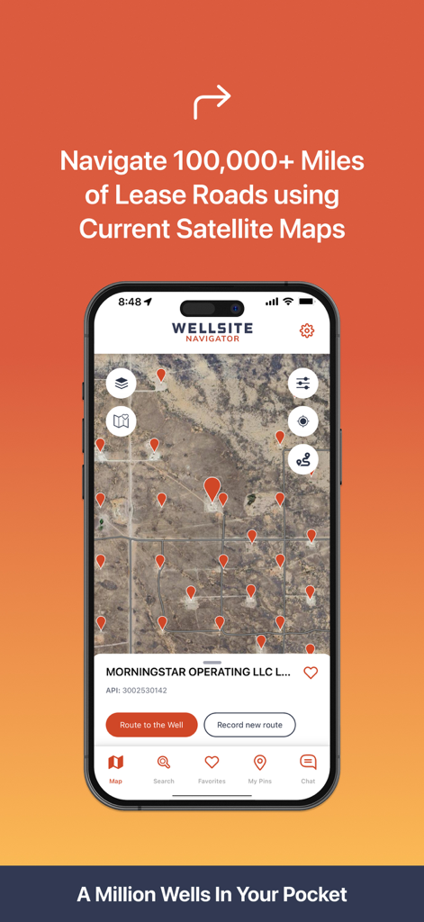
Wellsite Navigator mobile app interface showing oil well locations and satellite mapping for lease roads
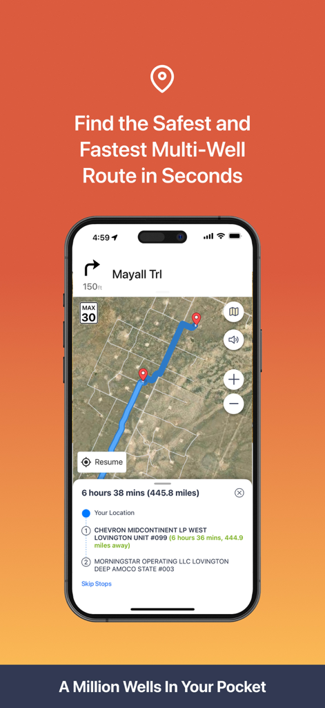
Wellsite Navigator app displaying a multi-stop route on a satellite map for oilfield navigation.
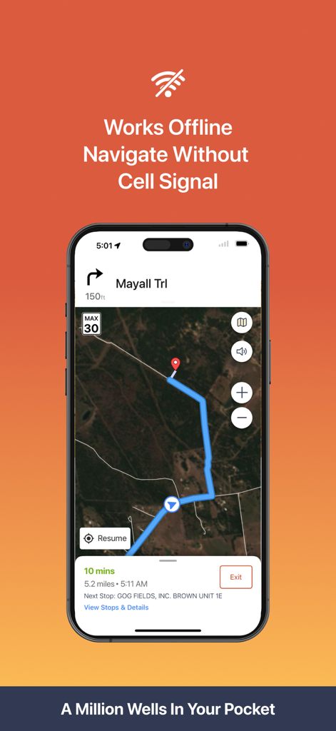
Wellsite Navigator mobile app showing offline satellite navigation to an oilfield location without cell signal
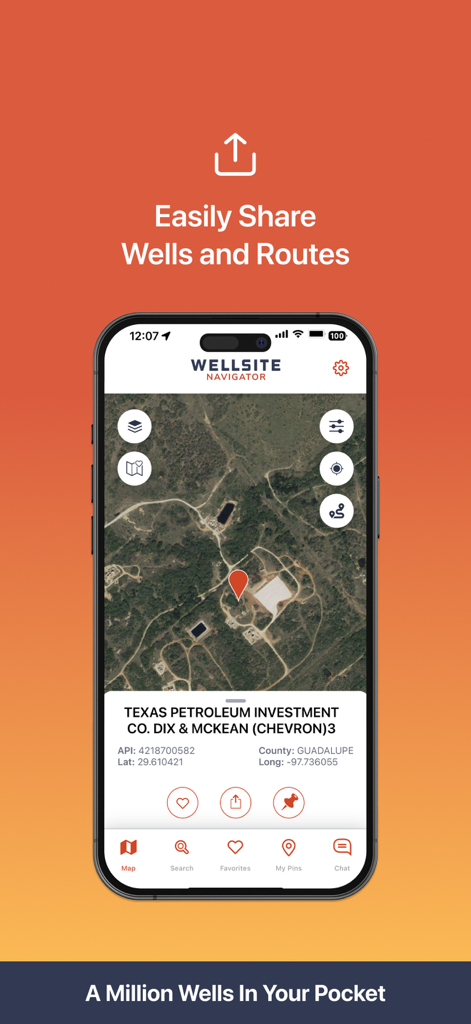
Smartphone showing the Wellsite Navigator app with a well location on a satellite map and sharing options.
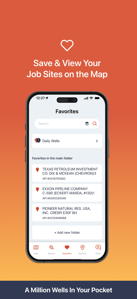
Wellsite Navigator mobile app favorites screen showing saved oilfield job sites with API numbers
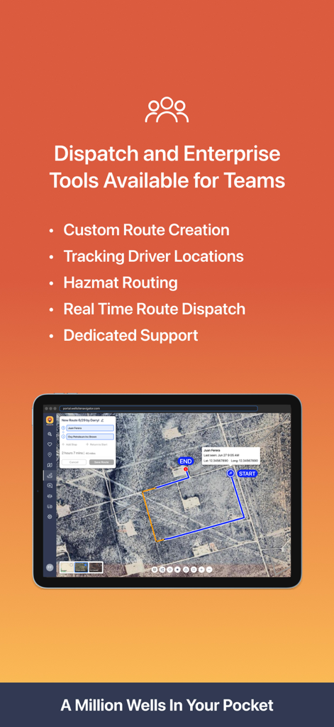
Wellsite Navigator app screen showing enterprise dispatch tools and route tracking for oilfield teams.

Promotional screen for Wellsite Navigator featuring Houston-based live customer support and their Director of Client Success
Description
Download
More Like This
Apps with similar features and user experience


This page is not an official page of the app or its developer, but an independent editorial publication created for informational and commentary purposes. Unless expressly stated otherwise, neither the app nor its developer is affiliated with, endorsed by, sponsored by, authorized by, or otherwise officially connected with MWM, Apple, Google Play, the app publisher, or the app's developer, and nothing on this page implies that the app was developed using MWM's services. Any trademarks, logos, screenshots, and other content remain the property of their respective owners.