This page is not an official page of the app or its developer, but an independent editorial publication created for informational and commentary purposes. Unless expressly stated otherwise, neither the app nor its developer is affiliated with, endorsed by, sponsored by, authorized by, or otherwise officially connected with MWM, Apple, Google Play, the app publisher, or the app's developer, and nothing on this page implies that the app was developed using MWM's services. Any trademarks, logos, screenshots, and other content remain the property of their respective owners.

onWater Fish Maps & Forecast
Stop guessing and start catching. Access real-time streamflows, precise property boundaries, and AI intelligence to maximize your time and efficiency on the water.
Downloads
223K+User Rating
Total Ratings
2K+Publisher
Category
NavigationLocales
1Latest Version
3.0.2Size
189.1 MBFirst Released
Jul 5, 2021Fish with Precision, Not Guesswork
Maximize your time on the water with the ultimate toolkit for the data-driven angler, consolidating real-time conditions, legal access, and AI-powered insights.
Master Public & Private Access
Navigate with confidence using detailed property boundaries. Avoid trespassing while discovering hidden boat ramps and public fishing spots others miss.
Real-Time Streamflow & Temps
Never waste a drive on a 'blown out' river. Track live water conditions and forecasts to know exactly when and where the fishing is optimal.
The following screenshots and description are sourced directly from the app's official store listing and are the property of the app developer.
App Store
Screenshots
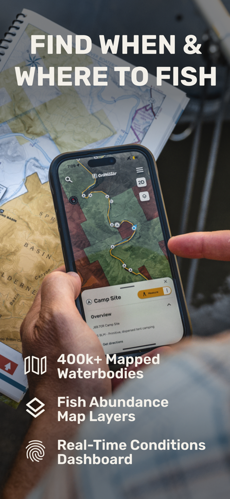
A person using the onWater app to plan a fishing trip with digital maps and real-time data
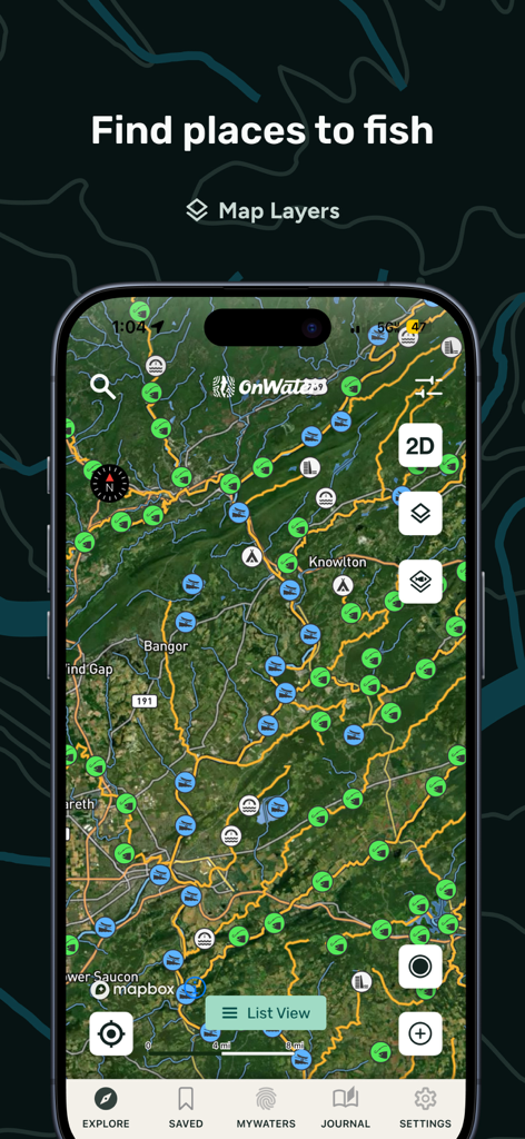
Screenshot of the onWater app showing a satellite map with multiple fishing location markers and map layer options
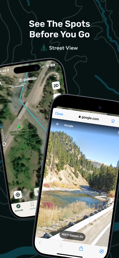
onWater app showing satellite map and street view of a river fishing access point
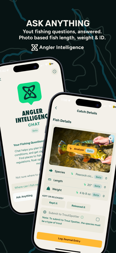
onWater app Angler Intelligence feature showing AI fish species identification and catch analysis
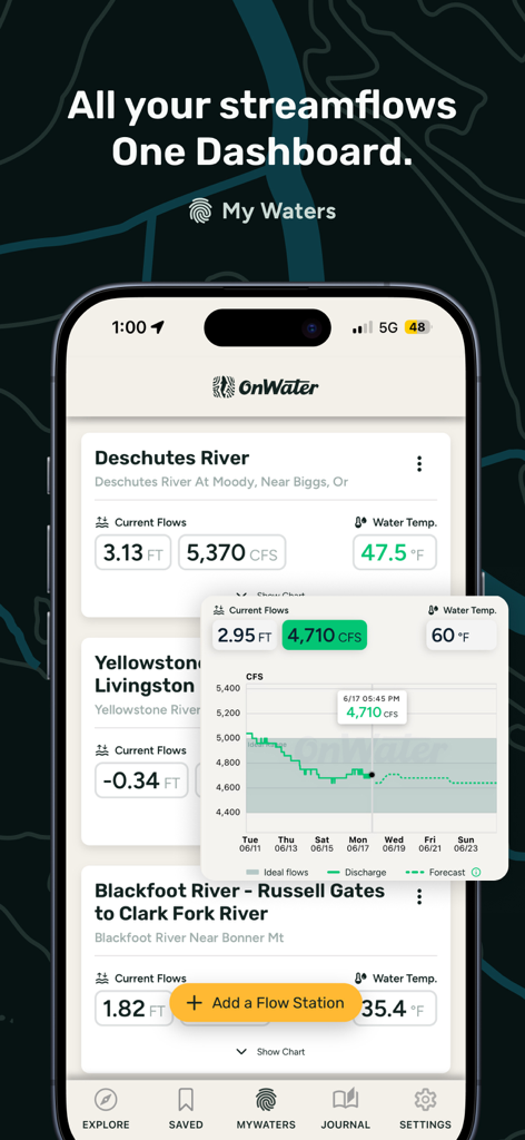
onWater app dashboard displaying river streamflow levels and water temperature data for fishing.
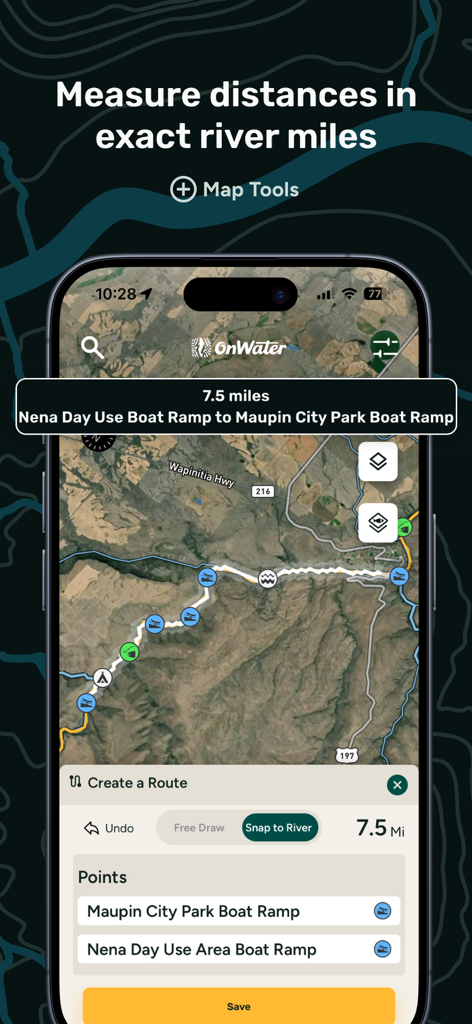
A mobile app screen showing the river measuring tool for calculating distances between boat ramps on a satellite map.
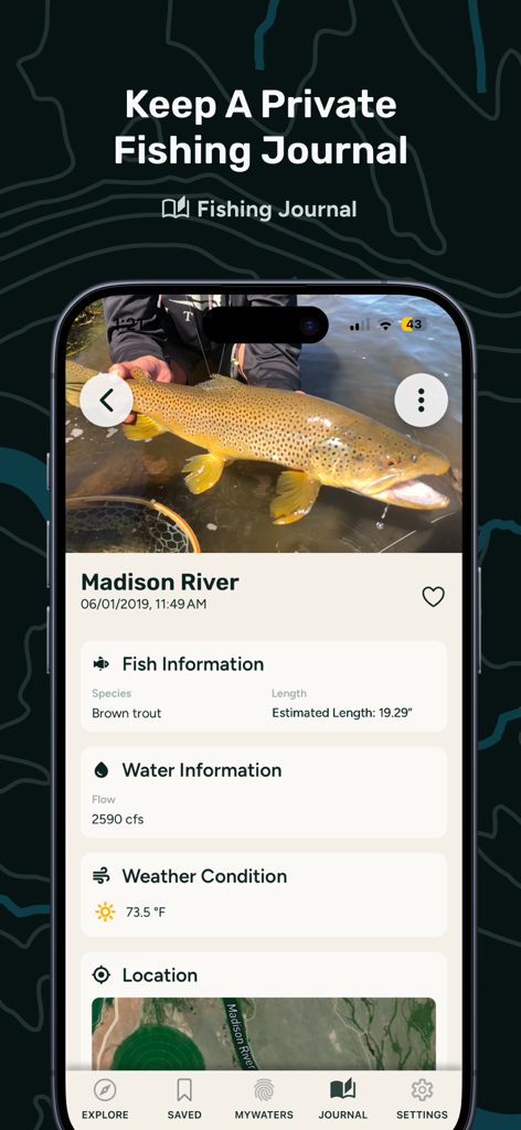
A fishing journal entry in the onWater app featuring a brown trout catch with river flow and weather data
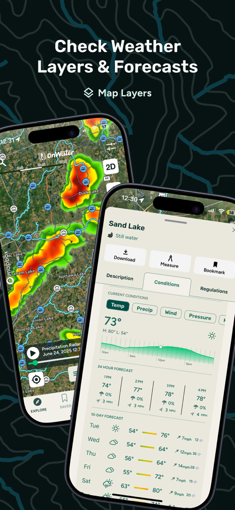
Fishing weather radar and 10-day forecast displayed on a mobile device.
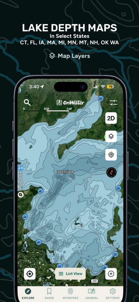
Detailed lake depth map on the onWater fishing app interface.
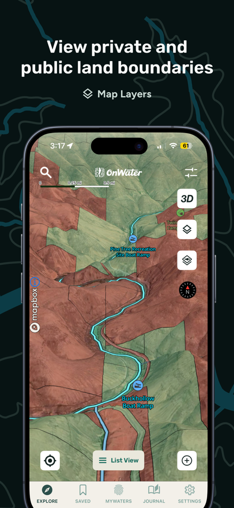
onWater app map view showing public and private land boundaries and boat ramps for anglers
Description
Download
More Like This
Apps with similar features and user experience

FishAngler - Fish Finder App
FishAngler, LLC

钓鱼天气预报
Hefei Sasha Technology Co., Ltd.

潮汐表-潮汐天气预报&钓鱼潮汐天气工具助手
荣虎 太

Fishbrain - Fishing App
FishBrain AB

Fishing Points: Map & Forecast
Fishing Points d.o.o.

onX Fish: Midwest Lake Finder
onXmaps, Inc.

Fishbox - Smart Fishing App
MEMS Group, Inc.

釣果記録FishRanker-フィッシュランカー,釣り,分析
SIIG Inc.

Fish Deeper - Fishing App
Deeper UAB
This page is not an official page of the app or its developer, but an independent editorial publication created for informational and commentary purposes. Unless expressly stated otherwise, neither the app nor its developer is affiliated with, endorsed by, sponsored by, authorized by, or otherwise officially connected with MWM, Apple, Google Play, the app publisher, or the app's developer, and nothing on this page implies that the app was developed using MWM's services. Any trademarks, logos, screenshots, and other content remain the property of their respective owners.