This page is not an official page of the app or its developer, but an independent editorial publication created for informational and commentary purposes. Unless expressly stated otherwise, neither the app nor its developer is affiliated with, endorsed by, sponsored by, authorized by, or otherwise officially connected with MWM, Apple, Google Play, the app publisher, or the app's developer, and nothing on this page implies that the app was developed using MWM's services. Any trademarks, logos, screenshots, and other content remain the property of their respective owners.

Fishing Points: Map & Forecast
Join 12 million anglers using professional-grade nautical charts, solunar feeding times, and detailed weather data to plan, navigate, and catch more fish.
Downloads
2M+User Rating
Total Ratings
66K+Publisher
Category
SportsLocales
11Latest Version
3.1.2Size
217.1 MBFirst Released
Apr 17, 2017Master the Water with Data-Driven Insights
From high-resolution nautical charts to precise feeding forecasts, get everything you need to outsmart the fish and optimize every trip.
Precision Spot Mapping
Locate hidden hotspots with NOAA nautical charts and detailed depth contours to target the perfect underwater structure.
Smart Feeding Forecasts
Maximize your catch by tracking solunar cycles, tides, and barometric pressure to identify peak activity windows.
Frequently Asked Questions
Everything you need to know about Fishing Points: Map & Forecast
How does Fishing Points help users find the best fishing times?
Fishing Points provides detailed fishing forecasts by analyzing tides, moon phases, marine, solunar, and weather data. It offers hourly feeding times, daily fish activity, and a best fishing times calendar for popular species.
What types of maps are available in the Fishing Points app?
Fishing Points offers four types of maps, including detailed satellite fishing maps, worldwide nautical charts, and offline marine nautical maps (NOAA). It also features layers for seagrass, oyster beds, mangroves, and lake maps with depth and contour charts.
Can I save fishing locations and trolling paths in Fishing Points?
Yes, Fishing Points allows users to save fishing spots, locations, hotspots, and waypoints. It also supports recording trolling paths and trotlines, enabling users to easily find their saved locations with GPS.
Does Fishing Points provide river data like water levels and flows?
Yes, Fishing Points provides current water levels and flows for more than 35,000 river stations. This feature helps anglers monitor river conditions to inform their fishing plans.
Can users log their catches within the Fishing Points app?
Yes, Fishing Points includes a private catch logbook. Users can save details for every catch, including photos, weight, and length, with weather, solunar, and tide information automatically added.
Does Fishing Points offer offline functionality for its maps?
Yes, Fishing Points offers an offline mode with marine nautical charts provided by NOAA. This functionality ensures users can access essential map data even without an internet connection.
How many anglers use the Fishing Points app worldwide?
Fishing Points connects more than 12 million anglers worldwide. This global community includes both salt and freshwater fishermen seeking to enhance their fishing experience.
Does Fishing Points show tide predictions and marine forecasts?
Yes, Fishing Points displays hourly tides charts with information on high and low tides, alongside detailed tidal current predictions. It also provides marine forecasts for waves, sea temperature, and ocean currents.
Can I sync my Fishing Points data across multiple devices?
Yes, Fishing Points enables users to sync their saved data across all their computer and mobile devices. A Webapp is also available for planning and analyzing fishing trips on a computer.
Does Fishing Points provide a rain radar feature?
Yes, Fishing Points includes a rain radar feature. This allows users to view live severe weather alerts and track rain intensity on a map, aiding in better trip planning.
The following screenshots and description are sourced directly from the app's official store listing and are the property of the app developer.
App Store
Screenshots
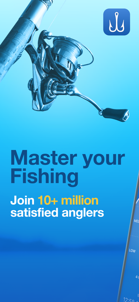
Promotional image for Fishing Points app featuring a fishing reel and the text Master your Fishing.
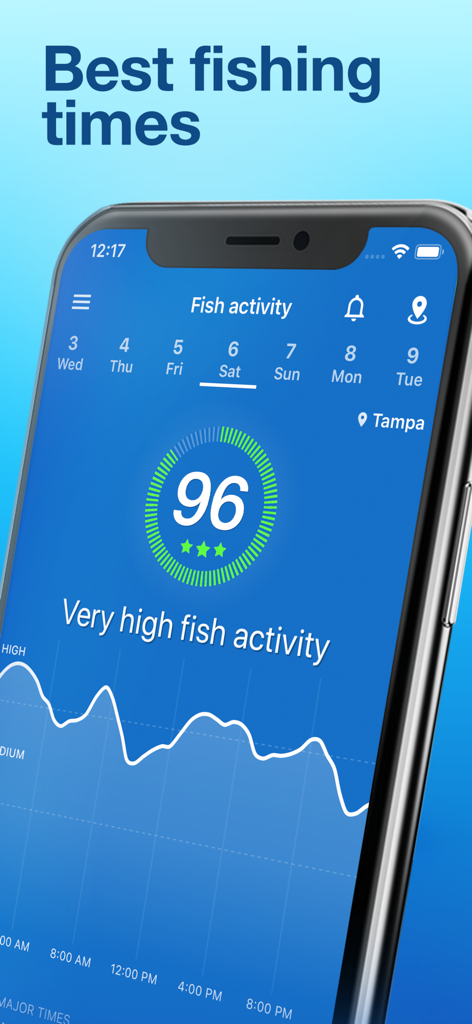
Fishing Points app interface showing a high fish activity forecast and best fishing times graph.
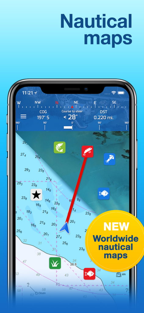
Fishing Points app interface displaying detailed worldwide nautical maps with depth contours and navigation waypoints
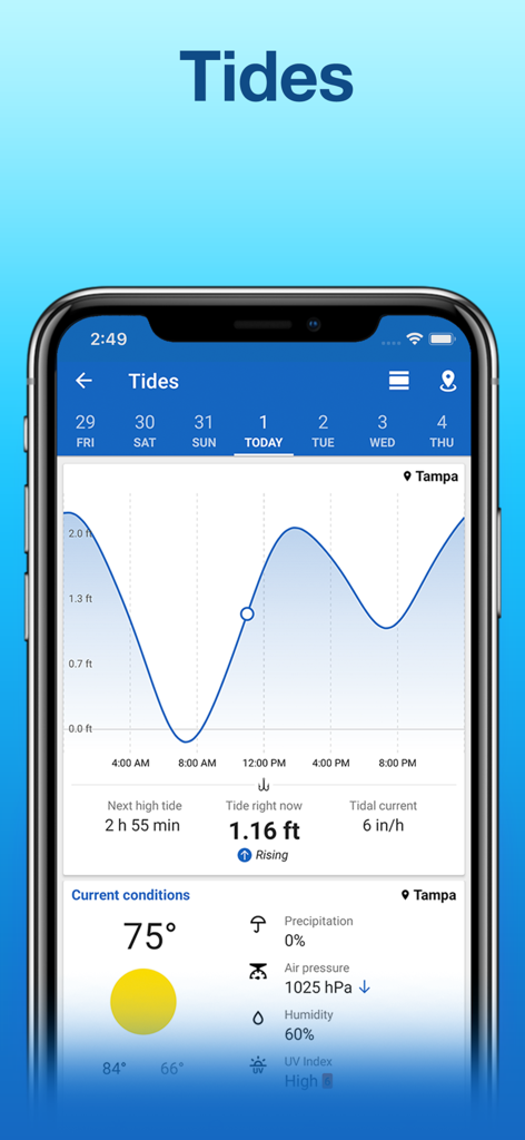
Interface of the Fishing Points app showing tide predictions and weather forecast for Tampa Florida
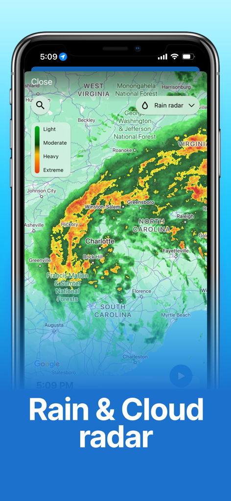
Fishing Points app displaying a live rain and cloud radar forecast map over North and South Carolina.
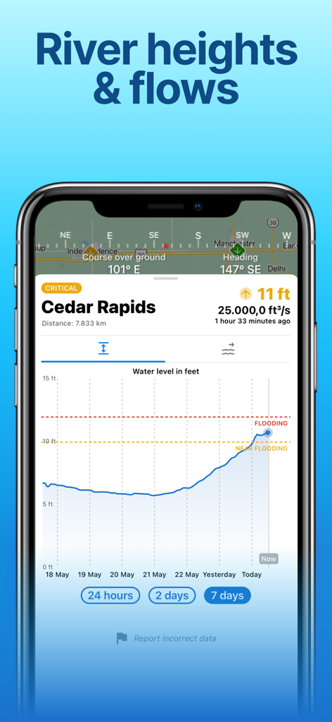
Mobile app screen showing a river water level chart with flooding alerts for Cedar Rapids.
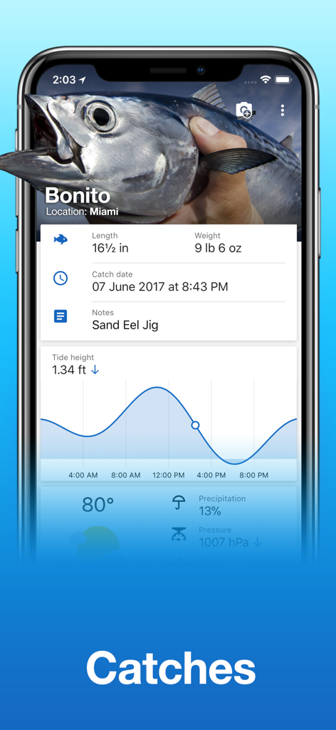
Fishing Points app screen displaying a catch log for a Bonito fish including details like length weight and a tide height graph
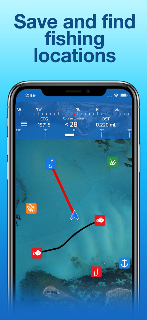
Smartphone screen showing Fishing Points app with a nautical map and saved fishing locations
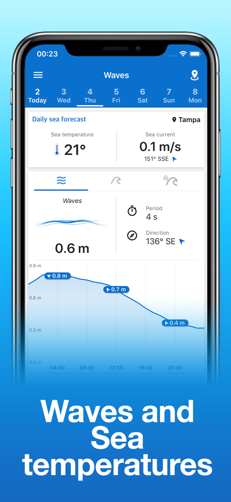
Mobile phone showing wave height and sea temperature forecasts on the Fishing Points app
Description
Download
More Like This
Apps with similar features and user experience

FishAngler - Fish Finder App
FishAngler, LLC

钓鱼天气预报
Hefei Sasha Technology Co., Ltd.

潮汐表-潮汐天气预报&钓鱼潮汐天气工具助手
荣虎 太

Fishbrain - Fishing App
FishBrain AB

onX Fish: Midwest Lake Finder
onXmaps, Inc.

Fishbox - Smart Fishing App
MEMS Group, Inc.

釣果記録FishRanker-フィッシュランカー,釣り,分析
SIIG Inc.

Fish Deeper - Fishing App
Deeper UAB

BigBlue Offshore Fishing
GeoPelagic LLC
This page is not an official page of the app or its developer, but an independent editorial publication created for informational and commentary purposes. Unless expressly stated otherwise, neither the app nor its developer is affiliated with, endorsed by, sponsored by, authorized by, or otherwise officially connected with MWM, Apple, Google Play, the app publisher, or the app's developer, and nothing on this page implies that the app was developed using MWM's services. Any trademarks, logos, screenshots, and other content remain the property of their respective owners.