This page is not an official page of the app or its developer, but an independent editorial publication created for informational and commentary purposes. Unless expressly stated otherwise, neither the app nor its developer is affiliated with, endorsed by, sponsored by, authorized by, or otherwise officially connected with MWM, Apple, Google Play, the app publisher, or the app's developer, and nothing on this page implies that the app was developed using MWM's services. Any trademarks, logos, screenshots, and other content remain the property of their respective owners.

OSM Maps
The powerful Open Source mapping solution for hikers and researchers. Capture tracks, photos, and voice notes in the field and sync them seamlessly across your iPhone, iPad, and Mac.
Downloads
2K+User Rating
Total Ratings
0Publisher
Category
NavigationLocales
2Latest Version
1.6Size
7.9 MBFirst Released
Aug 21, 2025Empower Your Exploration
Transform your map into a dynamic digital logbook. OSM Maps gives you the professional tools to record, document, and sync your outdoor adventures or field data with absolute privacy.
Complete Field Documentation
Go beyond simple markers. Attach photos, videos, and voice recordings to any location or track for a rich, detailed record of your surroundings.
Precision GPX Management
Record high-accuracy tracks, edit GPX files, and visualize your routes. Perfect for off-trail hiking, overlanding, and professional surveying.
The following screenshots and description are sourced directly from the app's official store listing and are the property of the app developer.
App Store
Screenshots
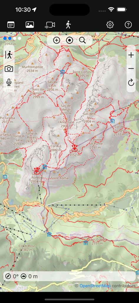
Topographic mountain map with hiking trails and navigation icons in the OSM Maps app
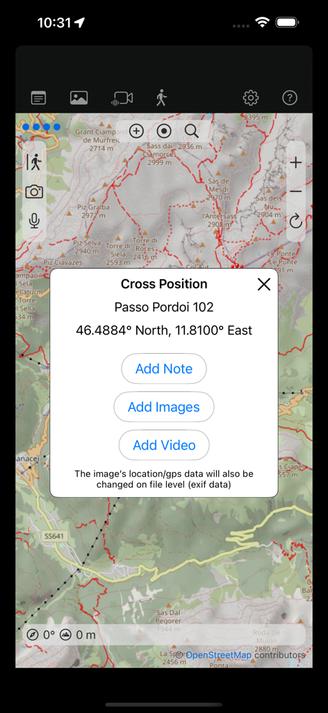
Interface of OSM Maps app showing options to add notes images and videos to a specific location on a topographical map
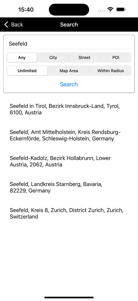
Search results screen in the OSM Maps app showing multiple locations for Seefeld with filtering options like City and POI.
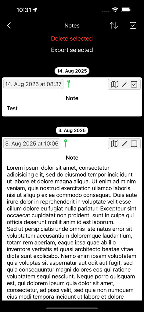
A list of geospatial notes in the OSM Maps app showing dated entries with location pins and map icons.
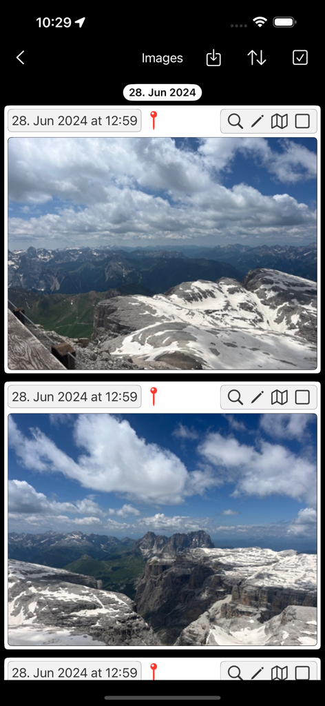
OSM Maps gallery of mountain photos with location pins and timestamps
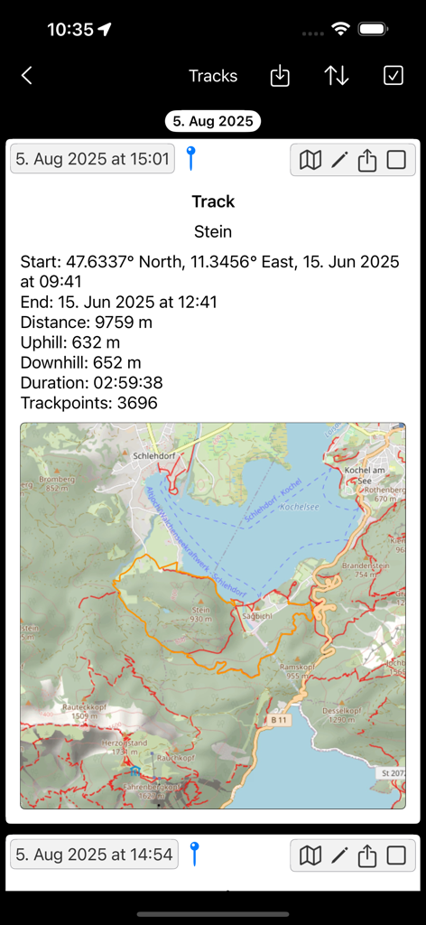
A screenshot of the OSM Maps app showing a recorded hiking track with distance, elevation, and a map.
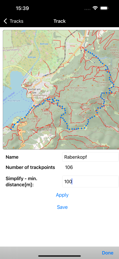
OSM Maps app screen showing a GPX track on a topographic map with data points and track simplification settings.
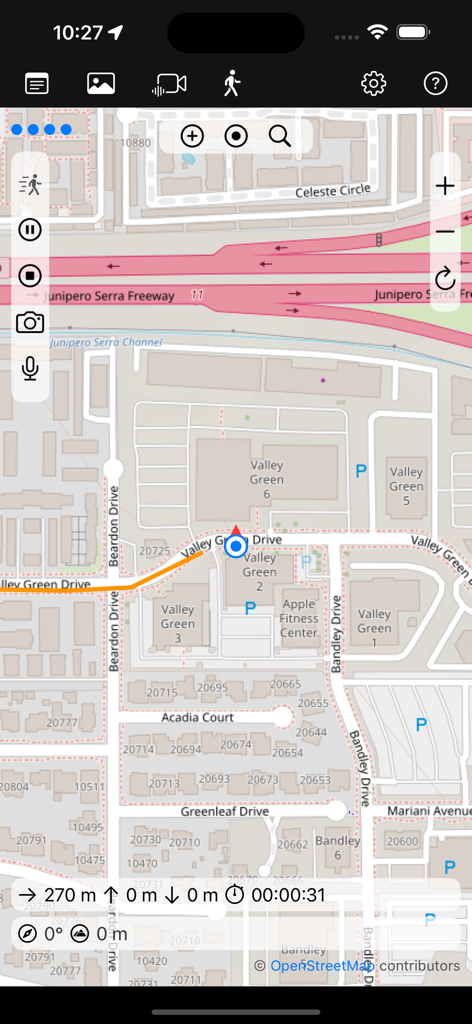
Live map view showing street details and tracking metrics in the OSM Maps app
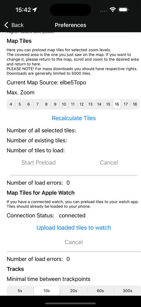
Preferences screen for preloading map tiles and setting track intervals in OSM Maps
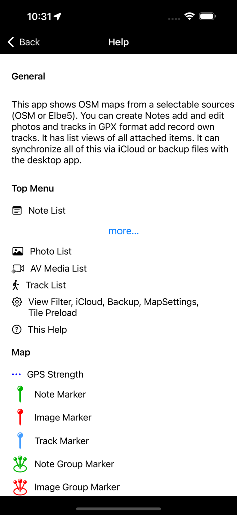
Help screen of the OSM Maps app showing explanations for menu icons and map markers.
Description
Download
More Like This
Top-ranked apps in the same category

Google Maps
Google LLC

Waze Navigation & Live Traffic
waze

AMap Global
AutoNavi Information Technology Co. Ltd.

百度地图-路线规划,出行必备
Beijing Baidu Netcom Science & Technology Co.,Ltd

Moovit: Bus & Transit Tracker
Moovit App Global LTD

Transit • Subway & Bus Times
9280-0366 Quebec inc.

ParkMobile: Park. Pay. Go.
Parkmobile USA, Inc

腾讯地图-路线规划,导航地铁打车出行
Shenzhen Tencent Computer Systems Company Limited

Île-de-France Mobilités
Ile de France Mobilites
This page is not an official page of the app or its developer, but an independent editorial publication created for informational and commentary purposes. Unless expressly stated otherwise, neither the app nor its developer is affiliated with, endorsed by, sponsored by, authorized by, or otherwise officially connected with MWM, Apple, Google Play, the app publisher, or the app's developer, and nothing on this page implies that the app was developed using MWM's services. Any trademarks, logos, screenshots, and other content remain the property of their respective owners.