This page is not an official page of the app or its developer, but an independent editorial publication created for informational and commentary purposes. Unless expressly stated otherwise, neither the app nor its developer is affiliated with, endorsed by, sponsored by, authorized by, or otherwise officially connected with MWM, Apple, Google Play, the app publisher, or the app's developer, and nothing on this page implies that the app was developed using MWM's services. Any trademarks, logos, screenshots, and other content remain the property of their respective owners.

Pacific Hurricane Tracker
Access real-time NHC and NOAA data at your fingertips. Track hurricane paths, wave heights, and surface winds with the precision needed to stay ahead of the storm and protect what matters most.
Downloads
60K+User Rating
Total Ratings
0Publisher
Category
WeatherLocales
1Latest Version
6.3Size
6.4 MBFirst Released
Oct 10, 2015Professional-Grade Storm Intelligence
Harness the power of direct NOAA and NHC data to protect your property, your vessel, and your family with precision tracking.
Direct NOAA & NHC Data
Skip the sensationalism. Access raw, real-time data and development chances straight from the National Hurricane Center.
Advanced Maritime Insights
Critical for boaters and coastal residents: track wave heights, buoy observations, and wind directions with accuracy.
The following screenshots and description are sourced directly from the app's official store listing and are the property of the app developer.
App Store
Screenshots
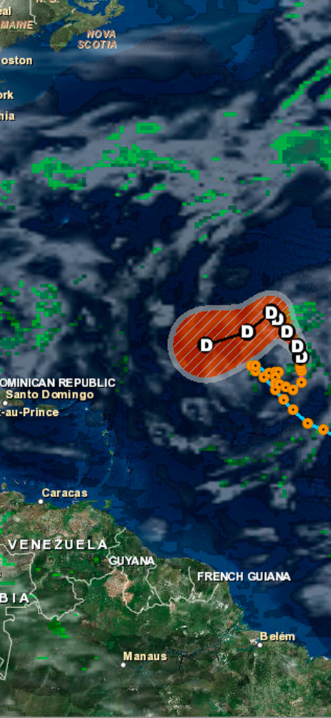
An interactive map showing hurricane tracks and cloud cover over the Caribbean and Atlantic Ocean.
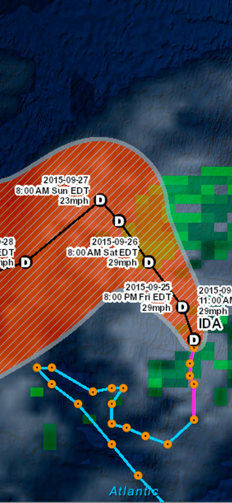
Interactive map from the Pacific Hurricane Tracker app showing the projected path and wind speeds for storm Ida in the Atlantic ocean.
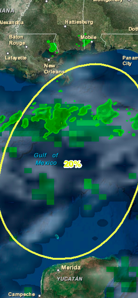
Map display of a 20 percent chance of hurricane development in the Gulf of Mexico
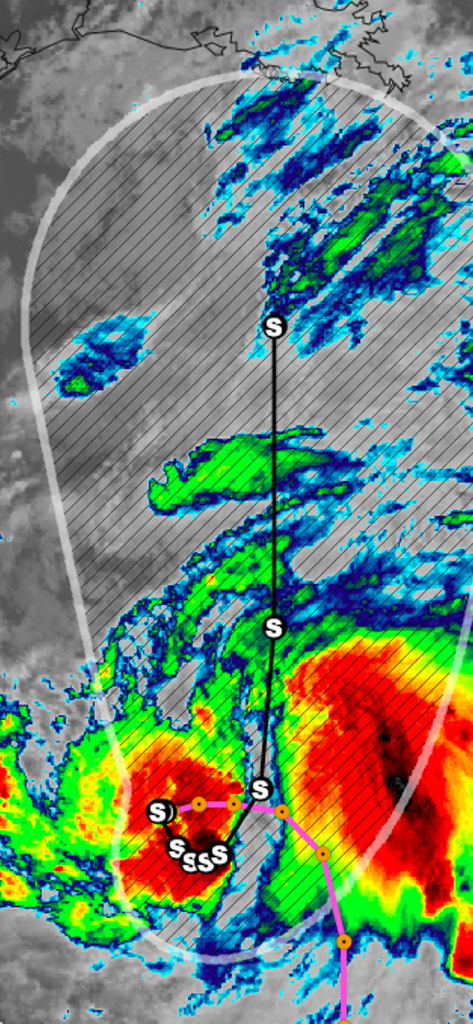
Interactive radar map showing storm tracks and hurricane forecast cone
Description
Download
More Like This
Top-ranked apps in the same category

墨迹天气-MojiWeather
Beijing MojiFengyun Technology Co.,Ltd.

The Weather Channel - Radar
The Weather Channel

Windy.com
Windyty, SE

天气预报-精准15日天气预报
Chongqing Caochen Technology Co., Ltd.

My Aurora Forecast & Alerts
JRustonApps B.V.

AccuWeather: Weather Forecast
AccuWeather International, Inc.

Weather & Radar - Storm radar
WetterOnline - Meteorologische Dienstleistungen GmbH

天气通
Weibo Internet Technology (China) Co.Ltd.

The Thermometer -Digital-
Vida Apps Incorporated
This page is not an official page of the app or its developer, but an independent editorial publication created for informational and commentary purposes. Unless expressly stated otherwise, neither the app nor its developer is affiliated with, endorsed by, sponsored by, authorized by, or otherwise officially connected with MWM, Apple, Google Play, the app publisher, or the app's developer, and nothing on this page implies that the app was developed using MWM's services. Any trademarks, logos, screenshots, and other content remain the property of their respective owners.