This page is not an official page of the app or its developer, but an independent editorial publication created for informational and commentary purposes. Unless expressly stated otherwise, neither the app nor its developer is affiliated with, endorsed by, sponsored by, authorized by, or otherwise officially connected with MWM, Apple, Google Play, the app publisher, or the app's developer, and nothing on this page implies that the app was developed using MWM's services. Any trademarks, logos, screenshots, and other content remain the property of their respective owners.

PastVu map
Uncover the hidden history of your neighborhood with a community-powered map of geo-located photos. Journey through time, filter by era, and see the streets of the past come to life right where you stand.
Downloads
0User Rating
Total Ratings
0Publisher
Category
TravelLocales
10Latest Version
11.1Size
7.9 MBFirst Released
May 3, 2024Relive History Street by Street
Journey through nearly two centuries of memories with an immersive map-based archive designed for the curious mind and the nostalgic soul.
Precise Geo-Location
View rare photos pinned to their exact shooting locations, allowing you to stand on any street corner and see the past through your screen.
Chronological Discovery
Effortlessly filter by year to watch your neighborhood’s evolution, from mid-19th century landscapes to the vibrant urban scenes of the late 1900s.
The following screenshots and description are sourced directly from the app's official store listing and are the property of the app developer.
App Store
Screenshots
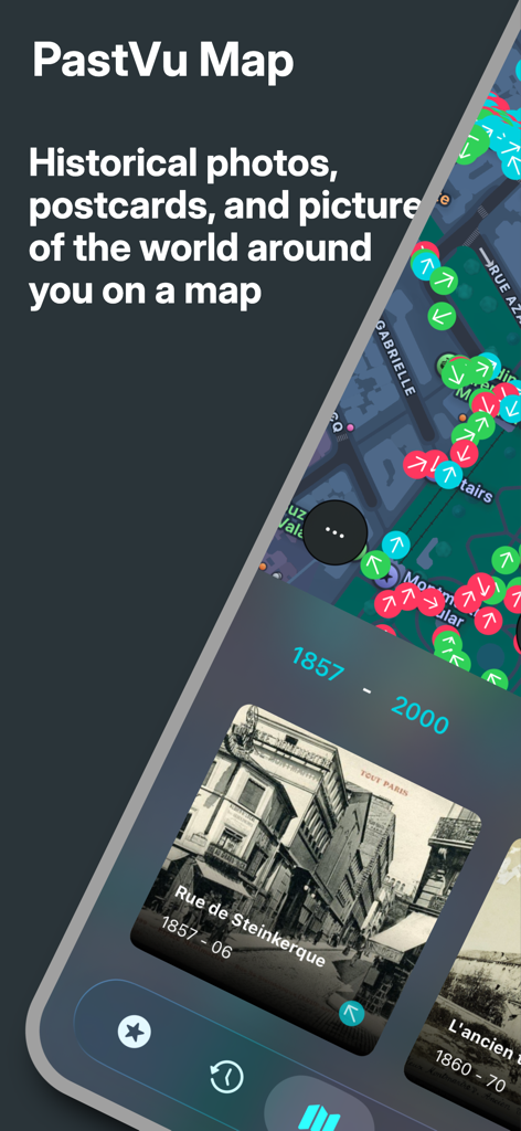
PastVu map app interface showing historical street photos from 1857 with location markers on a digital map
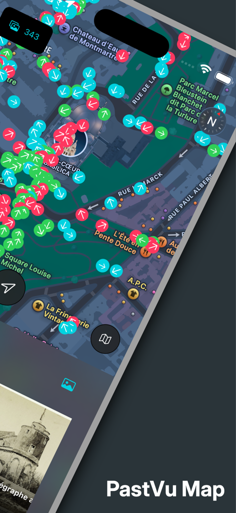
PastVu map showing historical photo shooting directions in Paris
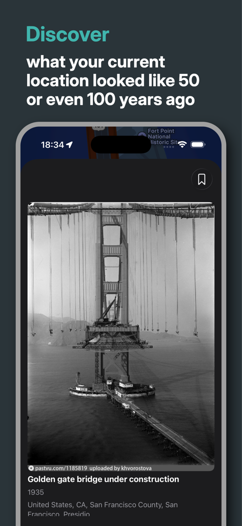
PastVu map app showing a historical photo of the Golden Gate Bridge under construction in 1935
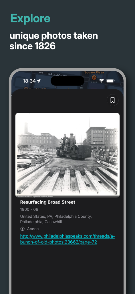
PastVu map app displaying a 1900 historical photo of Broad Street in Philadelphia

PastVu app screen showing a collection of historical photos titled Art Nouveau including vintage images of the Sagrada Familia and historical water towers.
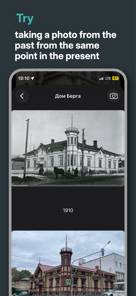
PastVu map app interface showing a historical photo of a building from 1910 compared with its modern appearance
Description
Download
More Like This
Top-ranked apps in the same category

Uber - Request a ride
Uber Technologies, Inc.

铁路12306
ACADEMY OF RAILWAY SCIENCES CO., ltd.

Airbnb
Airbnb, Inc.

Grab: Taxi Ride, Food Delivery
GRABTAXI HOLDINGS PTE. LTD.

Booking.com: Hotels & Travel
Booking.com B.V.

DiDi China: Ride Hailing
Didi Chuxing (Beijing) Network Platform Technology Co., Ltd

Trip.com: Book Flights, Hotels
Trip.com Travel Singapore Pte. Ltd.

携程旅行-订酒店机票火车票
Shanghai Ctrip Commerce Co.,Ltd

去哪儿旅行-订酒店机票火车票
Beijing Qunar Information Technology Company Limit
This page is not an official page of the app or its developer, but an independent editorial publication created for informational and commentary purposes. Unless expressly stated otherwise, neither the app nor its developer is affiliated with, endorsed by, sponsored by, authorized by, or otherwise officially connected with MWM, Apple, Google Play, the app publisher, or the app's developer, and nothing on this page implies that the app was developed using MWM's services. Any trademarks, logos, screenshots, and other content remain the property of their respective owners.