This page is not an official page of the app or its developer, but an independent editorial publication created for informational and commentary purposes. Unless expressly stated otherwise, neither the app nor its developer is affiliated with, endorsed by, sponsored by, authorized by, or otherwise officially connected with MWM, Apple, Google Play, the app publisher, or the app's developer, and nothing on this page implies that the app was developed using MWM's services. Any trademarks, logos, screenshots, and other content remain the property of their respective owners.

QLD Fires
Get peace of mind with live satellite hotspots, wind data, and emergency updates sourced directly from Australian government agencies. Protect your family, property, or travel plans with high-precision data even from half a world away.
Downloads
45K+User Rating
Total Ratings
4K+Publisher
Category
NewsLocales
1Latest Version
4.1.6Size
32.1 MBFirst Released
Nov 26, 2012Total Awareness From Any Distance
Bridge the gap between you and your loved ones with direct access to Queensland’s emergency data, providing peace of mind through real-time fire and weather tracking.
Proximity Monitoring
See exactly how far active fires are from specific family properties or travel routes with precise map and list overlays.
Live Satellite Hotspots
Track heat signatures via Geoscience Australia to detect potential threats early, providing the raw data you need before it hits the news.
The following screenshots and description are sourced directly from the app's official store listing and are the property of the app developer.
App Store
Screenshots
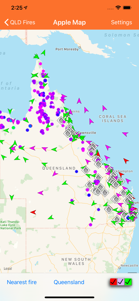
Map interface showing real time fire locations and wind data in Queensland Australia
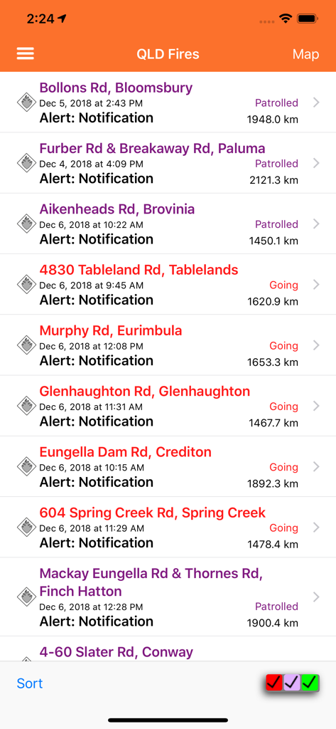
A list of fire alerts in the QLD Fires app showing locations and statuses.
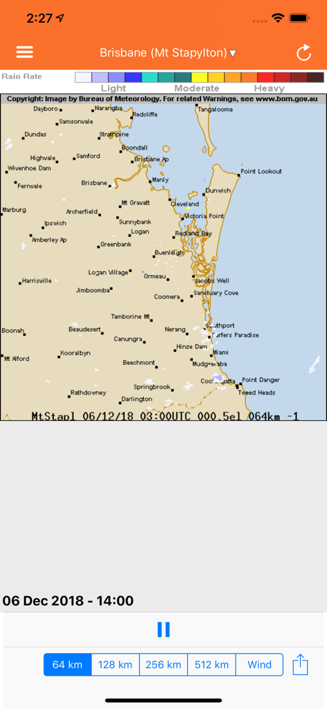
Weather radar map of Queensland showing rain rate and coastal locations in the QLD Fires app
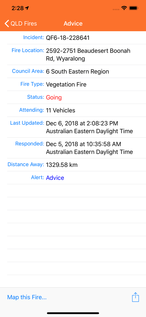
Detailed view of a fire incident in the QLD Fires mobile app including location status and emergency advice
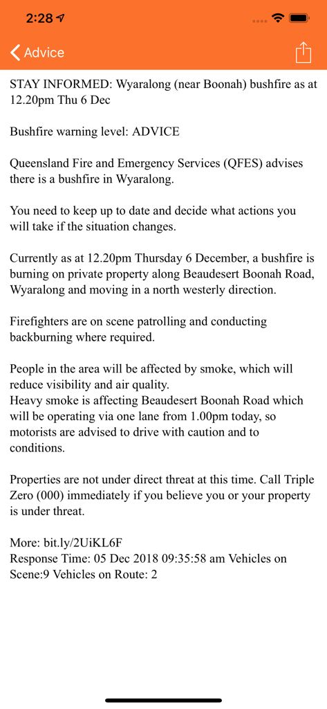
Emergency bushfire advice for Wyaralong in the QLD Fires app
Description
Download
More Like This
Top-ranked apps in the same category

X
X Corp.

REDDIT, INC.

Substack
Substack Inc.

NYTimes: US and Global News
The New York Times Company

Nextdoor: Neighborhood Network
Nextdoor.com, Inc.

CrimeRadar Dispatch Audio
Scoopz Inc.

NewsBreak: Local News & Alerts
Particle Media Inc.

Ground News
Snapwise Inc.

Google News
Google LLC
This page is not an official page of the app or its developer, but an independent editorial publication created for informational and commentary purposes. Unless expressly stated otherwise, neither the app nor its developer is affiliated with, endorsed by, sponsored by, authorized by, or otherwise officially connected with MWM, Apple, Google Play, the app publisher, or the app's developer, and nothing on this page implies that the app was developed using MWM's services. Any trademarks, logos, screenshots, and other content remain the property of their respective owners.