This page is not an official page of the app or its developer, but an independent editorial publication created for informational and commentary purposes. Unless expressly stated otherwise, neither the app nor its developer is affiliated with, endorsed by, sponsored by, authorized by, or otherwise officially connected with MWM, Apple, Google Play, the app publisher, or the app's developer, and nothing on this page implies that the app was developed using MWM's services. Any trademarks, logos, screenshots, and other content remain the property of their respective owners.

RadarScope
Experience raw NEXRAD Level II data and native radar products with zero latency. Track tornadoes, hurricanes, and severe storms using the same high-resolution tools trusted by meteorologists and first responders.
Downloads
408K+User Rating
Total Ratings
5K+Publisher
Category
WeatherLocales
4Latest Version
5.5.2Size
288.4 MBFirst Released
Feb 12, 2019Professional-Grade Radar Visualization
Access raw, high-resolution radar data and advanced storm-tracking tools designed for professionals and enthusiasts who demand accuracy over aesthetics.
Raw NEXRAD Level II Data
View radar data in its original radial format without smoothing, allowing you to identify velocity couplets and debris balls with zero latency.
Real-Time Severe Alerts
Monitor NWS-generated warnings for tornadoes, flash floods, and severe thunderstorms with integrated storm tracks and hail attributes.
The following screenshots and description are sourced directly from the app's official store listing and are the property of the app developer.
App Store
Screenshots
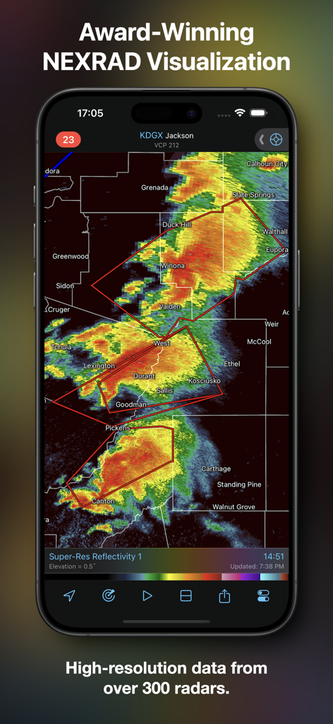
RadarScope app displaying high resolution NEXRAD radar data on a mobile device.
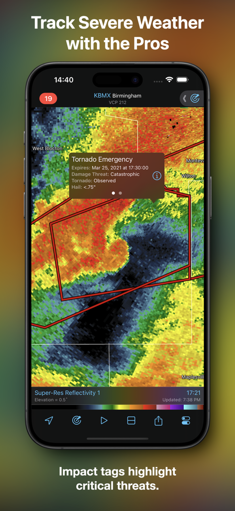
RadarScope app displaying a tornado emergency impact tag on a weather radar map.
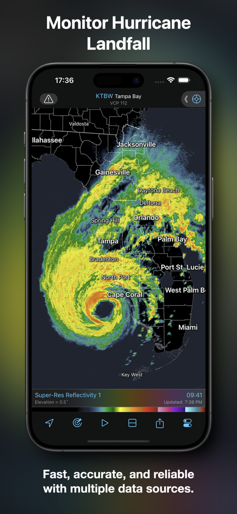
RadarScope app interface displaying a high-resolution hurricane radar loop over Florida.
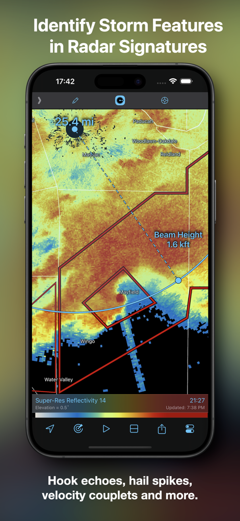
RadarScope app screenshot showing a radar map with distance and beam height markers to identify storm features.
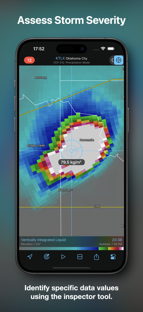
RadarScope app interface showing storm severity assessment using the inspector tool.
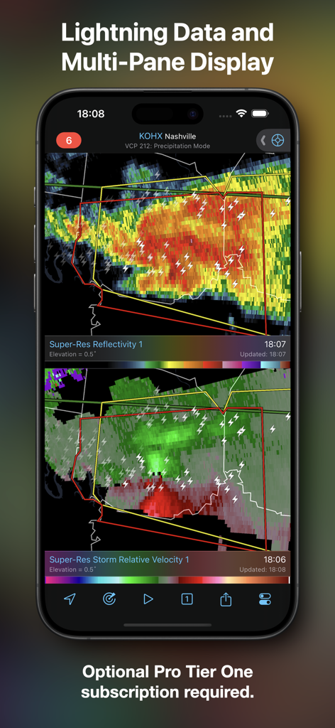
Screenshot of the RadarScope app showing a split-screen view with super-res reflectivity and storm relative velocity including lightning data.
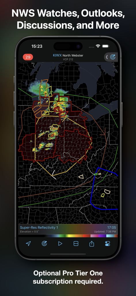
RadarScope app interface displaying National Weather Service watches and outlooks on a high resolution radar map
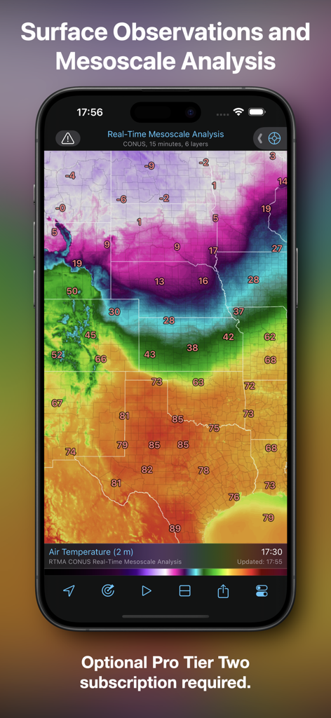
RadarScope app showing real-time mesoscale analysis and surface temperature observations
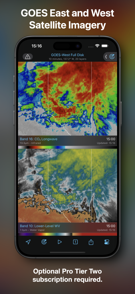
RadarScope mobile app displaying GOES East and West satellite imagery with infrared and water vapor layers
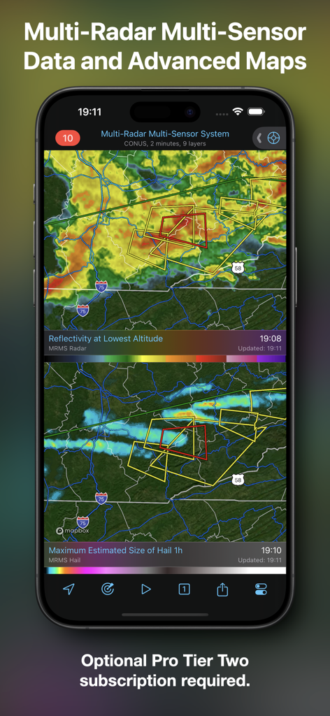
RadarScope app interface showing advanced weather maps with reflectivity and hail size data.
Description
Download
More Like This
Apps with similar features and user experience

墨迹天气-MojiWeather
Beijing MojiFengyun Technology Co.,Ltd.

Windy.com
Windyty, SE

天气通
Weibo Internet Technology (China) Co.Ltd.

Zoom Earth - Weather Forecast
Neave Interactive Limited

实时天气-40日精准天气实时预报
犇 牛

MyRadar Accurate Weather Radar
Aviation Data Systems, Inc

Ventusky: Weather & Live Radar
Ventusky s.r.o.

FOX Weather: Daily Forecasts
Fox News Network, LLC

2345天气王-天气和空气质量查询小组件
Shanghai 2345 Network Technology Co., Ltd.
This page is not an official page of the app or its developer, but an independent editorial publication created for informational and commentary purposes. Unless expressly stated otherwise, neither the app nor its developer is affiliated with, endorsed by, sponsored by, authorized by, or otherwise officially connected with MWM, Apple, Google Play, the app publisher, or the app's developer, and nothing on this page implies that the app was developed using MWM's services. Any trademarks, logos, screenshots, and other content remain the property of their respective owners.