This page is not an official page of the app or its developer, but an independent editorial publication created for informational and commentary purposes. Unless expressly stated otherwise, neither the app nor its developer is affiliated with, endorsed by, sponsored by, authorized by, or otherwise officially connected with MWM, Apple, Google Play, the app publisher, or the app's developer, and nothing on this page implies that the app was developed using MWM's services. Any trademarks, logos, screenshots, and other content remain the property of their respective owners.

Route Planner - GPS MGRS UTM
Master the terrain with military-grade MGRS grids, advanced coordinate projection, and offline topographic maps designed for tactical experts and outdoor professionals.
Downloads
5K+User Rating
Total Ratings
0Publisher
Category
NavigationLocales
4Latest Version
2.0.2Size
83.1 MBFirst Released
Apr 14, 2025Precision Tools for Tactical and Field Operations
Bridge the gap between consumer navigation and professional GIS. Our suite of high-accuracy tools is built for military personnel, field researchers, and backcountry professionals who demand reliability in the most remote environments.
Military-Grade Coordinate Precision
Toggle instantly between MGRS, UTM, and Latitude/Longitude. Perform tactical coordinate projections based on bearing and distance for pinpoint accuracy in the field.
Seamless GIS Data Integration
Standardize your workflow by importing and exporting KML, GPX, and GeoJSON files. Manage complex spatial data with custom layers, polygons, and professional-grade map annotations.
The following screenshots and description are sourced directly from the app's official store listing and are the property of the app developer.
App Store
Screenshots

A hiker in tactical gear in the wilderness with text describing the app as an all-in-one planner navigator and tracker
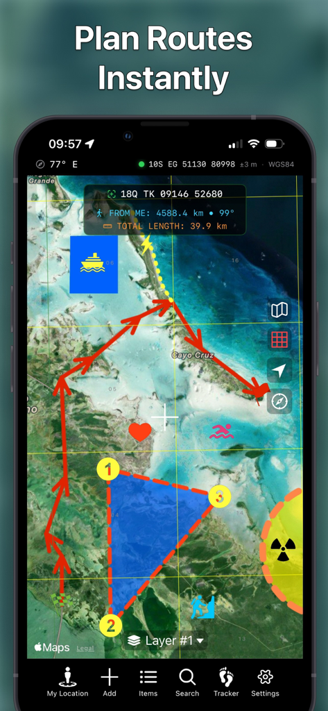
Smartphone displaying Route Planner app with tactical map route drawing and MGRS coordinates
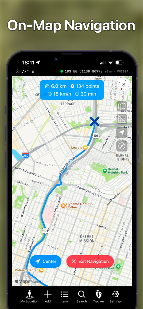
Mobile app screenshot showing on-map navigation with a blue route and MGRS coordinates
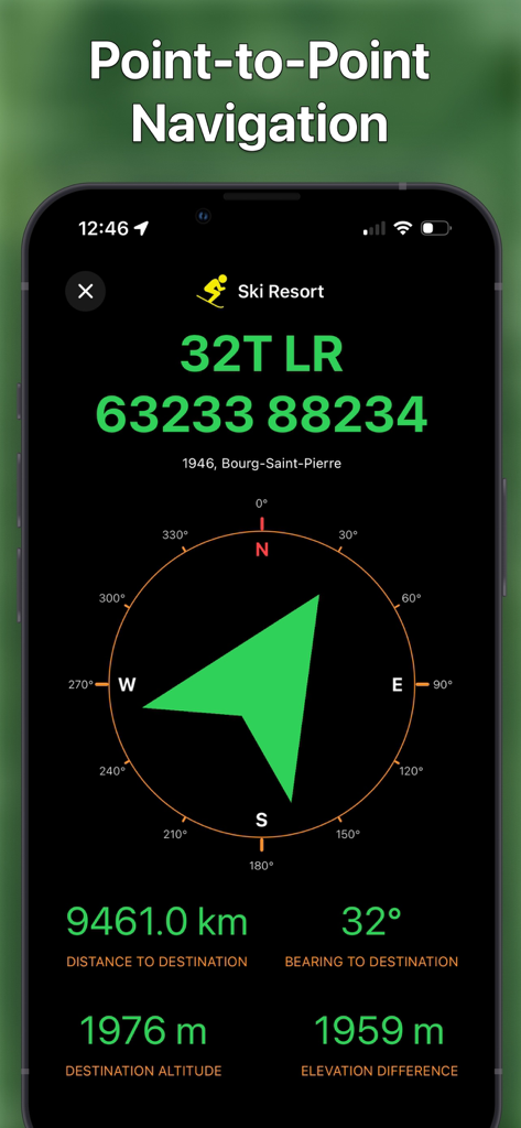
Tactical point to point navigation interface with MGRS coordinates and compass bearing
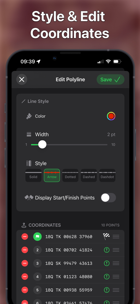
interface for styling map routes and managing MGRS coordinate points
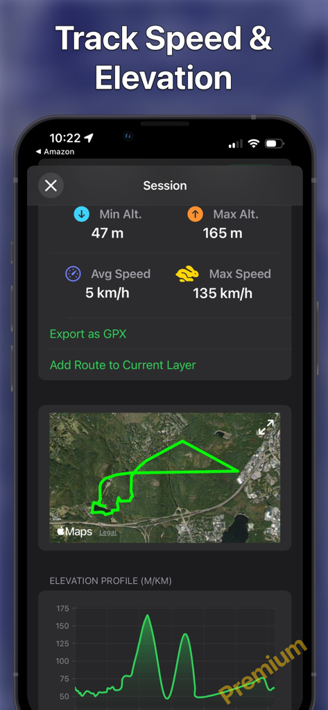
App interface displaying speed and elevation tracking stats with a route map and elevation profile
Description
Download
More Like This
Top-ranked apps in the same category

Google Maps
Google LLC

Waze Navigation & Live Traffic
waze

AMap Global
AutoNavi Information Technology Co. Ltd.

百度地图-路线规划,出行必备
Beijing Baidu Netcom Science & Technology Co.,Ltd

Moovit: Bus & Transit Tracker
Moovit App Global LTD

Transit • Subway & Bus Times
9280-0366 Quebec inc.

ParkMobile: Park. Pay. Go.
Parkmobile USA, Inc

腾讯地图-路线规划,导航地铁打车出行
Shenzhen Tencent Computer Systems Company Limited

Île-de-France Mobilités
Ile de France Mobilites
This page is not an official page of the app or its developer, but an independent editorial publication created for informational and commentary purposes. Unless expressly stated otherwise, neither the app nor its developer is affiliated with, endorsed by, sponsored by, authorized by, or otherwise officially connected with MWM, Apple, Google Play, the app publisher, or the app's developer, and nothing on this page implies that the app was developed using MWM's services. Any trademarks, logos, screenshots, and other content remain the property of their respective owners.