This page is not an official page of the app or its developer, but an independent editorial publication created for informational and commentary purposes. Unless expressly stated otherwise, neither the app nor its developer is affiliated with, endorsed by, sponsored by, authorized by, or otherwise officially connected with MWM, Apple, Google Play, the app publisher, or the app's developer, and nothing on this page implies that the app was developed using MWM's services. Any trademarks, logos, screenshots, and other content remain the property of their respective owners.
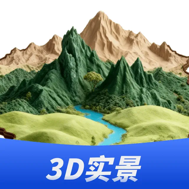
三维山水全景地图
Beyond flat maps: It empowers users to command 3D terrain, revealing Earth's hidden contours.
Downloads
25k+User Rating
Total Ratings
9Publisher
Category
NavigationLocales
1Latest Version
1.0.2Size
85.9 MBFirst Released
Jan 30, 2026Key features for advanced geographical analysis and virtual exploration.
'三维山水全景地图' App Evaluation
Interactive 3D Topographical Analysis
The app provides real-time interactive 3D terrain visualization, allowing users to effortlessly rotate, zoom, and intuitively grasp complex geographical features such as mountain ranges, water systems, and elevation changes.
In-depth Landscape Detail Exploration
This tool features the ability to scrutinize every minute detail of mountains and rivers from a 3D perspective, enabling comprehensive understanding of terrain dynamics even without physical presence.
Multi-Source Map Integration
It integrates various map sources, offering users a versatile platform for comparative analysis and ensuring access to diverse geographical information within a single interface.
Comprehensive Geographical Data Access
The app provides a vast repository of geographical data, supporting in-depth research, detailed planning, and extensive virtual exploration across numerous landscapes.
The following screenshots and description are sourced directly from the app's official store listing and are the property of the app developer.
App Store
Screenshots
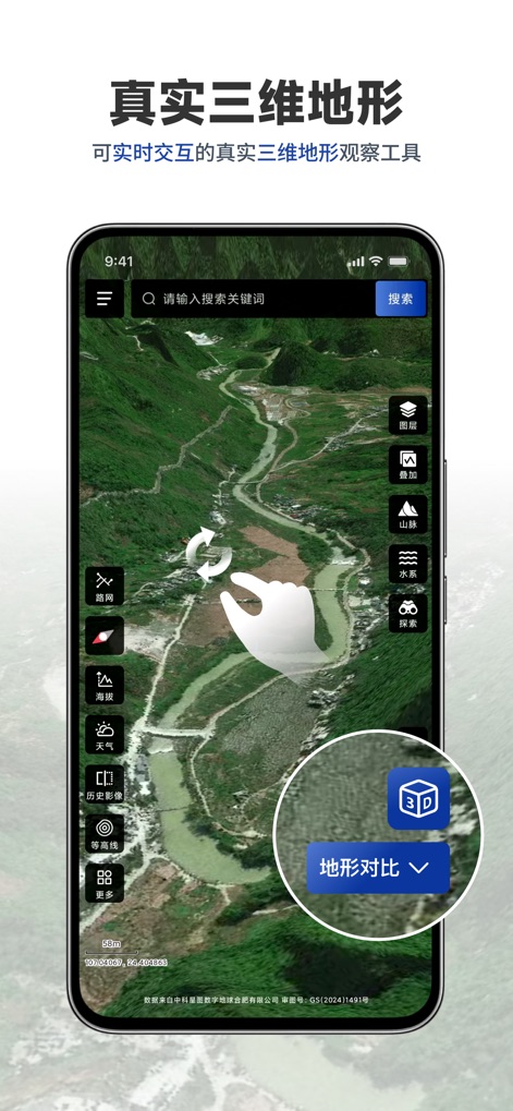
The app offers dynamic 3D terrain observation, allowing users to intuitively grasp mountain ranges and water system distribution through interactive swiping and 3D comparison tools.
Interactive 3D Terrain
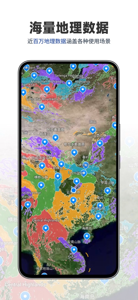
This tool provides a massive repository of geographical data, visually categorized by distinct colored regions and precisely marked with numerous location pins for comprehensive coverage.
Extensive Geo Data
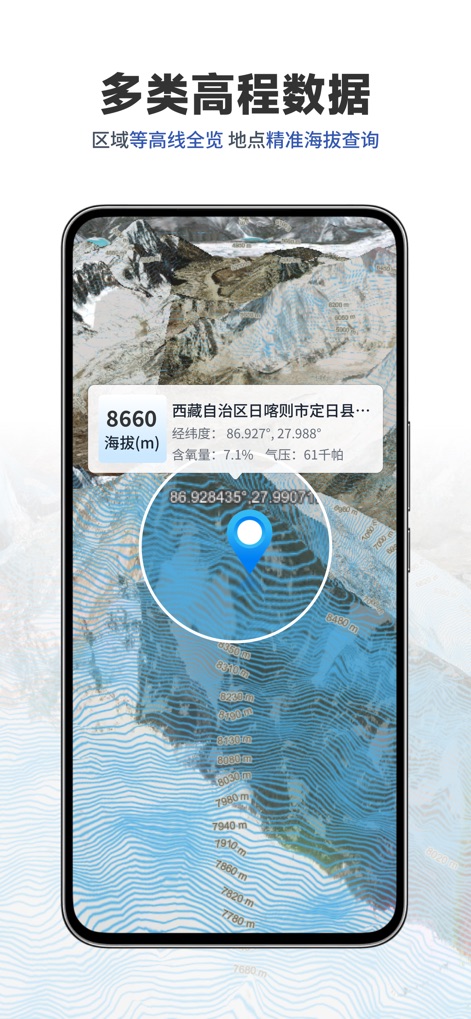
Users can explore detailed contour line visualizations and access precise altitude queries, including exact latitude, longitude, and other environmental data for any point.
Precision Elevation Data
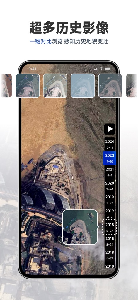
The app enables a unique historical perspective, allowing seamless comparison of past geographical changes through an interactive timeline and a gallery of historical aerial images.
Historical Imagery Timeline
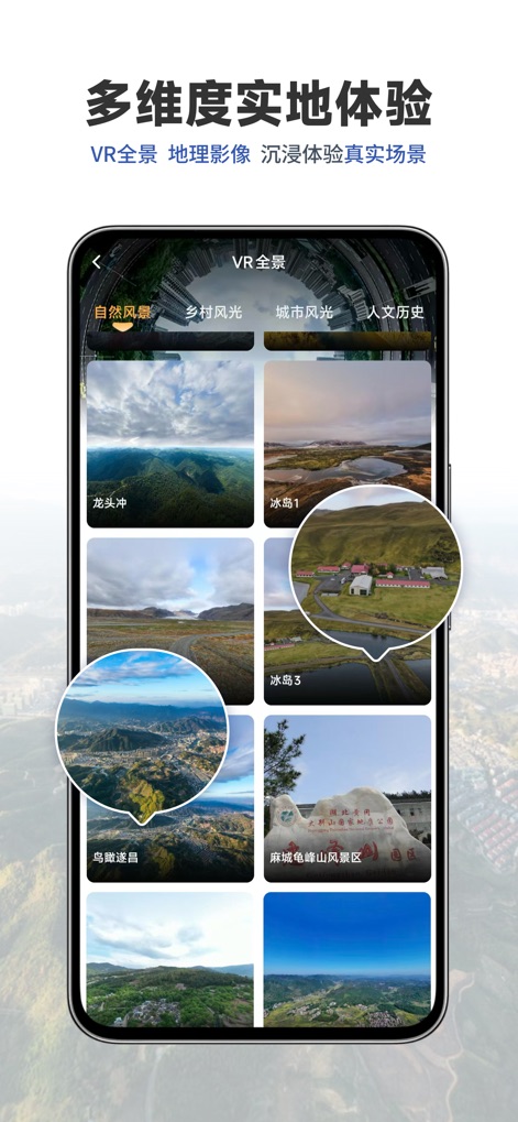
Dive into immersive field experiences with VR panoramic images, categorized neatly into "Natural Scenery" and "Urban Scenery" for diverse virtual exploration.
Immersive Panoramic Views
Description
Download
More Like This
Top-ranked apps in the same category

Google Maps
Google LLC

AMap Global
AutoNavi Information Technology Co. Ltd.

Waze Navigation & Live Traffic
waze

百度地图-路线规划,出行必备
Beijing Baidu Netcom Science & Technology Co.,Ltd

Moovit: Bus & Transit Tracker
Moovit App Global LTD

Transit • Subway & Bus Times
9280-0366 Quebec inc.

ParkMobile: Park. Pay. Go.
Parkmobile USA, Inc

腾讯地图-路线规划,导航地铁打车出行
Shenzhen Tencent Computer Systems Company Limited

MapXplorer: Map Radar Navigate
GOLDLAB APPLICATIONS YAZILIM VE BILISIM ANONIM SIRKETI
This page is not an official page of the app or its developer, but an independent editorial publication created for informational and commentary purposes. Unless expressly stated otherwise, neither the app nor its developer is affiliated with, endorsed by, sponsored by, authorized by, or otherwise officially connected with MWM, Apple, Google Play, the app publisher, or the app's developer, and nothing on this page implies that the app was developed using MWM's services. Any trademarks, logos, screenshots, and other content remain the property of their respective owners.