This page is not an official page of the app or its developer, but an independent editorial publication created for informational and commentary purposes. Unless expressly stated otherwise, neither the app nor its developer is affiliated with, endorsed by, sponsored by, authorized by, or otherwise officially connected with MWM, Apple, Google Play, the app publisher, or the app's developer, and nothing on this page implies that the app was developed using MWM's services. Any trademarks, logos, screenshots, and other content remain the property of their respective owners.

Sensnap - Outdoor Assistant
The professional sensor dashboard for serious explorers. Track altitude and barometric trends, log background GPS data, and create stunning photos with custom data watermarks.
Downloads
74K+User Rating
Total Ratings
300Publisher
Category
TravelLocales
10Latest Version
4.0Size
12.1 MBFirst Released
Sep 12, 2016Master Every Metric on the Trail
Turn your device into a professional-grade sensor dashboard. Track, log, and share your outdoor achievements with precision-engineered tools designed for the data-driven adventurer.
Real-Time Sensor Dashboard
Access altitude, barometric pressure, heading, and speed at a glance through a clean, minimalist interface optimized for high-intensity movement.
Background Logging & Export
Automatically record elevation trends and GPS coordinates in the background. Export your data to CSV for professional analysis of your performance.
The following screenshots and description are sourced directly from the app's official store listing and are the property of the app developer.
App Store
Screenshots
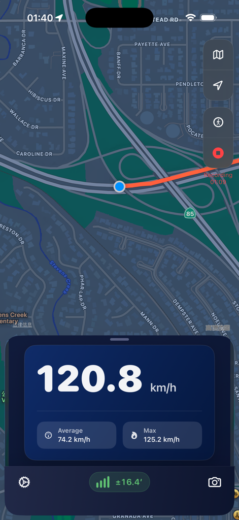
Sensnap app interface showing real time speed tracking with average and maximum speed data over a map route
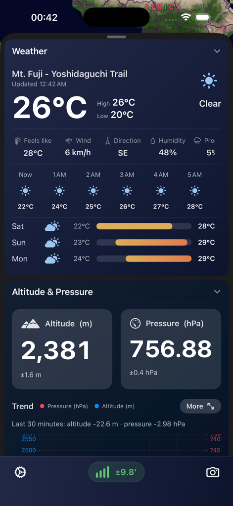
Sensnap app interface showing real-time weather and altitude data for a hiking trail.
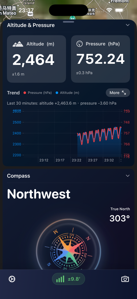
A technical dashboard interface showing altitude, barometric pressure trends, and a digital compass for hiking and outdoor activities.
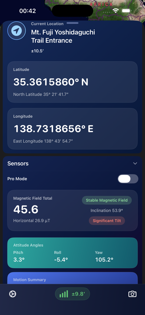
Sensnap app dashboard showing precise latitude longitude and magnetic field sensors at Mt Fuji
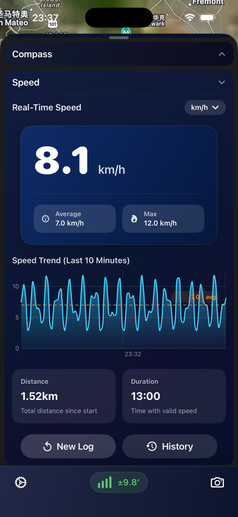
Sensnap app dashboard displaying real-time speed metrics and trend charts for outdoor activities.
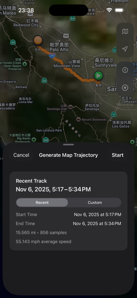
Map interface of Sensnap app showing a recorded GPS track with distance and average speed statistics
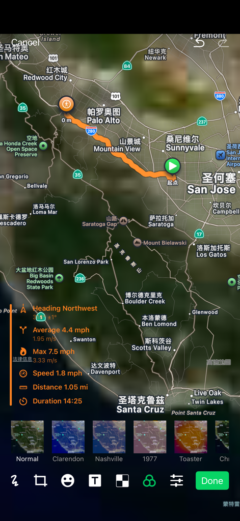
A map view of an outdoor track route with a data watermark overlay showing speed distance and duration
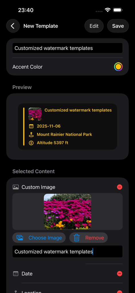
Sensnap app screen for customizing photo watermarks with altitude, date, and location data.
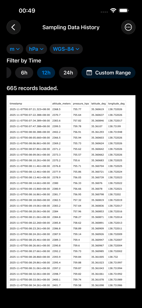
Sensnap app interface showing historical sensor data log including altitude and GPS coordinates
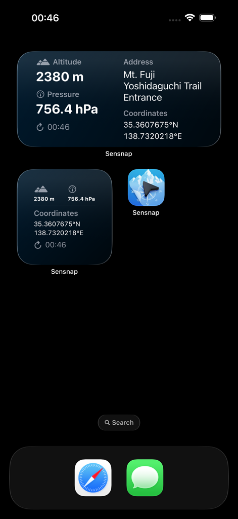
Sensnap iPhone widgets displaying live altitude barometric pressure and GPS location data
Description
Download
More Like This
Top-ranked apps in the same category

Uber - Request a ride
Uber Technologies, Inc.

Airbnb
Airbnb, Inc.

铁路12306
ACADEMY OF RAILWAY SCIENCES CO., ltd.

Booking.com: Hotels & Travel
Booking.com B.V.

Grab: Taxi Ride, Food Delivery
GRABTAXI HOLDINGS PTE. LTD.

Trip.com: Book Flights, Hotels
Trip.com Travel Singapore Pte. Ltd.

DiDi China: Ride Hailing
Didi Chuxing (Beijing) Network Platform Technology Co., Ltd

去哪儿旅行-订酒店机票火车票
Beijing Qunar Information Technology Company Limit

Bolt: Request a Ride
BOLT TECHNOLOGY OU
This page is not an official page of the app or its developer, but an independent editorial publication created for informational and commentary purposes. Unless expressly stated otherwise, neither the app nor its developer is affiliated with, endorsed by, sponsored by, authorized by, or otherwise officially connected with MWM, Apple, Google Play, the app publisher, or the app's developer, and nothing on this page implies that the app was developed using MWM's services. Any trademarks, logos, screenshots, and other content remain the property of their respective owners.