This page is not an official page of the app or its developer, but an independent editorial publication created for informational and commentary purposes. Unless expressly stated otherwise, neither the app nor its developer is affiliated with, endorsed by, sponsored by, authorized by, or otherwise officially connected with MWM, Apple, Google Play, the app publisher, or the app's developer, and nothing on this page implies that the app was developed using MWM's services. Any trademarks, logos, screenshots, and other content remain the property of their respective owners.

四维地球-高清卫星地图导航软件
Experience ultra-HD 0.5m resolution across 337 cities. Track construction and land changes with historical data since 2018 using professional-grade GIS measurement tools.
Downloads
0User Rating
Total Ratings
0Publisher
Category
NavigationLocales
1Latest Version
2.3.8Size
110.4 MBFirst Released
Jul 26, 2018Professional Satellite Intelligence at Your Fingertips
Monitor China's landscape with sub-meter resolution, historical data, and professional-grade analysis tools tailored for investors and researchers.
0.5m Ultra-HD Imagery
Access high-precision maps of 337 Chinese cities, offering a level of granular detail far superior to standard consumer navigation apps.
Historical Change Tracking
Compare massive imagery archives dating back to 2018 to verify construction progress, environmental shifts, or urban development over time.
The following screenshots and description are sourced directly from the app's official store listing and are the property of the app developer.
App Store
Screenshots
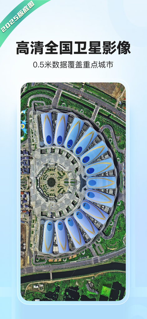
High-definition 0.5m resolution satellite imagery of a modern building in China from the Siwei Earth mobile app.
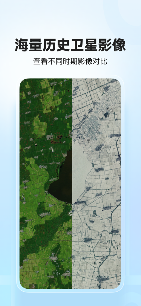
Split-screen comparison of historical satellite imagery in the Siwei Earth app showing land development over time

Siwei Earth app interface demonstrating satellite map land area measurement tool.
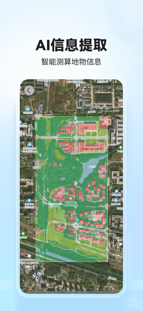
Satellite map view with AI-powered information extraction overlay highlighting building footprints and land classification
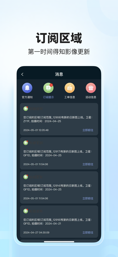
Screenshot of Siwei Earth app message center showing satellite imagery update notifications.
Description
Download
More Like This
Top-ranked apps in the same category

Google Maps
Google LLC

AMap Global
AutoNavi Information Technology Co. Ltd.

Waze Navigation & Live Traffic
waze

百度地图-路线规划,出行必备
Beijing Baidu Netcom Science & Technology Co.,Ltd

Moovit: Bus & Transit Tracker
Moovit App Global LTD

腾讯地图-路线规划,导航地铁打车出行
Shenzhen Tencent Computer Systems Company Limited

ParkMobile: Park. Pay. Go.
Parkmobile USA, Inc

Transit • Subway & Bus Times
9280-0366 Quebec inc.

NAVER Maps, Navigation
NAVER Corp.
This page is not an official page of the app or its developer, but an independent editorial publication created for informational and commentary purposes. Unless expressly stated otherwise, neither the app nor its developer is affiliated with, endorsed by, sponsored by, authorized by, or otherwise officially connected with MWM, Apple, Google Play, the app publisher, or the app's developer, and nothing on this page implies that the app was developed using MWM's services. Any trademarks, logos, screenshots, and other content remain the property of their respective owners.