This page is not an official page of the app or its developer, but an independent editorial publication created for informational and commentary purposes. Unless expressly stated otherwise, neither the app nor its developer is affiliated with, endorsed by, sponsored by, authorized by, or otherwise officially connected with MWM, Apple, Google Play, the app publisher, or the app's developer, and nothing on this page implies that the app was developed using MWM's services. Any trademarks, logos, screenshots, and other content remain the property of their respective owners.

Singapore MRT Map Route 新加坡地铁
Effortlessly plan your journey with the fastest route finder and most up-to-date bilingual map. Get instant route optimization and precise travel times for all lines, from Changi Airport to the city center.
Downloads
382K+User Rating
Total Ratings
6K+Publisher
Category
NavigationLocales
1Latest Version
2.9.8Size
182.0 MBFirst Released
Jun 28, 2012Navigate Singapore with Local Precision
Experience the world’s most efficient transit system with a tool designed for speed, accuracy, and the needs of international travelers.
Instant Route Calculation
Save time with intelligent routing that finds the fastest path between any two stations in under a second.
Latest MRT System Updates
Travel with confidence using the most current maps, including full coverage of the newly expanded Thomson-East Coast Line.
Frequently Asked Questions
Everything you need to know about Singapore MRT Map Route 新加坡地铁
What is the primary function of the Singapore MRT Map Route app?
The Singapore MRT Map Route app allows users to view the latest subway map, calculate the best route between two stations, and display estimated travel times.
Does the Singapore MRT Map Route app show estimated travel times for routes?
Yes, the Singapore MRT Map Route app displays estimated travel times for routes. It shows duration such as "28 MINS" and "55 MINS" directly on the map.
Which subway lines are updated in the Singapore MRT Map Route app?
The Singapore MRT Map Route app includes the updated North-South, East-West, North East, Circle, Downtown, and Thomson-East Coast Lines, ensuring current route information.
Can the Singapore MRT Map Route app calculate the best route between two MRT stations?
Yes, the Singapore MRT Map Route app calculates the best route between any two stations. It provides an optimized path for travel across the subway system.
The following screenshots and description are sourced directly from the app's official store listing and are the property of the app developer.
App Store
Screenshots
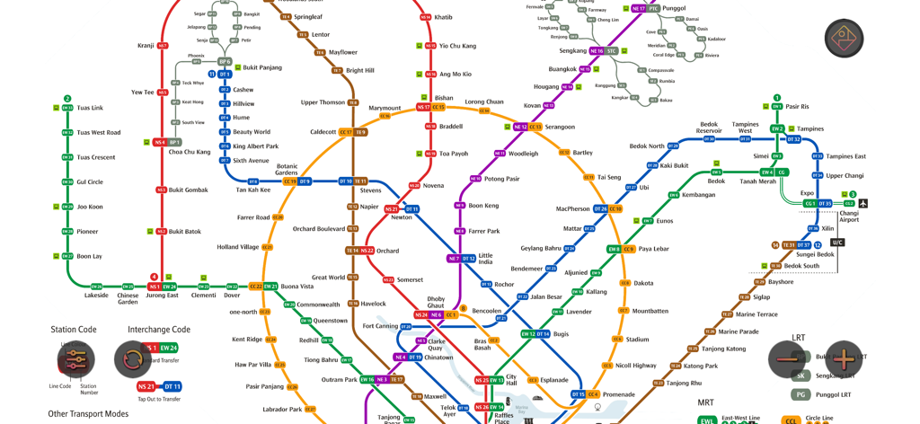
A comprehensive map of the Singapore MRT subway system showing all color-coded transit lines and station names.
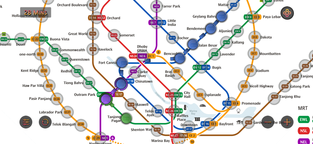
Interactive Singapore MRT map showing routes and travel time estimation
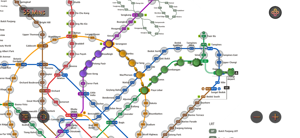
An interactive Singapore MRT map showing various transit lines and estimated travel time calculations.
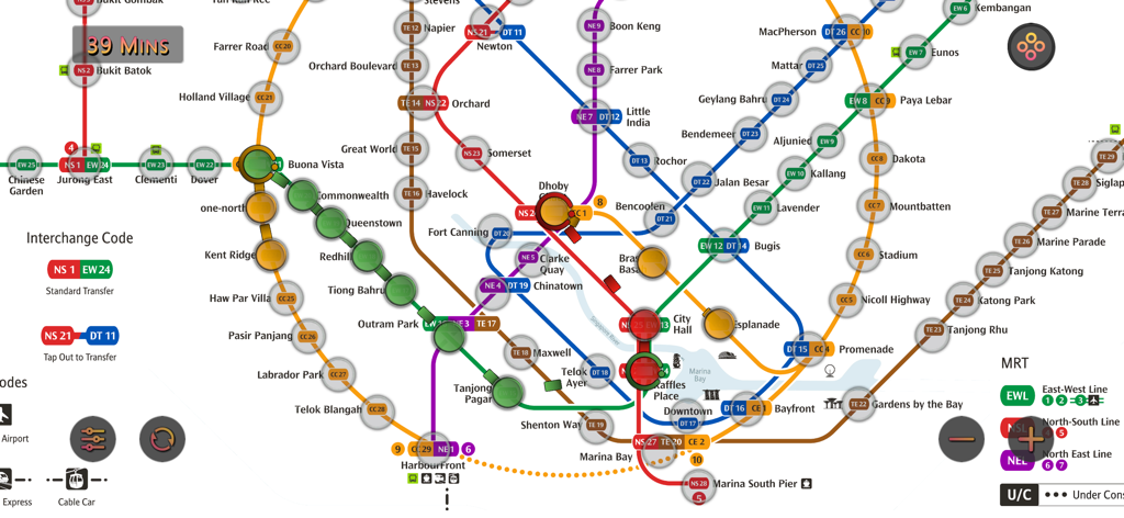
A detailed interface of the Singapore MRT map showing various subway lines and travel time estimation
Description
Download
More Like This
Top-ranked apps in the same category

Google Maps
Google LLC

Waze Navigation & Live Traffic
waze

AMap Global
AutoNavi Information Technology Co. Ltd.

百度地图-路线规划,出行必备
Beijing Baidu Netcom Science & Technology Co.,Ltd

Moovit: Bus & Transit Tracker
Moovit App Global LTD

Transit • Subway & Bus Times
9280-0366 Quebec inc.

ParkMobile: Park. Pay. Go.
Parkmobile USA, Inc

腾讯地图-路线规划,导航地铁打车出行
Shenzhen Tencent Computer Systems Company Limited

Île-de-France Mobilités
Ile de France Mobilites
This page is not an official page of the app or its developer, but an independent editorial publication created for informational and commentary purposes. Unless expressly stated otherwise, neither the app nor its developer is affiliated with, endorsed by, sponsored by, authorized by, or otherwise officially connected with MWM, Apple, Google Play, the app publisher, or the app's developer, and nothing on this page implies that the app was developed using MWM's services. Any trademarks, logos, screenshots, and other content remain the property of their respective owners.