This page is not an official page of the app or its developer, but an independent editorial publication created for informational and commentary purposes. Unless expressly stated otherwise, neither the app nor its developer is affiliated with, endorsed by, sponsored by, authorized by, or otherwise officially connected with MWM, Apple, Google Play, the app publisher, or the app's developer, and nothing on this page implies that the app was developed using MWM's services. Any trademarks, logos, screenshots, and other content remain the property of their respective owners.

SITA eWAS for iPhone
Enhance your cockpit decision-making with real-time weather, turbulence, and icing data delivered via Satcom and ACARS for optimized flight safety and efficiency.
Downloads
205K+User Rating
Total Ratings
100Publisher
Category
WeatherLocales
1Latest Version
3.9.3Size
423.4 MBFirst Released
Sep 2, 2016Advanced Flight Deck Weather Intelligence
The industry-leading EFB tool for commercial pilots to visualize atmospheric hazards in 4D and make safer, more efficient tactical decisions.
Precise 4D Hazard Mapping
Monitor thunderstorms, icing, and turbulence with vertical and horizontal views for total situational awareness at every flight level.
Mission-Critical Connectivity
Stay updated in the cockpit with high-compression data uplinks via satellite and ACARS, optimized for low-bandwidth environments.
The following screenshots and description are sourced directly from the app's official store listing and are the property of the app developer.
App Store
Screenshots
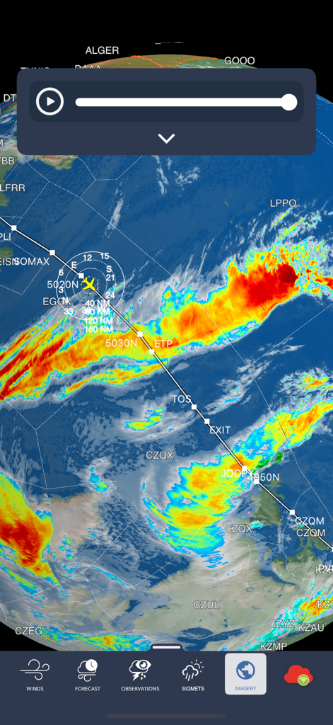
Professional aviation weather map showing a flight path and thunderstorm activity in the SITA eWAS app
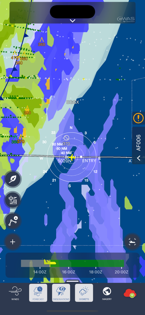
Professional aviation map showing flight path through weather hazard zones
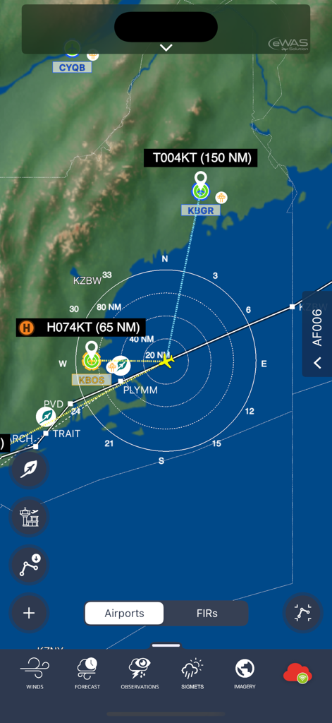
Professional aviation weather map interface with flight paths and real-time wind data
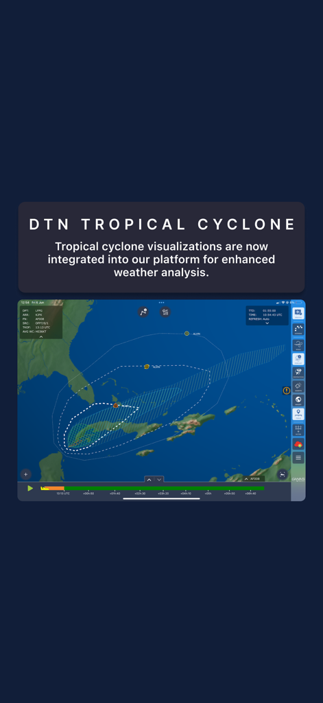
SITA eWAS app interface displaying DTN tropical cyclone tracking and flight path visualization
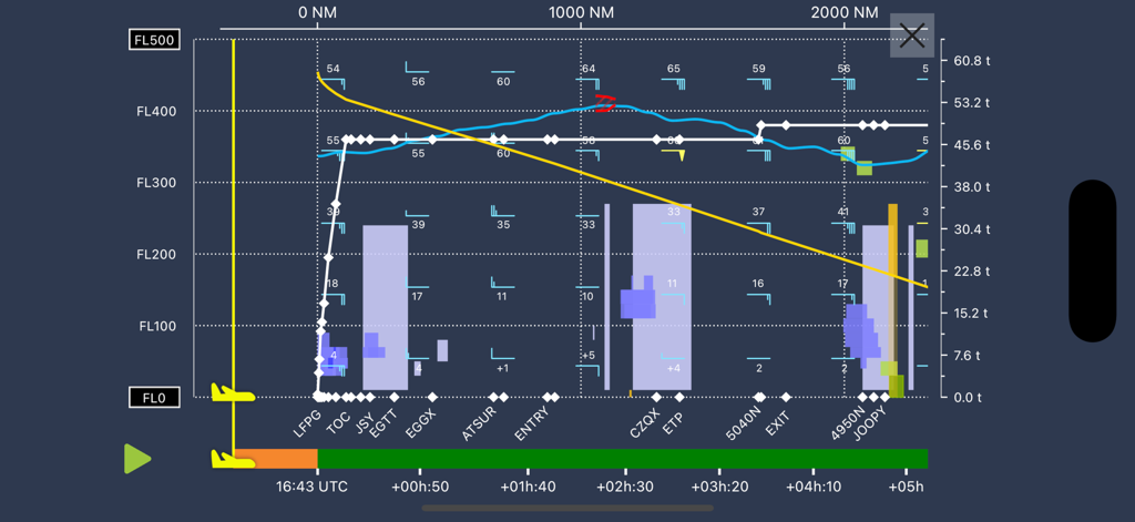
SITA eWAS app 4D vertical flight profile showing altitude levels and weather hazards
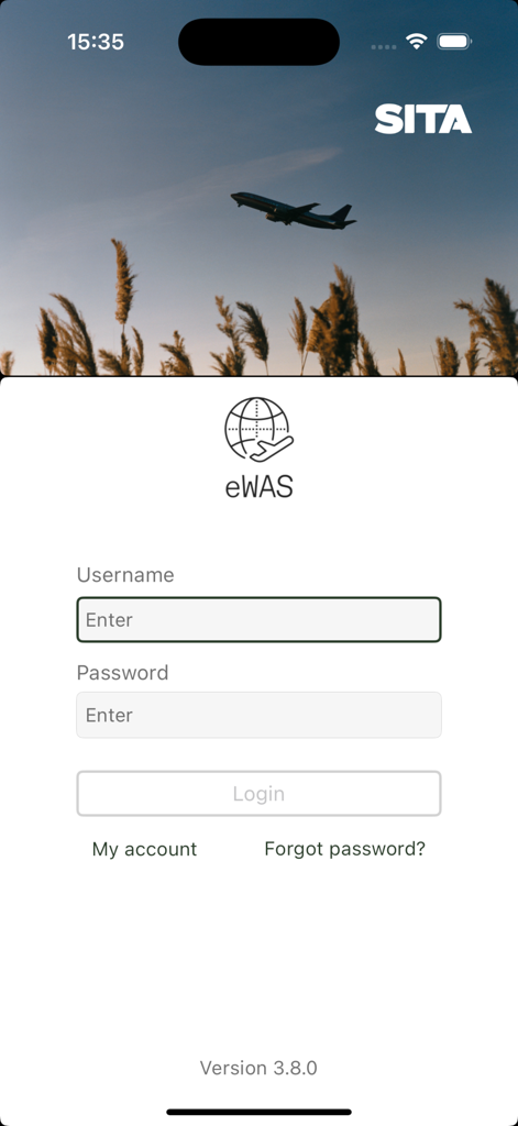
Login screen for the SITA eWAS professional aviation weather app showing username and password fields
Description
Download
More Like This
Top-ranked apps in the same category

墨迹天气-MojiWeather
Beijing MojiFengyun Technology Co.,Ltd.

The Weather Channel - Radar
The Weather Channel

Windy.com
Windyty, SE

天气预报-精准15日天气预报
Chongqing Caochen Technology Co., Ltd.

My Aurora Forecast & Alerts
JRustonApps B.V.

AccuWeather: Weather Forecast
AccuWeather International, Inc.

Weather & Radar - Storm radar
WetterOnline - Meteorologische Dienstleistungen GmbH

天气通
Weibo Internet Technology (China) Co.Ltd.

The Thermometer -Digital-
Vida Apps Incorporated
This page is not an official page of the app or its developer, but an independent editorial publication created for informational and commentary purposes. Unless expressly stated otherwise, neither the app nor its developer is affiliated with, endorsed by, sponsored by, authorized by, or otherwise officially connected with MWM, Apple, Google Play, the app publisher, or the app's developer, and nothing on this page implies that the app was developed using MWM's services. Any trademarks, logos, screenshots, and other content remain the property of their respective owners.