This page is not an official page of the app or its developer, but an independent editorial publication created for informational and commentary purposes. Unless expressly stated otherwise, neither the app nor its developer is affiliated with, endorsed by, sponsored by, authorized by, or otherwise officially connected with MWM, Apple, Google Play, the app publisher, or the app's developer, and nothing on this page implies that the app was developed using MWM's services. Any trademarks, logos, screenshots, and other content remain the property of their respective owners.

SITA eWAS
Optimize your flight path with innovative horizontal and vertical views. Stay informed with continuous in-flight updates via satellite and ACARS to avoid turbulence, icing, and thunderstorms.
Downloads
174K+User Rating
Total Ratings
200Publisher
Category
WeatherLocales
1Latest Version
3.9.3Size
423.4 MBFirst Released
Aug 2, 2016Complete Weather Situational Awareness
Empowering professional pilots with 4D weather insights and seamless connectivity to ensure safer, more efficient flights from takeoff to touchdown.
Innovative 4D Visualization
Go beyond flat maps with a unique vertical profile and horizontal view, allowing you to visualize weather hazards across time and altitude.
Global In-Flight Connectivity
Stay updated at 35,000 feet via satellite or ACARS with high-compression data formats designed for limited-bandwidth cockpit environments.
The following screenshots and description are sourced directly from the app's official store listing and are the property of the app developer.
App Store
Screenshots
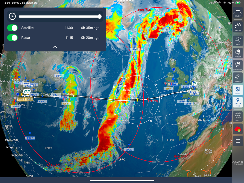
A global aviation weather map on SITA eWAS displaying satellite and radar overlays
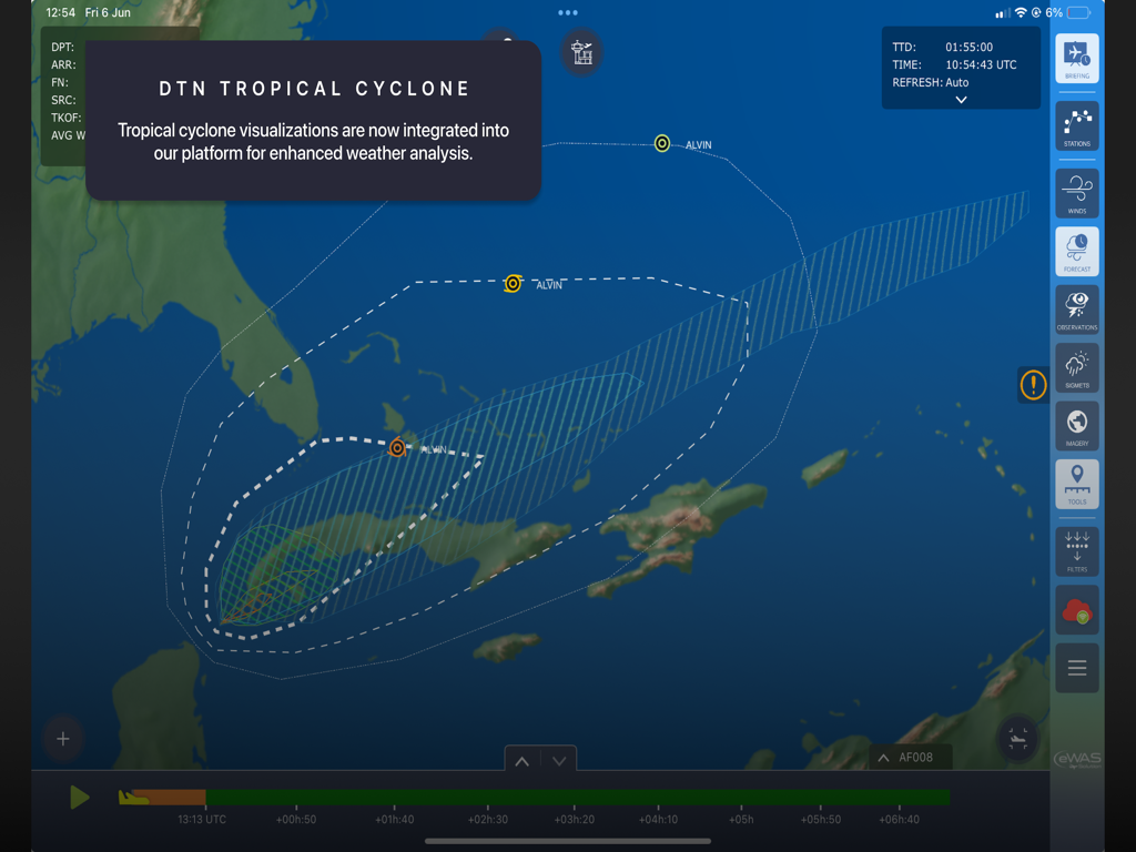
SITA eWAS aviation weather app displaying a tropical cyclone visualization on a map
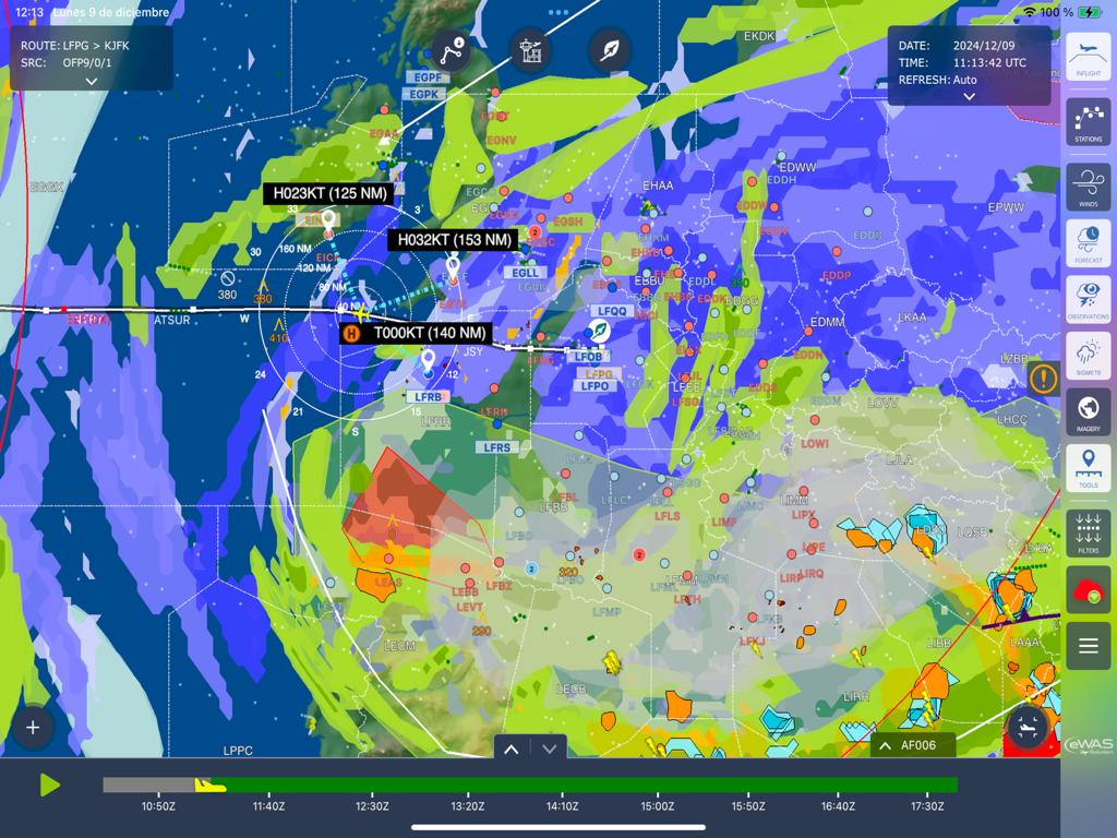
Professional aviation weather map interface showing flight routes and meteorological data
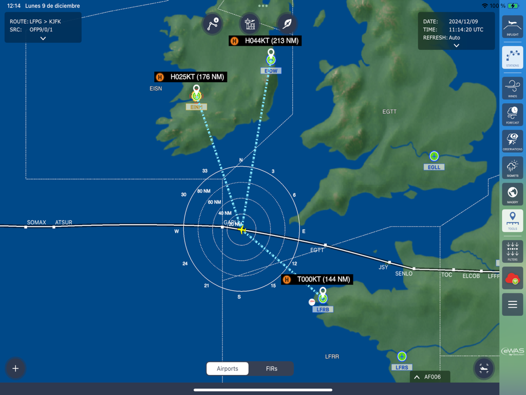
A digital flight navigation map in SITA eWAS showing a flight path and wind data for professional pilots
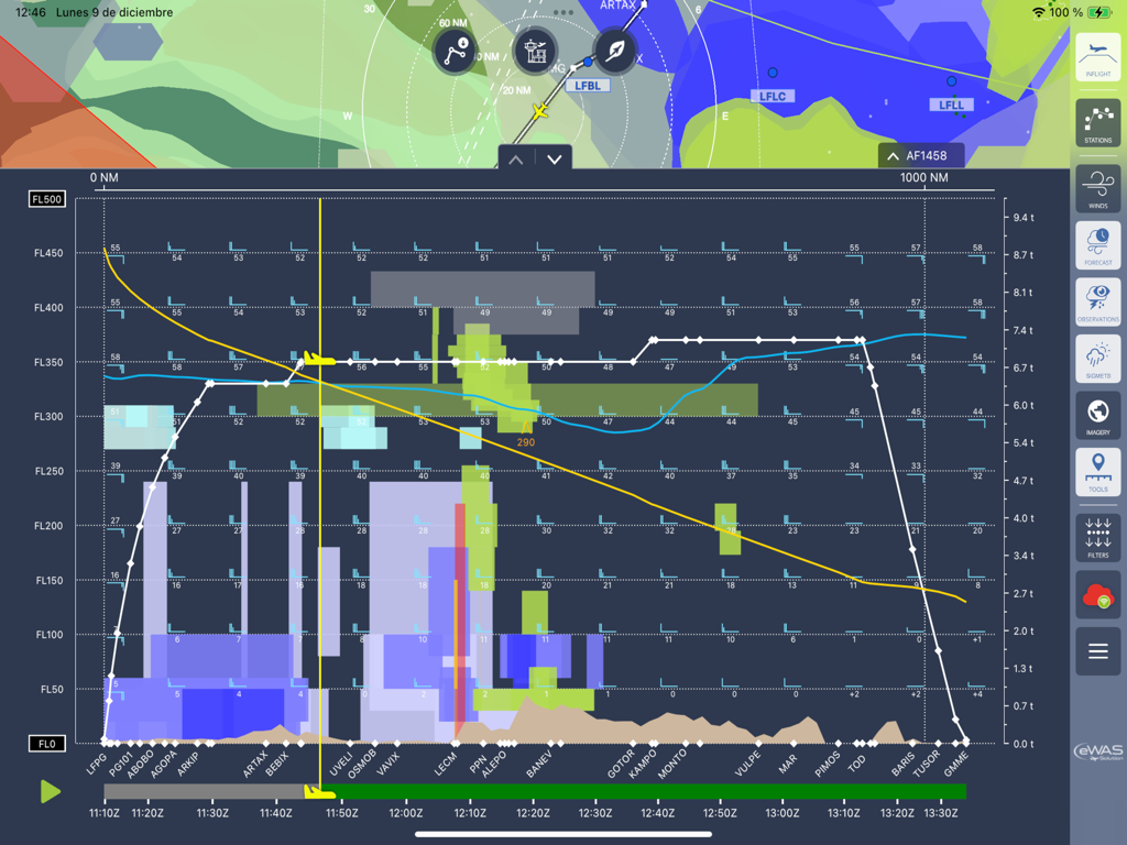
SITA eWAS iPad app displaying a vertical 4D weather profile for aviation flight planning
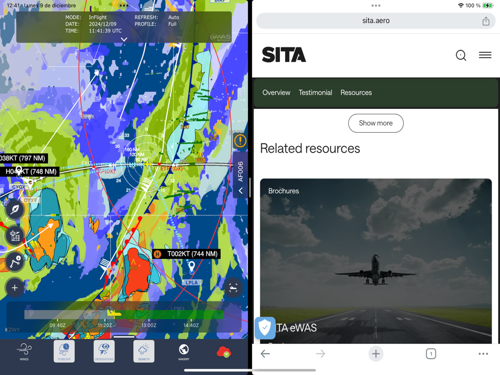
iPad split screen display featuring the SITA eWAS aviation weather map and company website resources
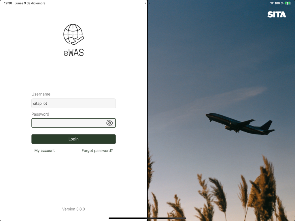
Login screen for the SITA eWAS aviation weather application for pilots.
Description
Download
More Like This
Top-ranked apps in the same category

墨迹天气-MojiWeather
Beijing MojiFengyun Technology Co.,Ltd.

The Weather Channel - Radar
The Weather Channel

Windy.com
Windyty, SE

天气预报-精准15日天气预报
Chongqing Caochen Technology Co., Ltd.

My Aurora Forecast & Alerts
JRustonApps B.V.

AccuWeather: Weather Forecast
AccuWeather International, Inc.

Weather & Radar - Storm radar
WetterOnline - Meteorologische Dienstleistungen GmbH

天气通
Weibo Internet Technology (China) Co.Ltd.

The Thermometer -Digital-
Vida Apps Incorporated
This page is not an official page of the app or its developer, but an independent editorial publication created for informational and commentary purposes. Unless expressly stated otherwise, neither the app nor its developer is affiliated with, endorsed by, sponsored by, authorized by, or otherwise officially connected with MWM, Apple, Google Play, the app publisher, or the app's developer, and nothing on this page implies that the app was developed using MWM's services. Any trademarks, logos, screenshots, and other content remain the property of their respective owners.