This page is not an official page of the app or its developer, but an independent editorial publication created for informational and commentary purposes. Unless expressly stated otherwise, neither the app nor its developer is affiliated with, endorsed by, sponsored by, authorized by, or otherwise officially connected with MWM, Apple, Google Play, the app publisher, or the app's developer, and nothing on this page implies that the app was developed using MWM's services. Any trademarks, logos, screenshots, and other content remain the property of their respective owners.

Timelapse Map:Purple Satellite
Scrub through decades of high-resolution satellite history with a single touch. From urban sprawl to shifting coastlines, explore the world's transformation through professional-grade geospatial data.
Downloads
0User Rating
Total Ratings
0Publisher
Category
EducationLocales
1Latest Version
2026.02.02Size
145.3 MBFirst Released
Sep 27, 2024Witness Every Change on Earth
Experience decades of planetary evolution through a seamless, interactive timelapse. From urban sprawl to environmental shifts, see the world's story unfold in high resolution.
Effortless Time Scrubbing
Slide your finger to watch years of history unfold in seconds. No complex layers or configuration—just a direct, intuitive window into the planet’s transformation.
Pro-Grade Geospatial Insights
Analyze urban expansion and agricultural patterns using advanced Shortwave Infrared (SWIR) tools and real-time data used by professionals.
The following screenshots and description are sourced directly from the app's official store listing and are the property of the app developer.
App Store
Screenshots
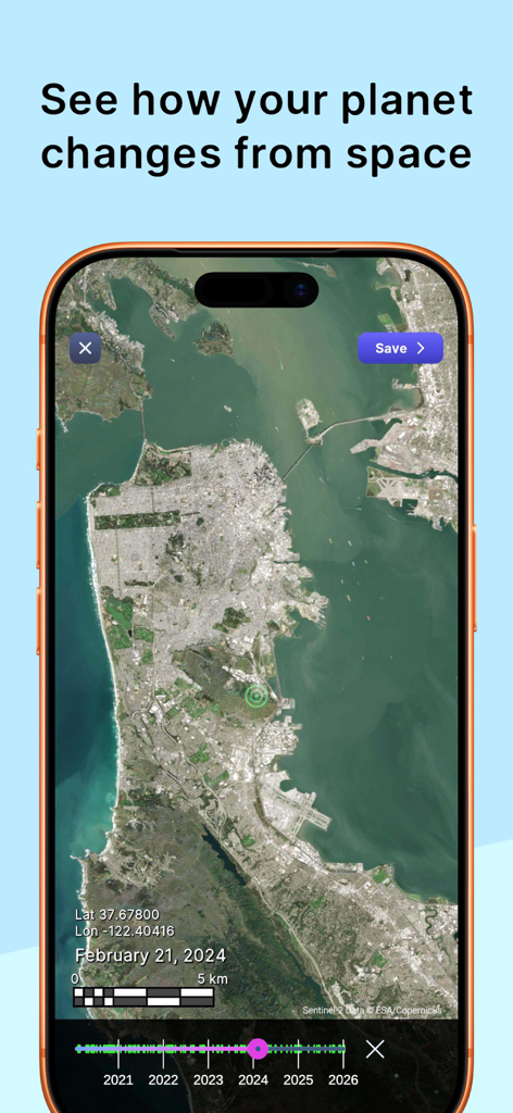
Satellite view of San Francisco on a mobile screen showing the time lapse slider and date
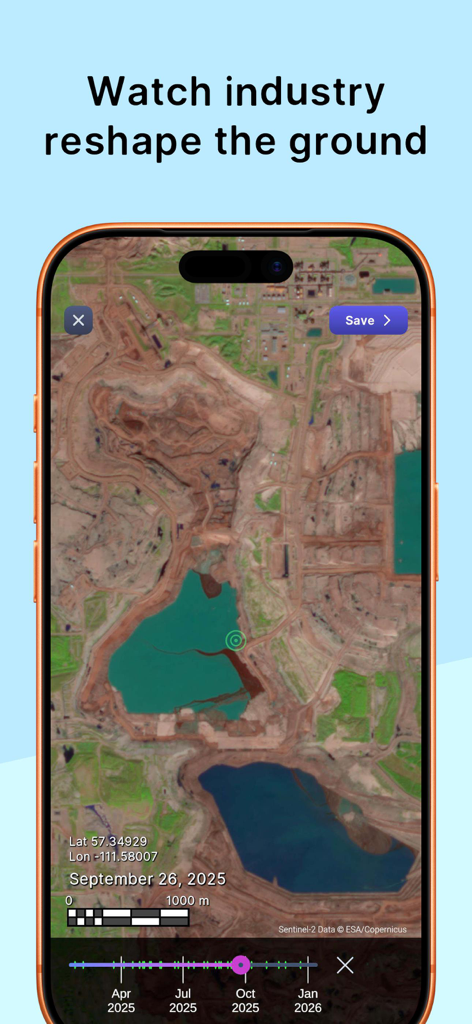
Satellite view of a mining site with a timelapse slider showing industrial expansion
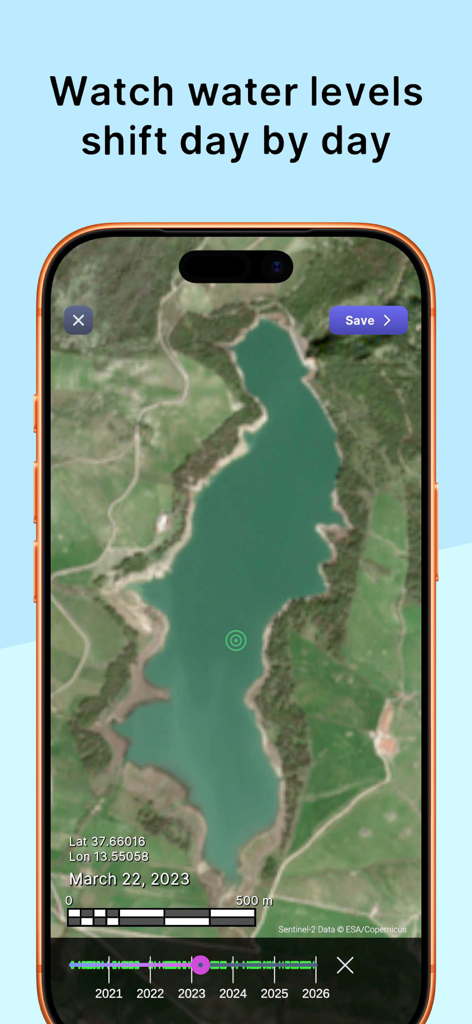
Purple Satellite app screenshot showing water level changes in a lake over time.
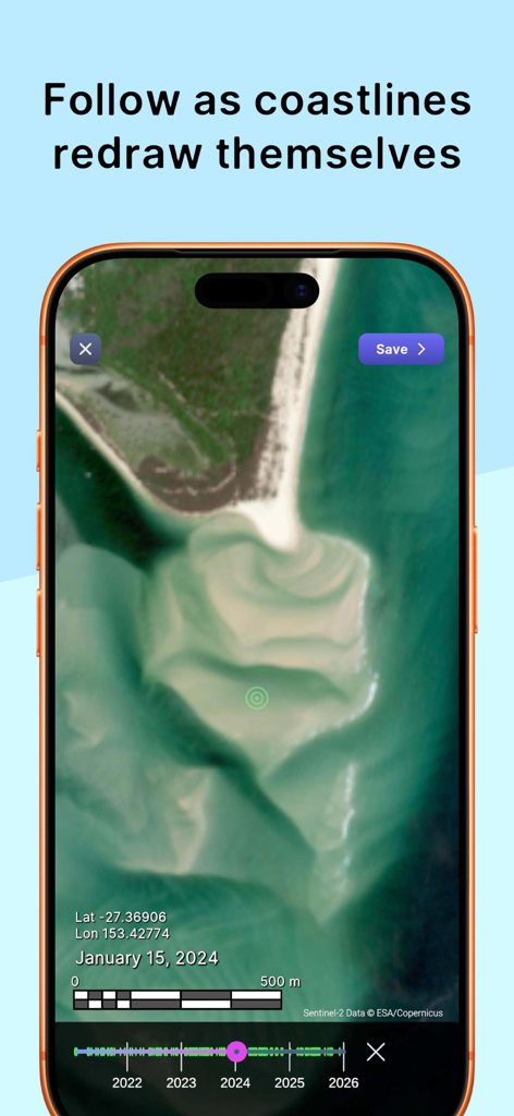
Satellite imagery of a changing coastline with a time slider interface in the Purple Satellite app
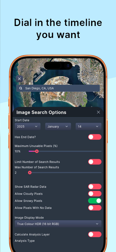
The Purple Satellite app interface showing advanced image search options and timeline filters for satellite maps.
Description
Download
More Like This
Top-ranked apps in the same category

Duolingo - Language Lessons
Duolingo, Inc

Speak & Learn English: Learna
DEEP FLOW SOFTWARE SERVICES - FZCO

Toca Boca World
Toca Boca AB

驾考宝典-科一科四驾驶证考试驾考通
Wuhan Jiakaobaodian Information Service Co., Ltd.

Google Classroom
Google LLC

作业帮-中小学家长作业检查和辅导工具
Guangzhou Polar Future Culture Technology Co., Ltd

Gauth: AI Study Companion
GAUTHTECH PTE. LTD.

Nail Salon Games for Kids 2-5
Brainytrainee Ltd

Quizlet: More than Flashcards
Quizlet Inc
This page is not an official page of the app or its developer, but an independent editorial publication created for informational and commentary purposes. Unless expressly stated otherwise, neither the app nor its developer is affiliated with, endorsed by, sponsored by, authorized by, or otherwise officially connected with MWM, Apple, Google Play, the app publisher, or the app's developer, and nothing on this page implies that the app was developed using MWM's services. Any trademarks, logos, screenshots, and other content remain the property of their respective owners.