This page is not an official page of the app or its developer, but an independent editorial publication created for informational and commentary purposes. Unless expressly stated otherwise, neither the app nor its developer is affiliated with, endorsed by, sponsored by, authorized by, or otherwise officially connected with MWM, Apple, Google Play, the app publisher, or the app's developer, and nothing on this page implies that the app was developed using MWM's services. Any trademarks, logos, screenshots, and other content remain the property of their respective owners.

Topo Maps 2
Master the terrain with official USGS and NRCAN maps in stunning 2D and 3D. Whether you are overlanding or backpacking, get reliable, high-precision data that works anywhere—no cell signal required.
Downloads
2K+User Rating
Total Ratings
0Publisher
Category
NavigationLocales
1Latest Version
2.8Size
196.9 MBFirst Released
Jun 16, 2024Engineered for the Off-Grid Explorer
Professional-grade topographic maps and 3D visualization for those who venture where cellular signals disappear.
Total Offline Autonomy
Navigate the most remote regions of North America without cell service. Download USGS and NR Canada maps directly to your device for guaranteed reliability.
Pro-Grade 3D Visualization
Identify peaks with Panorama Mode and scout routes using 3D fly-overs to analyze terrain and elevation before you set foot on the trail.
The following screenshots and description are sourced directly from the app's official store listing and are the property of the app developer.
App Store
Screenshots
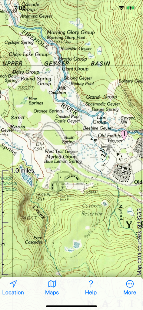
USGS topographical map showing Old Faithful Geyser area with detailed contour lines and trails
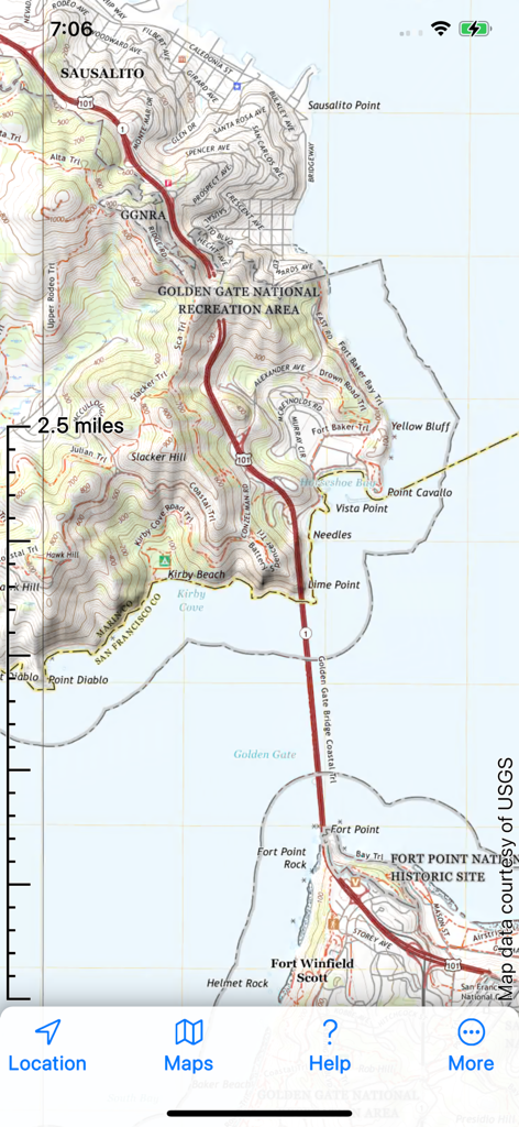
A detailed topographic map interface of the Golden Gate National Recreation Area with contour lines and trail routes.
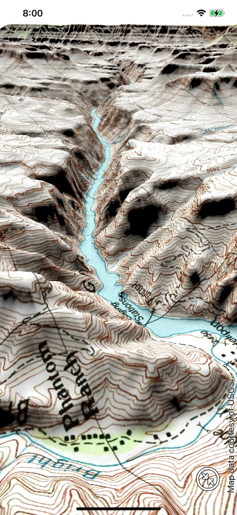
3D topographic map visualization of a canyon terrain with contour lines
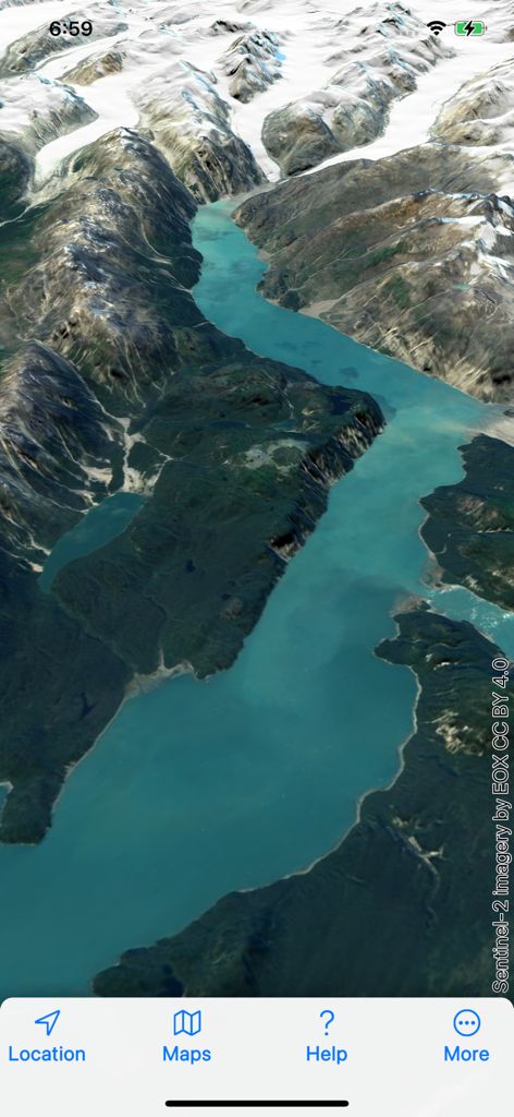
A 3D satellite view of snow capped mountains and a glacier fjord in the Topo Maps 2 mobile app interface
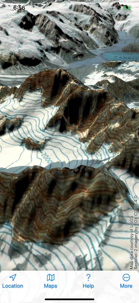
A 3D topographical map showing snow covered mountain peaks with contour lines in the Topo Maps 2 app
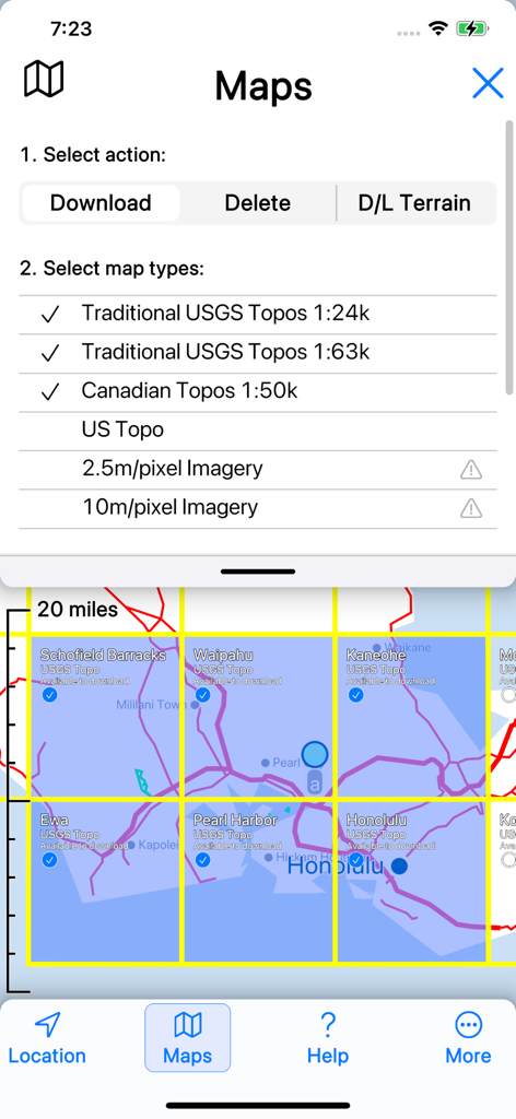
Topo Maps 2 app screen showing selection of USGS and Canadian topographical maps for offline download
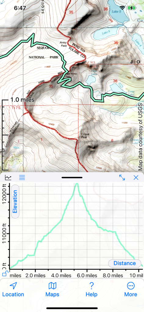
Topo Maps 2 app interface showing a topographical map of Sequoia National Park above a detailed elevation profile graph.
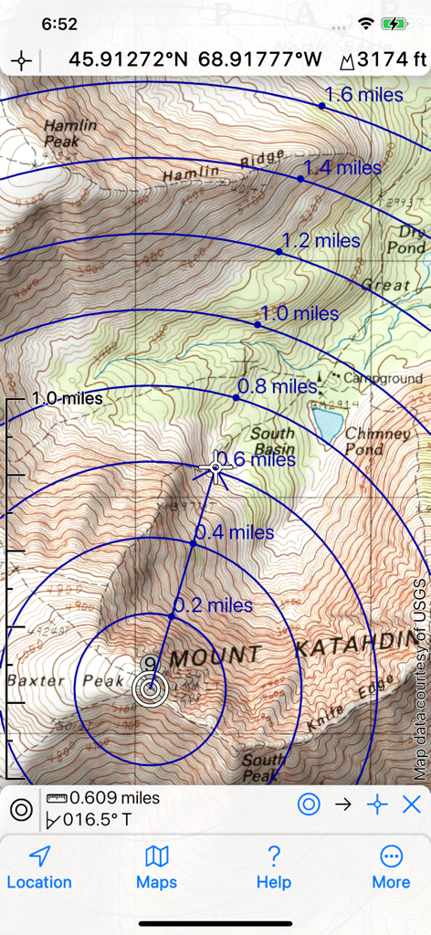
Topographic map of Mount Katahdin in Topo Maps 2 showing distance rings and contour lines.
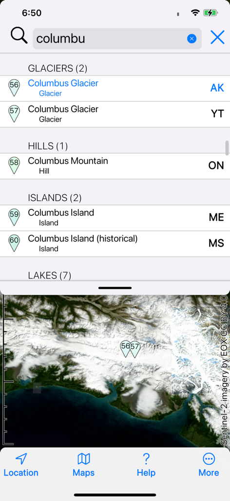
Search results for Columbus Glacier and geographic features with a satellite map view in the Topo Maps 2 app
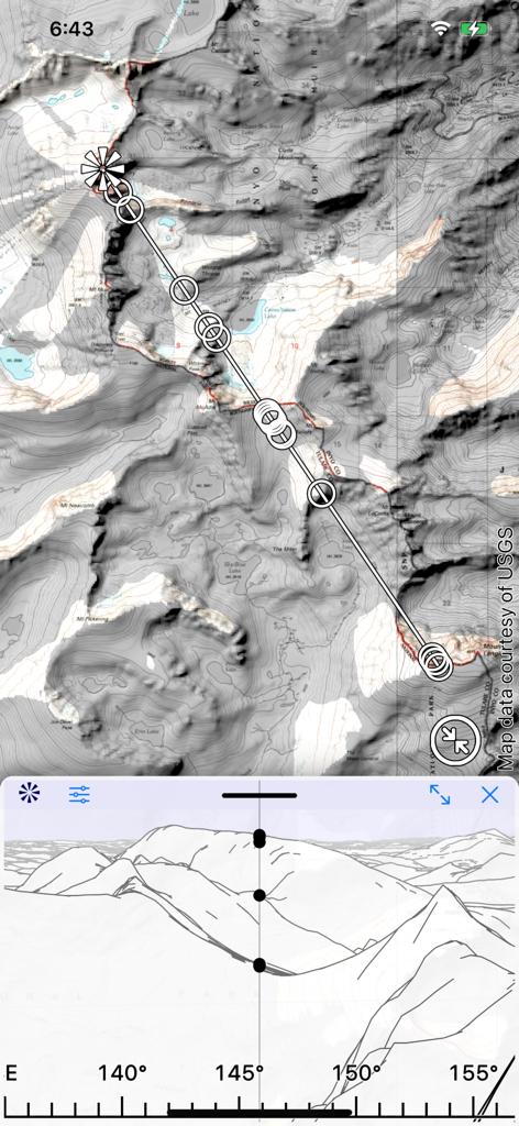
Split screen view showing a topographic map and a panorama silhouette of the mountain range
Description
Download
More Like This
Top-ranked apps in the same category

Google Maps
Google LLC

Waze Navigation & Live Traffic
waze

AMap Global
AutoNavi Information Technology Co. Ltd.

百度地图-路线规划,出行必备
Beijing Baidu Netcom Science & Technology Co.,Ltd

Moovit: Bus & Transit Tracker
Moovit App Global LTD

Transit • Subway & Bus Times
9280-0366 Quebec inc.

ParkMobile: Park. Pay. Go.
Parkmobile USA, Inc

腾讯地图-路线规划,导航地铁打车出行
Shenzhen Tencent Computer Systems Company Limited

Île-de-France Mobilités
Ile de France Mobilites
This page is not an official page of the app or its developer, but an independent editorial publication created for informational and commentary purposes. Unless expressly stated otherwise, neither the app nor its developer is affiliated with, endorsed by, sponsored by, authorized by, or otherwise officially connected with MWM, Apple, Google Play, the app publisher, or the app's developer, and nothing on this page implies that the app was developed using MWM's services. Any trademarks, logos, screenshots, and other content remain the property of their respective owners.