This page is not an official page of the app or its developer, but an independent editorial publication created for informational and commentary purposes. Unless expressly stated otherwise, neither the app nor its developer is affiliated with, endorsed by, sponsored by, authorized by, or otherwise officially connected with MWM, Apple, Google Play, the app publisher, or the app's developer, and nothing on this page implies that the app was developed using MWM's services. Any trademarks, logos, screenshots, and other content remain the property of their respective owners.

TopoRec - Map Viewer
Empower your next discovery by overlaying historical maps on modern landscapes. The precision tool built for historians, metal detectorists, and explorers to mark finds and export field data.
Downloads
4K+User Rating
Total Ratings
0Publisher
Category
NavigationLocales
21Latest Version
1.0.117Size
89.2 MBFirst Released
Jul 10, 2024Master the Art of Field Discovery
TopoRec combines professional-grade mapping tools with historical archives, giving you the precision needed to uncover what the world has forgotten.
Time-Travel Map Overlays
Toggle between historical and current maps to identify old homesteads, forgotten trails, and archaeological sites with ease.
Precision Field Marking
Drop pins on exact finds, outline survey areas, and record tracks. Ensure your fieldwork is organized and geographically accurate.
The following screenshots and description are sourced directly from the app's official store listing and are the property of the app developer.
App Store
Screenshots
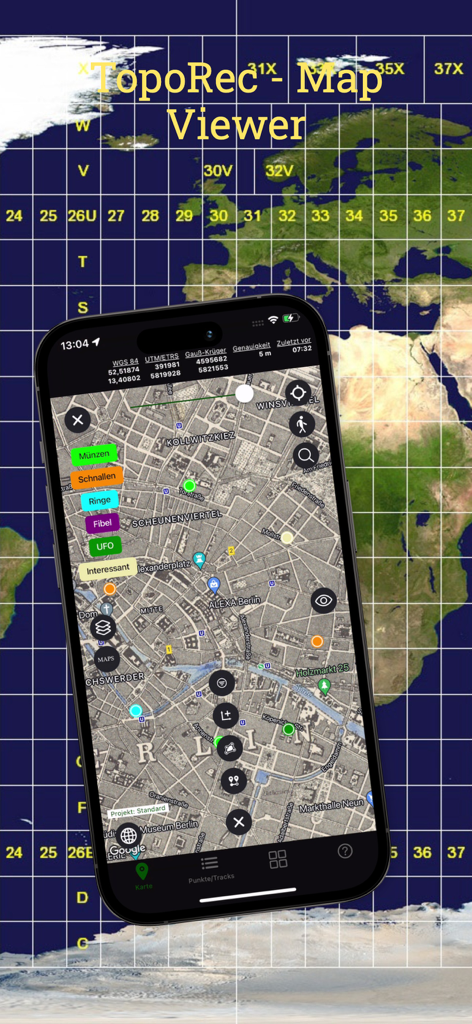
TopoRec Map Viewer app displaying a historical map with custom markers on a smartphone
TopoRec mobile app interface showing a historical map overlay with GPS tracking and coordinates
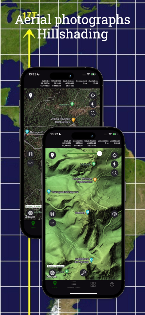
TopoRec app interface showing aerial photography and hillshading topographic map layers on mobile devices
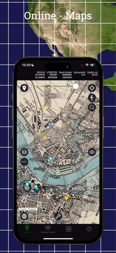
TopoRec app interface displaying historical and topographical map layers with precise GPS coordinates on a smartphone screen
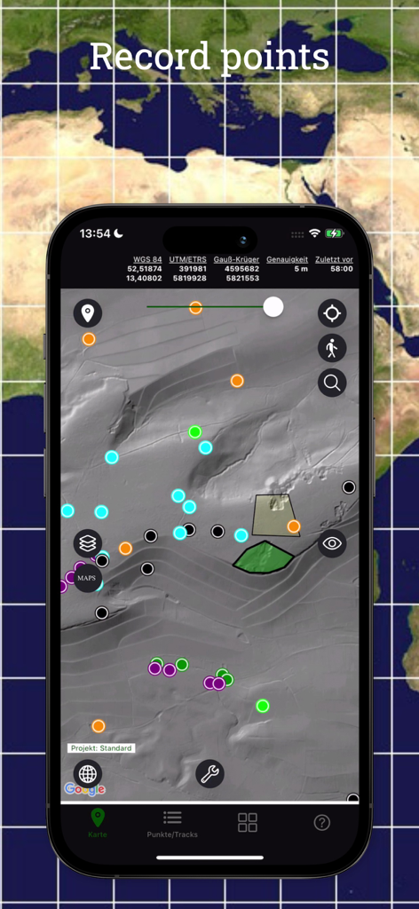
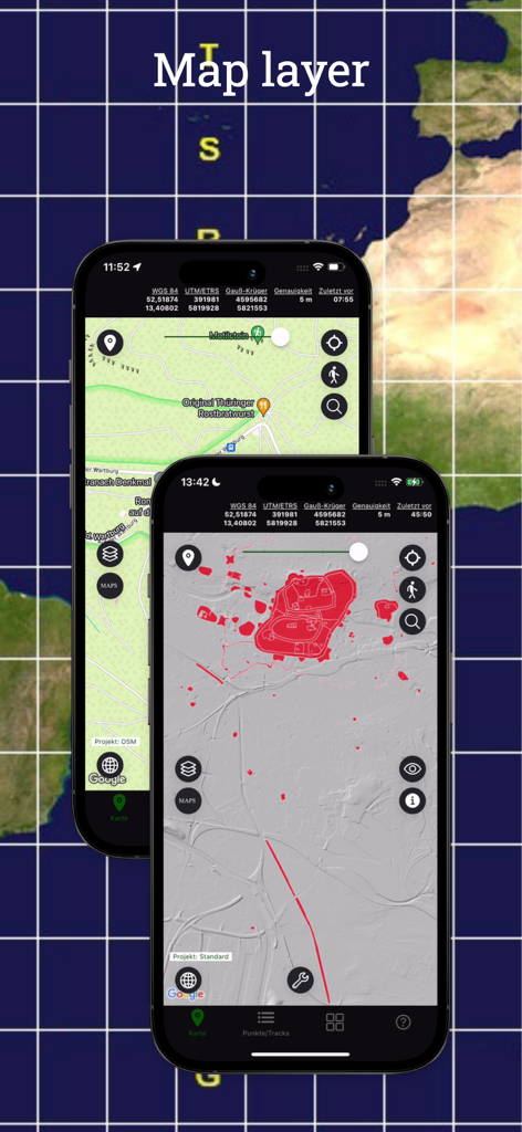
A smartphone screen displaying the TopoRec app interface with multiple colored pins and recorded areas on a detailed topographical map.
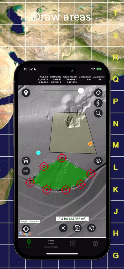
Topographic map app interface showing area measurement and polygon drawing tools
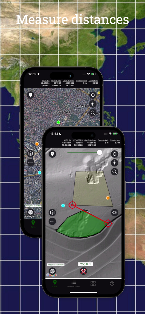
TopoRec mobile app interface showing distance measurement and area marking on a topographical terrain map
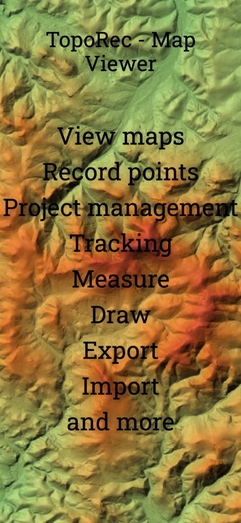
TopoRec app features list showing tracking and recording points over a topographical map background
Description
Download
More Like This
Top-ranked apps in the same category

Google Maps
Google LLC

Waze Navigation & Live Traffic
waze

AMap Global
AutoNavi Information Technology Co. Ltd.

百度地图-路线规划,出行必备
Beijing Baidu Netcom Science & Technology Co.,Ltd

Moovit: Bus & Transit Tracker
Moovit App Global LTD

Transit • Subway & Bus Times
9280-0366 Quebec inc.

ParkMobile: Park. Pay. Go.
Parkmobile USA, Inc

腾讯地图-路线规划,导航地铁打车出行
Shenzhen Tencent Computer Systems Company Limited

Île-de-France Mobilités
Ile de France Mobilites
This page is not an official page of the app or its developer, but an independent editorial publication created for informational and commentary purposes. Unless expressly stated otherwise, neither the app nor its developer is affiliated with, endorsed by, sponsored by, authorized by, or otherwise officially connected with MWM, Apple, Google Play, the app publisher, or the app's developer, and nothing on this page implies that the app was developed using MWM's services. Any trademarks, logos, screenshots, and other content remain the property of their respective owners.