This page is not an official page of the app or its developer, but an independent editorial publication created for informational and commentary purposes. Unless expressly stated otherwise, neither the app nor its developer is affiliated with, endorsed by, sponsored by, authorized by, or otherwise officially connected with MWM, Apple, Google Play, the app publisher, or the app's developer, and nothing on this page implies that the app was developed using MWM's services. Any trademarks, logos, screenshots, and other content remain the property of their respective owners.

TrailSnap: Hike, Bike & Walk
The distraction-free GPS tracker designed for explorers who value real milestones. Overlay live altitude, coordinates, and mountain weather onto your photos to turn every summit into a visual diary—no gamified junk, just pure adventure on your wrist.
Downloads
0User Rating
Total Ratings
0Publisher
Category
TravelLocales
11Latest Version
1.0.4Size
21.4 MBFirst Released
Feb 5, 2026Elevate Your Adventure
No cluttered feeds or gamified junk. Just precise mountain data and visual memories designed for the minimalist explorer who values the climb.
Altitude-Stamped Photos
Turn your photos into a visual diary. Automatically overlay precise elevation, GPS coordinates, and weather data to capture the soul of every summit.
Wrist-First Tracking
Leave your phone in your pocket. Monitor your vertical gain, distance, and pace directly from your Apple Watch for a distraction-free hiking experience.
The following screenshots and description are sourced directly from the app's official store listing and are the property of the app developer.
App Store
Screenshots
TrailSnap app elevation camera showing a 1420 meter altitude overlay on a mountain landscape
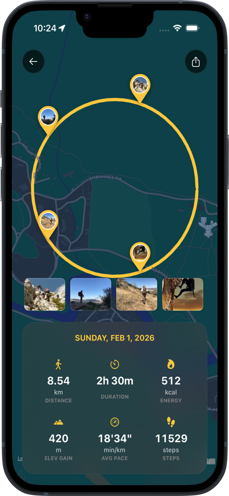
TrailSnap app interface displaying a map with photo pins along a route and a summary of hiking statistics including distance, elevation gain, and duration.
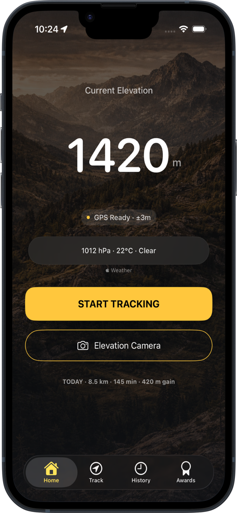
TrailSnap app home screen displaying elevation weather and start tracking button
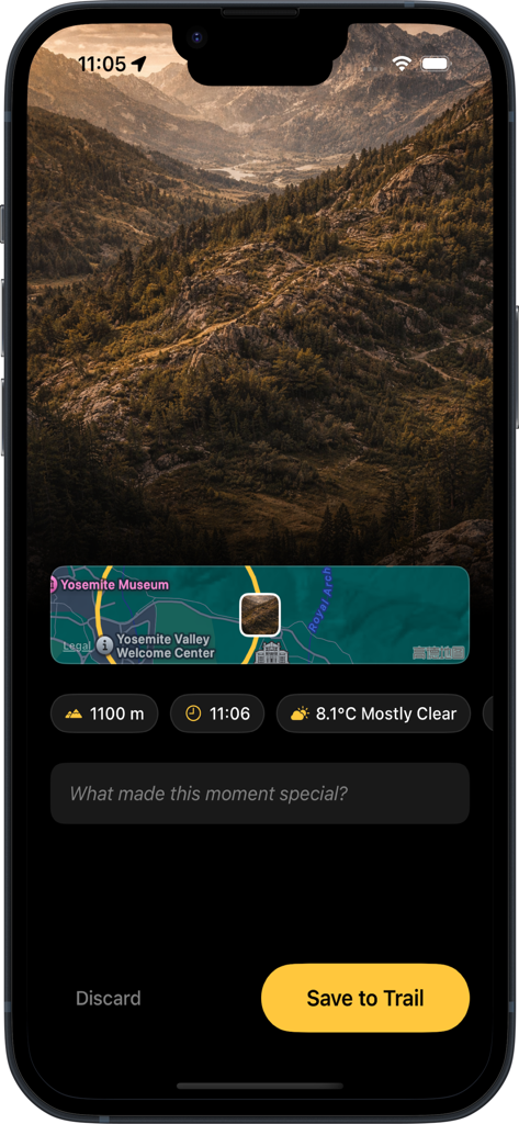
Hiking app screen displaying a mountain photo with altitude location map and weather details
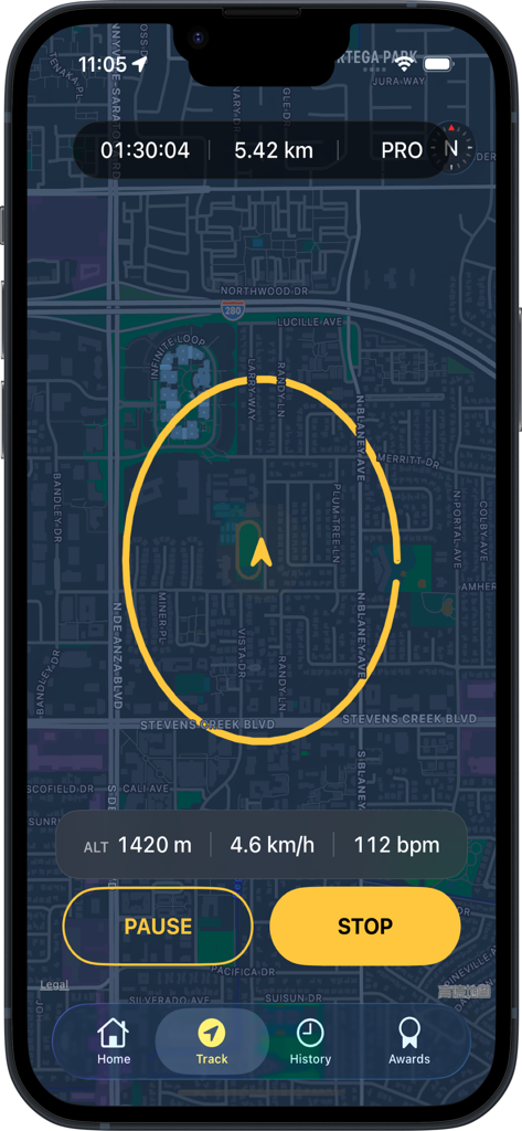
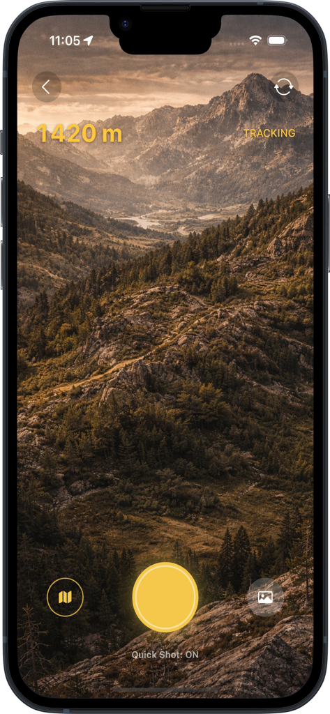
TrailSnap app showing live GPS trail tracking with altitude and heart rate data
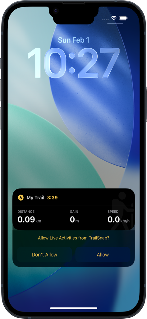
iPhone lock screen showing TrailSnap Live Activity tracking trail distance and speed
Description
Download
More Like This
Top-ranked apps in the same category

Uber - Request a ride
Uber Technologies, Inc.

铁路12306
ACADEMY OF RAILWAY SCIENCES CO., ltd.

Airbnb
Airbnb, Inc.

Grab: Taxi Ride, Food Delivery
GRABTAXI HOLDINGS PTE. LTD.

Booking.com: Hotels & Travel
Booking.com B.V.

DiDi China: Ride Hailing
Didi Chuxing (Beijing) Network Platform Technology Co., Ltd

Trip.com: Book Flights, Hotels
Trip.com Travel Singapore Pte. Ltd.

携程旅行-订酒店机票火车票
Shanghai Ctrip Commerce Co.,Ltd

去哪儿旅行-订酒店机票火车票
Beijing Qunar Information Technology Company Limit
This page is not an official page of the app or its developer, but an independent editorial publication created for informational and commentary purposes. Unless expressly stated otherwise, neither the app nor its developer is affiliated with, endorsed by, sponsored by, authorized by, or otherwise officially connected with MWM, Apple, Google Play, the app publisher, or the app's developer, and nothing on this page implies that the app was developed using MWM's services. Any trademarks, logos, screenshots, and other content remain the property of their respective owners.