This page is not an official page of the app or its developer, but an independent editorial publication created for informational and commentary purposes. Unless expressly stated otherwise, neither the app nor its developer is affiliated with, endorsed by, sponsored by, authorized by, or otherwise officially connected with MWM, Apple, Google Play, the app publisher, or the app's developer, and nothing on this page implies that the app was developed using MWM's services. Any trademarks, logos, screenshots, and other content remain the property of their respective owners.

UkFloodPro
Get precise, ad-free data from official UK agencies. Stay informed with live flood warnings and gauge levels to protect your property and plan your day.
Downloads
3K+User Rating
Total Ratings
0Publisher
Category
WeatherLocales
1Latest Version
2.61Size
265.4 MBFirst Released
Jan 2, 2024Professional Flood Risk & Water Level Intelligence
Stay ahead of environmental changes with comprehensive, ad-free data directly from the UK’s leading official environmental agencies.
Live Official Agency Data
Access real-time rainfall, river, and tidal levels from over 900 stations across England, Scotland, and Wales with zero adverts.
Advanced Risk Preparation
Monitor detailed 5-day flood forecasts and active warnings to proactively protect your property, land, and assets.
The following screenshots and description are sourced directly from the app's official store listing and are the property of the app developer.
App Store
Screenshots
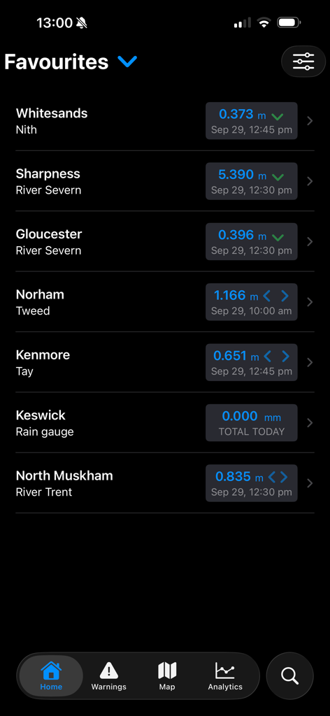
A list of favorite river and rain monitoring stations in the UkFloodPro app showing live data levels.
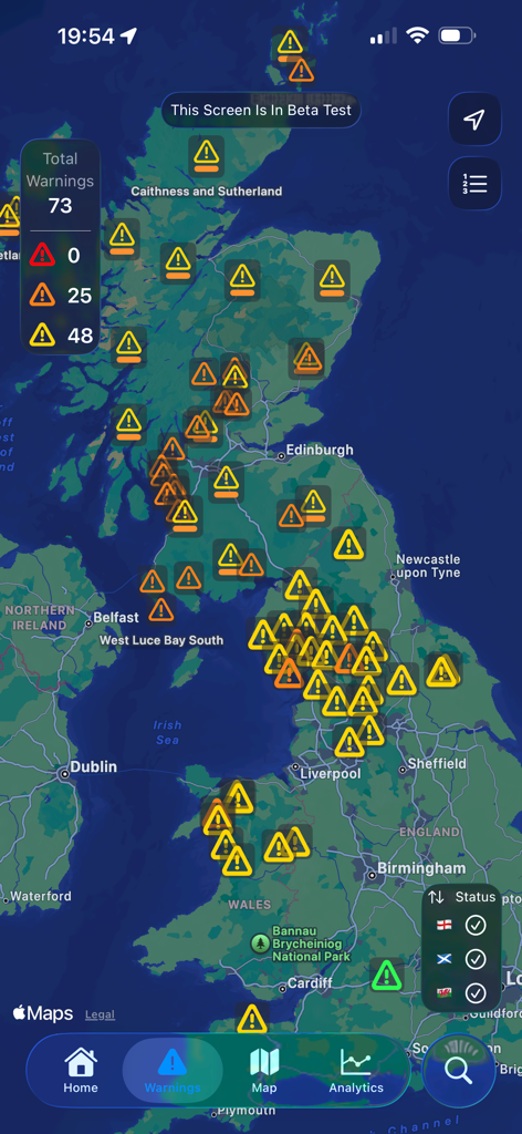
Map view of the UK displaying multiple flood warning icons and an alert summary
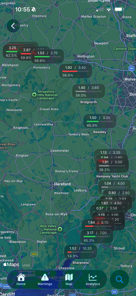
UK map displaying live river level data and flood station status
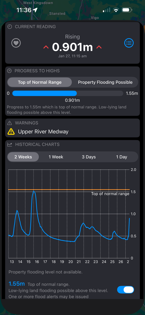
Detailed river level reading and historical chart for Upper River Medway on the UkFloodPro app
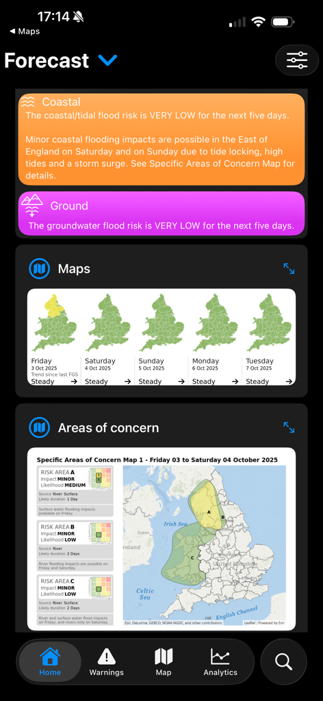
Five day flood forecast dashboard for the United Kingdom showing regional risk maps.
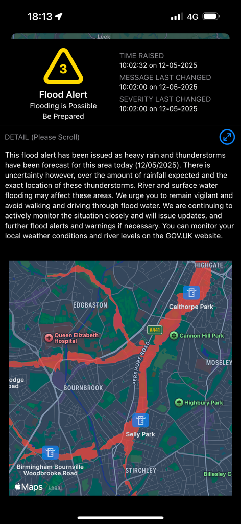
Detailed flood alert screen with risk map showing flood zones in Birmingham
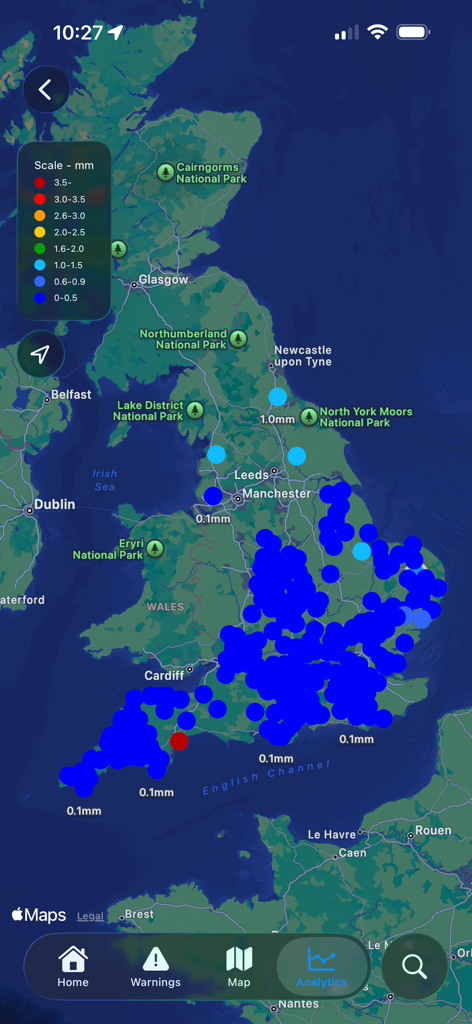
Map display of the UkFloodPro app showing live rainfall data across the United Kingdom
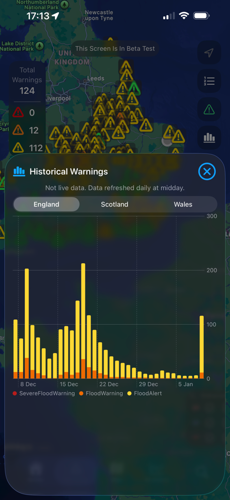
A bar chart showing historical flood warnings and alerts for England displayed over a map view.
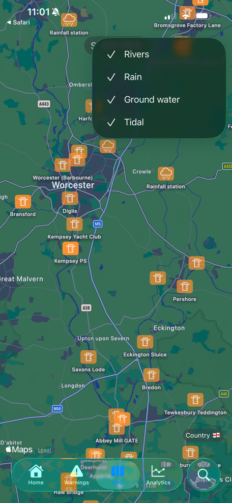
Map view of the UkFloodPro app showing weather stations and data filters
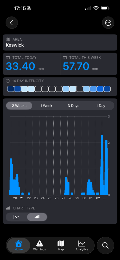
UkFloodPro app screen displaying rainfall data and charts for Keswick
Description
Download
More Like This
Top-ranked apps in the same category

墨迹天气-MojiWeather
Beijing MojiFengyun Technology Co.,Ltd.

The Weather Channel - Radar
The Weather Channel

Windy.com
Windyty, SE

天气预报-精准15日天气预报
Chongqing Caochen Technology Co., Ltd.

My Aurora Forecast & Alerts
JRustonApps B.V.

AccuWeather: Weather Forecast
AccuWeather International, Inc.

Weather & Radar - Storm radar
WetterOnline - Meteorologische Dienstleistungen GmbH

天气通
Weibo Internet Technology (China) Co.Ltd.

The Thermometer -Digital-
Vida Apps Incorporated
This page is not an official page of the app or its developer, but an independent editorial publication created for informational and commentary purposes. Unless expressly stated otherwise, neither the app nor its developer is affiliated with, endorsed by, sponsored by, authorized by, or otherwise officially connected with MWM, Apple, Google Play, the app publisher, or the app's developer, and nothing on this page implies that the app was developed using MWM's services. Any trademarks, logos, screenshots, and other content remain the property of their respective owners.