This page is not an official page of the app or its developer, but an independent editorial publication created for informational and commentary purposes. Unless expressly stated otherwise, neither the app nor its developer is affiliated with, endorsed by, sponsored by, authorized by, or otherwise officially connected with MWM, Apple, Google Play, the app publisher, or the app's developer, and nothing on this page implies that the app was developed using MWM's services. Any trademarks, logos, screenshots, and other content remain the property of their respective owners.

UoB Campus Map
Navigate Edgbaston and Selly Oak with ease. Find real-time study spaces, track live transit, and access inclusive, stair-free routing—all in one essential app for the Birmingham community.
Downloads
64K+User Rating
Total Ratings
0Publisher
Category
NavigationLocales
1Latest Version
3.2Size
44.6 MBFirst Released
Jan 22, 2019Master Your Campus Experience
Navigate Edgbaston and Selly Oak like a pro. From finding hidden study nooks to tracking live transit, we put the University of Birmingham in your pocket.
Smart Campus Navigation
Get turn-by-turn directions to any building with customizable stair-free routes for inclusive, stress-free travel.
Instant Study Space Finder
Don't waste time searching for a seat. Quickly locate the best study spots across campus to maximize your productivity.
The following screenshots and description are sourced directly from the app's official store listing and are the property of the app developer.
App Store
Screenshots
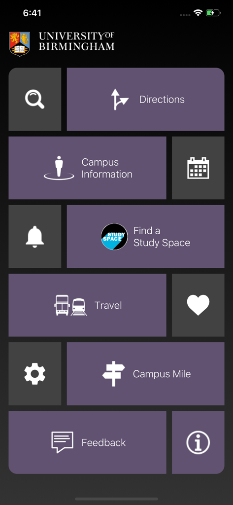
The main menu of the University of Birmingham campus map app displaying tiles for directions, travel, and study spaces
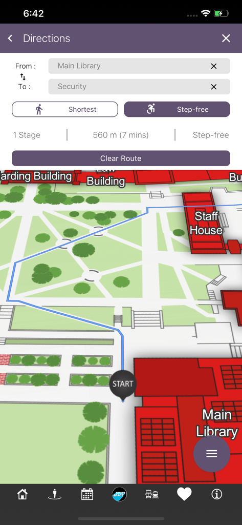
Screenshot of the UoB Campus Map app showing step-free walking directions from the Main Library to Security
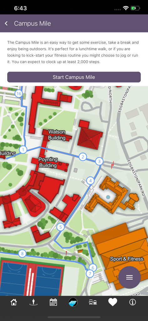
UoB Campus Map app showing a designated walking route called the Campus Mile on the university map.
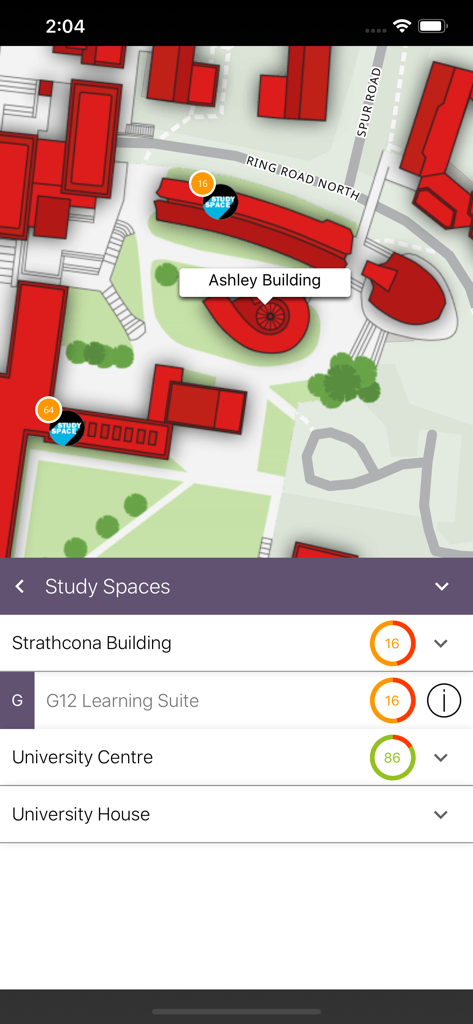
Interface of the UoB Campus Map app showing real-time availability of study spaces across the University of Birmingham campus.
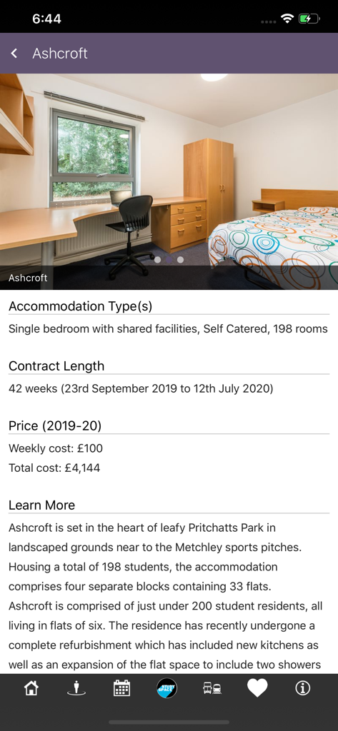
Screenshot of the UoB Campus Map app displaying details for Ashcroft student accommodation including room photo and pricing
Description
Download
More Like This
Top-ranked apps in the same category

Google Maps
Google LLC

AMap Global
AutoNavi Information Technology Co. Ltd.

Waze Navigation & Live Traffic
waze

百度地图-路线规划,出行必备
Beijing Baidu Netcom Science & Technology Co.,Ltd

Moovit: Bus & Transit Tracker
Moovit App Global LTD

Transit • Subway & Bus Times
9280-0366 Quebec inc.

ParkMobile: Park. Pay. Go.
Parkmobile USA, Inc

腾讯地图-路线规划,导航地铁打车出行
Shenzhen Tencent Computer Systems Company Limited

MapXplorer: Map Radar Navigate
GOLDLAB APPLICATIONS YAZILIM VE BILISIM ANONIM SIRKETI
This page is not an official page of the app or its developer, but an independent editorial publication created for informational and commentary purposes. Unless expressly stated otherwise, neither the app nor its developer is affiliated with, endorsed by, sponsored by, authorized by, or otherwise officially connected with MWM, Apple, Google Play, the app publisher, or the app's developer, and nothing on this page implies that the app was developed using MWM's services. Any trademarks, logos, screenshots, and other content remain the property of their respective owners.