This page is not an official page of the app or its developer, but an independent editorial publication created for informational and commentary purposes. Unless expressly stated otherwise, neither the app nor its developer is affiliated with, endorsed by, sponsored by, authorized by, or otherwise officially connected with MWM, Apple, Google Play, the app publisher, or the app's developer, and nothing on this page implies that the app was developed using MWM's services. Any trademarks, logos, screenshots, and other content remain the property of their respective owners.

UP NOAH
Harness the power of advanced hazard mapping and localized risk assessments to safeguard lives and property against floods, landslides, and storm surges in the Philippines.
Downloads
10K+User Rating
Total Ratings
0Publisher
Category
WeatherLocales
1Latest Version
1.0Size
7.3 MBFirst Released
Mar 26, 2025Protect What Matters Most, From Anywhere
Empowering the global Filipino community with high-precision hazard mapping and real-time scientific data to safeguard families and properties in the Philippines.
Hyper-Local Risk Mapping
Identify flood, landslide, and storm surge hazards down to the barangay level to assess specific risks to your family home or investments.
Science-Backed Monitoring
Leverage advanced satellite data and University of the Philippines research for objective, real-time alerts that bypass the noise.
The following screenshots and description are sourced directly from the app's official store listing and are the property of the app developer.
App Store
Screenshots
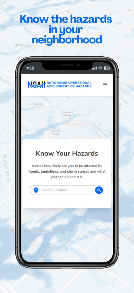
The home screen of the UP NOAH app showing the search interface for assessing natural hazards like floods and landslides.
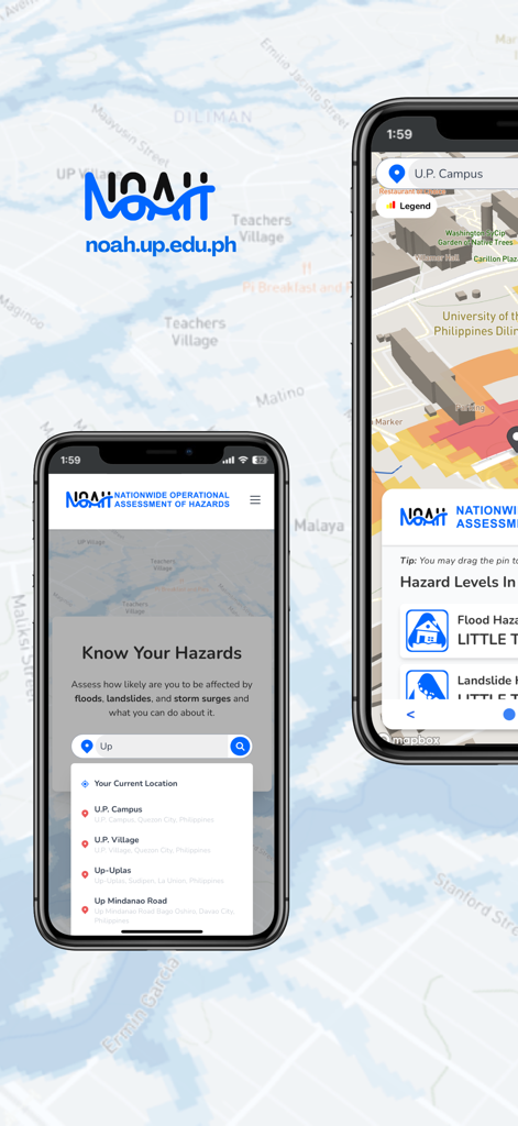
Two smartphones displaying the UP NOAH mobile app interface with hazard risk maps and location search functionality
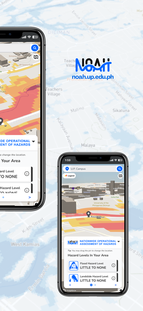
The UP NOAH app interface showing interactive flood and landslide hazard levels on a smartphone screen.
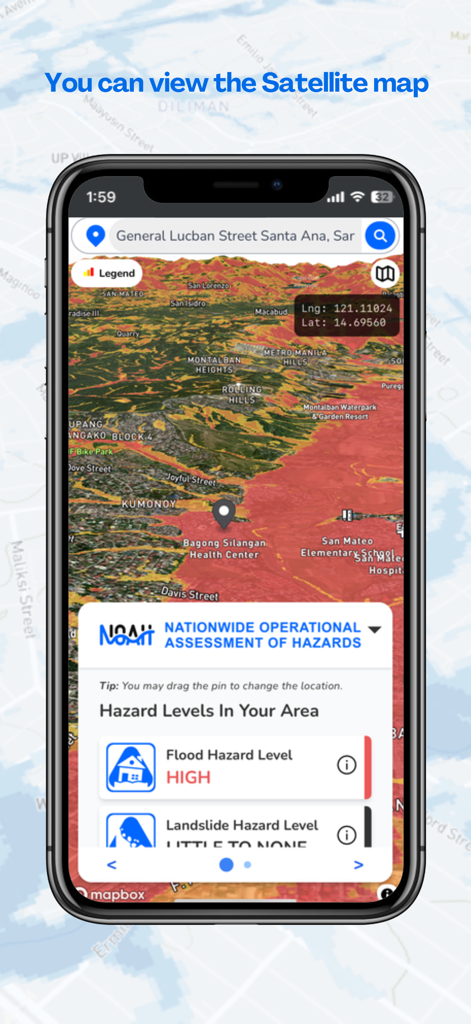
UP NOAH app interface showing a satellite map with a high flood hazard level alert
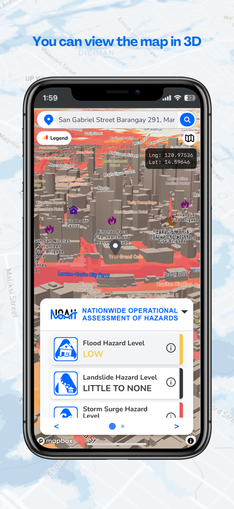
UP NOAH mobile app screen displaying a 3D map with localized flood and landslide hazard assessments
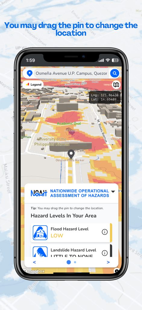
Interface of UP NOAH app showing a hazard risk map and flood level assessment for a selected location
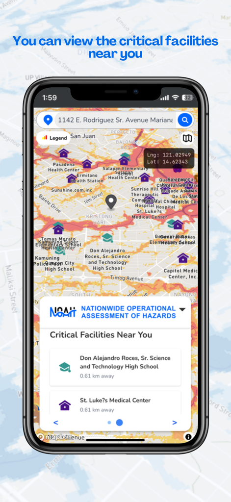
UP NOAH app interface showing a hazard map with critical facilities such as schools and medical centers.
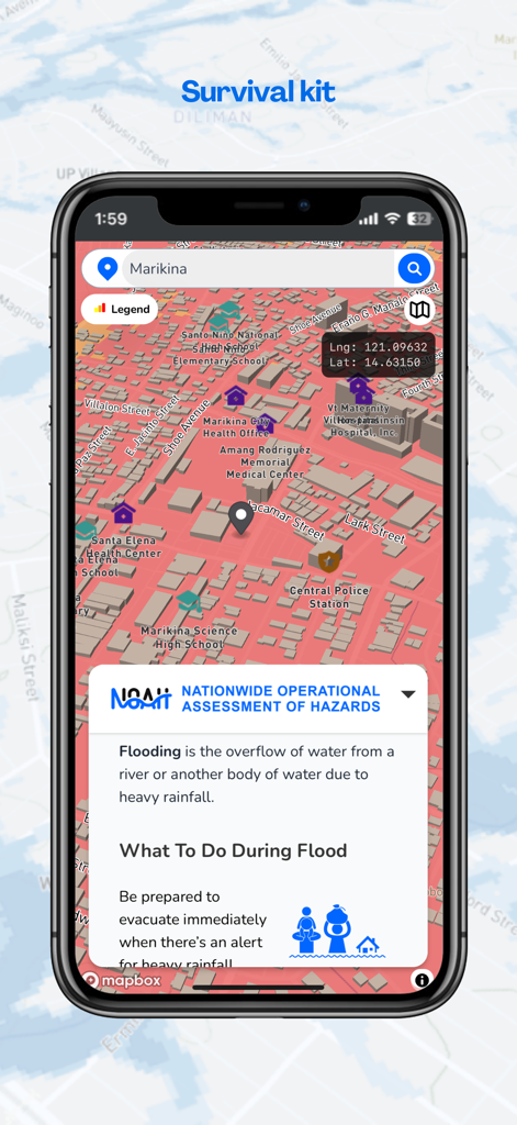
UP NOAH app displaying a flood risk map of Marikina and survival kit information.
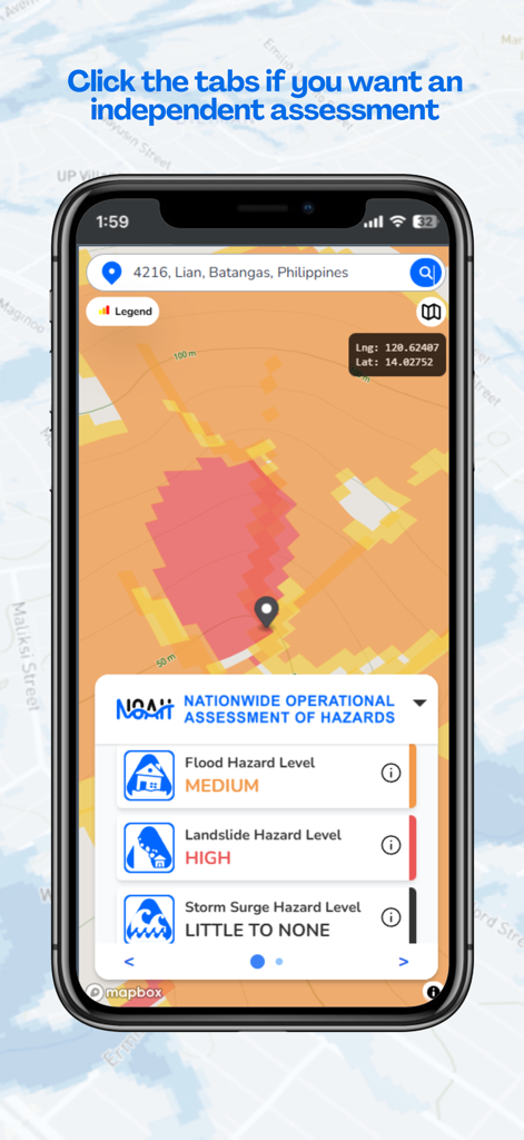
UP NOAH app interface showing flood and landslide hazard levels for a specific location
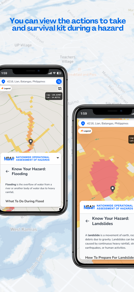
UP NOAH mobile app screenshots showing interactive hazard maps for flooding and landslides with survival instructions
Description
Download
More Like This
Top-ranked apps in the same category

墨迹天气-MojiWeather
Beijing MojiFengyun Technology Co.,Ltd.

Windy.com
Windyty, SE

天气预报-精准15日天气预报
Chongqing Caochen Technology Co., Ltd.

The Weather Channel - Radar
The Weather Channel

AccuWeather: Weather Forecast
AccuWeather International, Inc.

Weather & Radar USA
WetterOnline - Meteorologische Dienstleistungen GmbH

My Aurora Forecast & Alerts
JRustonApps B.V.

天气通
Weibo Internet Technology (China) Co.Ltd.

Acme Weather
Acme Weather Corporation, LLC
This page is not an official page of the app or its developer, but an independent editorial publication created for informational and commentary purposes. Unless expressly stated otherwise, neither the app nor its developer is affiliated with, endorsed by, sponsored by, authorized by, or otherwise officially connected with MWM, Apple, Google Play, the app publisher, or the app's developer, and nothing on this page implies that the app was developed using MWM's services. Any trademarks, logos, screenshots, and other content remain the property of their respective owners.