This page is not an official page of the app or its developer, but an independent editorial publication created for informational and commentary purposes. Unless expressly stated otherwise, neither the app nor its developer is affiliated with, endorsed by, sponsored by, authorized by, or otherwise officially connected with MWM, Apple, Google Play, the app publisher, or the app's developer, and nothing on this page implies that the app was developed using MWM's services. Any trademarks, logos, screenshots, and other content remain the property of their respective owners.

Voyage Radar: AIS Ship Tracker
Monitor 350,000+ vessels with live AIS data, detailed port insights, and real-time wave conditions. The ultimate precision tool for mariners, ship owners, and maritime enthusiasts.
Downloads
100+User Rating
Total Ratings
0Publisher
Category
NavigationLocales
1Latest Version
1.0.11Size
47.3 MBFirst Released
Dec 14, 2025Master the Seas with Precision Intelligence
From real-time AIS tracking to deep-sea wave analysis, Voyage Radar provides the high-density data required by maritime professionals and coastal enthusiasts.
Live Global AIS Tracking
Monitor over 350,000 vessels in real-time with precise GPS coordinates, heading, and speed data at your fingertips.
Comprehensive Marine Weather
Stay safe with live wave height, period, and wind data integrated directly into your vessel and port maps.
The following screenshots and description are sourced directly from the app's official store listing and are the property of the app developer.
App Store
Screenshots
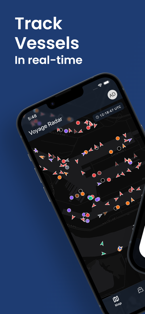
Voyage Radar app interface showing real-time ship tracking and vessel locations on a dark mode map.
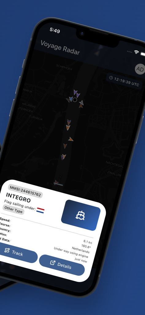
Voyage Radar app interface showing a real-time AIS vessel tracking map with detailed ship information for a vessel named Integro
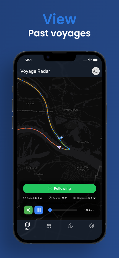
Voyage Radar app interface showing a map with a ship trajectory for the past voyages playback feature
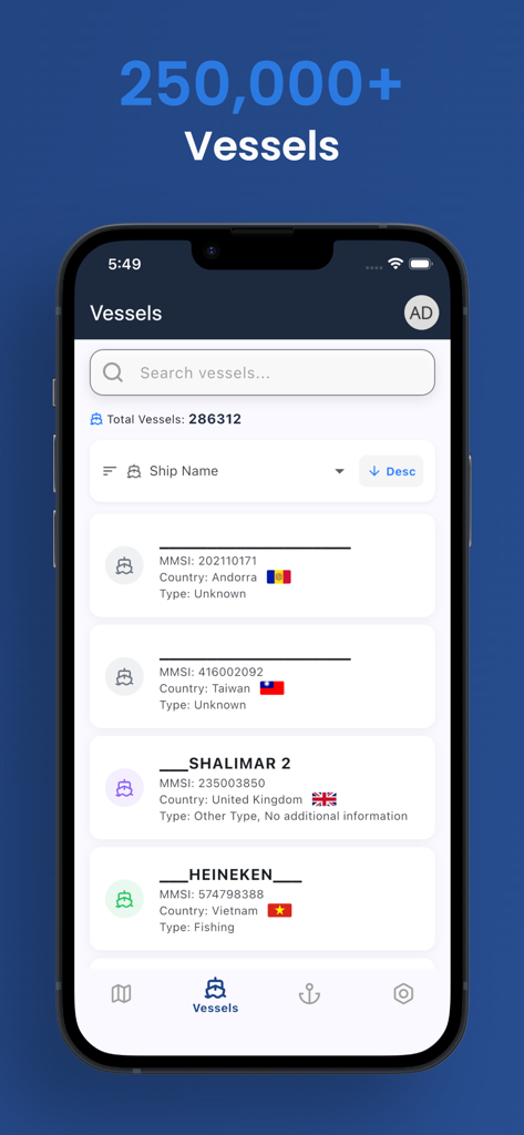
Voyage Radar app showing a searchable list of over 250,000 vessels with AIS data and country flags.
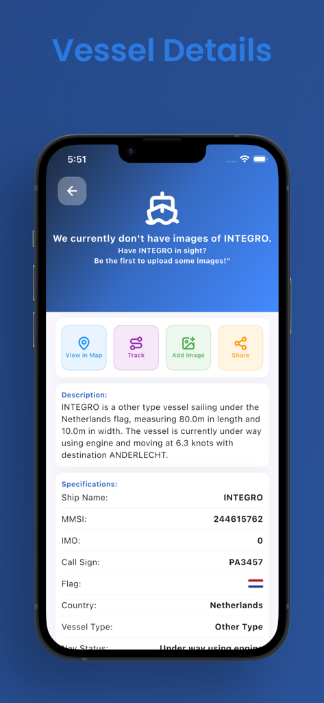
Detailed vessel specifications and status for a ship named INTEGRO in the Voyage Radar app.
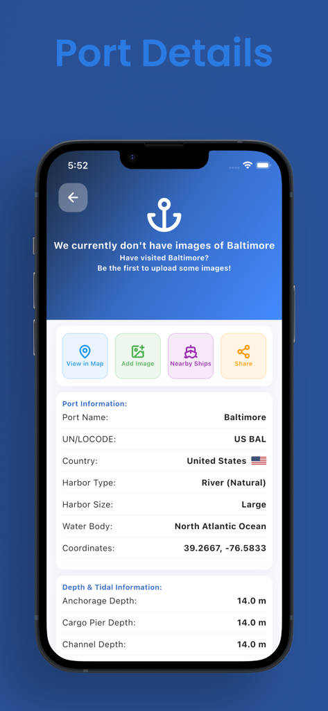
Technical details for the Port of Baltimore in the Voyage Radar app including depth information
Description
Download
More Like This
Top-ranked apps in the same category

Google Maps
Google LLC

AMap Global
AutoNavi Information Technology Co. Ltd.

Waze Navigation & Live Traffic
waze

百度地图-路线规划,出行必备
Beijing Baidu Netcom Science & Technology Co.,Ltd

Moovit: Bus & Transit Tracker
Moovit App Global LTD

ParkMobile: Park. Pay. Go.
Parkmobile USA, Inc

腾讯地图-路线规划,导航地铁打车出行
Shenzhen Tencent Computer Systems Company Limited

Transit • Subway & Bus Times
9280-0366 Quebec inc.

MapXplorer: Map Radar Navigate
GOLDLAB APPLICATIONS YAZILIM VE BILISIM ANONIM SIRKETI
This page is not an official page of the app or its developer, but an independent editorial publication created for informational and commentary purposes. Unless expressly stated otherwise, neither the app nor its developer is affiliated with, endorsed by, sponsored by, authorized by, or otherwise officially connected with MWM, Apple, Google Play, the app publisher, or the app's developer, and nothing on this page implies that the app was developed using MWM's services. Any trademarks, logos, screenshots, and other content remain the property of their respective owners.