This page is not an official page of the app or its developer, but an independent editorial publication created for informational and commentary purposes. Unless expressly stated otherwise, neither the app nor its developer is affiliated with, endorsed by, sponsored by, authorized by, or otherwise officially connected with MWM, Apple, Google Play, the app publisher, or the app's developer, and nothing on this page implies that the app was developed using MWM's services. Any trademarks, logos, screenshots, and other content remain the property of their respective owners.

WeatherSatelliteMap
Monitor East Asia with precision using real-time high-resolution infrared, radar, and visible cloud data sourced directly from the Central Weather Bureau.
Downloads
156K+User Rating
Total Ratings
100Publisher
Category
WeatherLocales
5Latest Version
9.0Size
8.3 MBFirst Released
Jun 14, 2016Professional Meteorological Insights
Harness the power of raw satellite data from the Central Weather Bureau of Taiwan for high-precision global and regional weather monitoring.
Direct CWB Data Source
Access unadulterated meteorological feeds directly from Taiwan's leading weather authority for unmatched data accuracy and reliability.
Advanced Imaging Layers
Go beyond basic icons with professional-grade visualizations including Infrared Color Intensification and Radar Topography maps.
The following screenshots and description are sourced directly from the app's official store listing and are the property of the app developer.
App Store
Screenshots
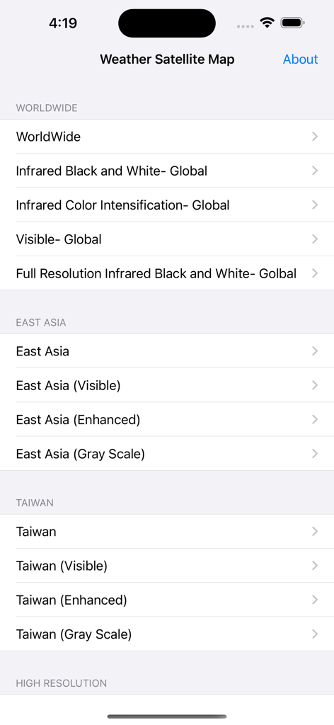
Selection screen for various satellite weather maps including infrared and visible views
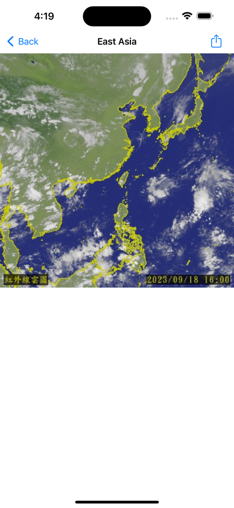
Satellite infrared cloud map of East Asia displaying regional weather patterns and landmass outlines
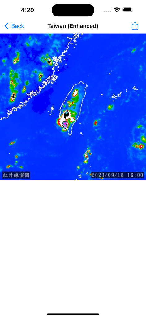
Enhanced infrared satellite image of Taiwan showing regional weather patterns
Description
Download
More Like This
Top-ranked apps in the same category

墨迹天气-MojiWeather
Beijing MojiFengyun Technology Co.,Ltd.

The Weather Channel - Radar
The Weather Channel

Windy.com
Windyty, SE

天气预报-精准15日天气预报
Chongqing Caochen Technology Co., Ltd.

My Aurora Forecast & Alerts
JRustonApps B.V.

AccuWeather: Weather Forecast
AccuWeather International, Inc.

Weather & Radar - Storm radar
WetterOnline - Meteorologische Dienstleistungen GmbH

天气通
Weibo Internet Technology (China) Co.Ltd.

The Thermometer -Digital-
Vida Apps Incorporated
This page is not an official page of the app or its developer, but an independent editorial publication created for informational and commentary purposes. Unless expressly stated otherwise, neither the app nor its developer is affiliated with, endorsed by, sponsored by, authorized by, or otherwise officially connected with MWM, Apple, Google Play, the app publisher, or the app's developer, and nothing on this page implies that the app was developed using MWM's services. Any trademarks, logos, screenshots, and other content remain the property of their respective owners.