This page is not an official page of the app or its developer, but an independent editorial publication created for informational and commentary purposes. Unless expressly stated otherwise, neither the app nor its developer is affiliated with, endorsed by, sponsored by, authorized by, or otherwise officially connected with MWM, Apple, Google Play, the app publisher, or the app's developer, and nothing on this page implies that the app was developed using MWM's services. Any trademarks, logos, screenshots, and other content remain the property of their respective owners.

卫星导航系统 支持北斗 全球高清地图
Experience unparalleled accuracy with the Beidou satellite constellation. From dense urban canyons to low-latitude regions, enjoy high-definition maps and stable positioning for driving, cycling, and walking worldwide.
Downloads
409K+User Rating
Total Ratings
21K+Publisher
Category
NavigationLocales
1Latest Version
1.6.4Size
45.4 MBFirst Released
Apr 26, 2021Unrivaled Precision in Every Direction
Harness the power of the Beidou Satellite System for high-definition navigation that outperforms standard GPS in signal stability and global accuracy.
Triple-Orbit Precision
Utilize Beidou's unique three-track satellite technology to ensure superior positioning and faster signal locks, especially in low-latitude regions.
Urban Canyon Reliability
Stay on track with advanced anti-interference capabilities designed to maintain a stable signal even among skyscrapers and dense city environments.
The following screenshots and description are sourced directly from the app's official store listing and are the property of the app developer.
App Store
Screenshots
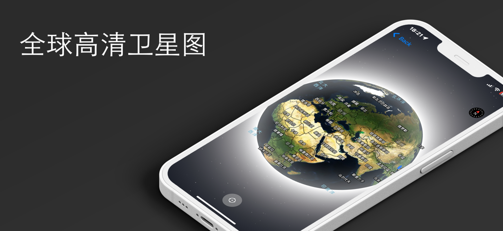
An iPhone screen displaying a high-definition 3D global satellite map from the Beidou navigation application
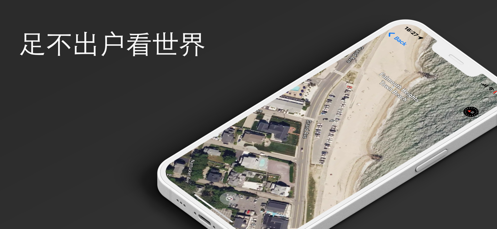
Smartphone screen displaying a 3D satellite view of Falmouth Heights Town Beach with Chinese text overlay.
Description
Download
More Like This
Top-ranked apps in the same category

Google Maps
Google LLC

Waze Navigation & Live Traffic
waze

AMap Global
AutoNavi Information Technology Co. Ltd.

百度地图-路线规划,出行必备
Beijing Baidu Netcom Science & Technology Co.,Ltd

Moovit: Bus & Transit Tracker
Moovit App Global LTD

Transit • Subway & Bus Times
9280-0366 Quebec inc.

ParkMobile: Park. Pay. Go.
Parkmobile USA, Inc

腾讯地图-路线规划,导航地铁打车出行
Shenzhen Tencent Computer Systems Company Limited

Île-de-France Mobilités
Ile de France Mobilites
This page is not an official page of the app or its developer, but an independent editorial publication created for informational and commentary purposes. Unless expressly stated otherwise, neither the app nor its developer is affiliated with, endorsed by, sponsored by, authorized by, or otherwise officially connected with MWM, Apple, Google Play, the app publisher, or the app's developer, and nothing on this page implies that the app was developed using MWM's services. Any trademarks, logos, screenshots, and other content remain the property of their respective owners.