This page is not an official page of the app or its developer, but an independent editorial publication created for informational and commentary purposes. Unless expressly stated otherwise, neither the app nor its developer is affiliated with, endorsed by, sponsored by, authorized by, or otherwise officially connected with MWM, Apple, Google Play, the app publisher, or the app's developer, and nothing on this page implies that the app was developed using MWM's services. Any trademarks, logos, screenshots, and other content remain the property of their respective owners.

WilCo - Pilot Aviation Weather
Master the skies with decoded METARs, 3D airport visualizations, and professional-grade flight tools. Designed by pilots to elevate situational awareness for students, private aviators, and flight sim enthusiasts.
Downloads
31K+User Rating
Total Ratings
0Publisher
Category
WeatherLocales
10Latest Version
2.6.18Size
48.8 MBFirst Released
Feb 3, 2021Master Your Flight with Professional Precision
WilCo streamlines your pre-flight routine by consolidating decoded weather, 3D situational awareness, and critical performance tools into one intuitive digital flight bag.
Decoded Weather & NOTAMs
No more manual decoding. Access plain-English METAR, TAF, and NOTAM reports with integrated wind vector analysis for your specific runway.
3D Airport Situational Awareness
Explore your destination before you fly. Use the 3D map to preview approaches and surround-view terrain to increase safety and confidence.
The following screenshots and description are sourced directly from the app's official store listing and are the property of the app developer.
App Store
Screenshots
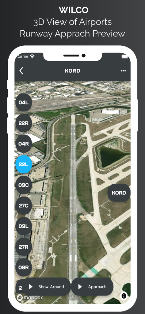
3D satellite view of Chicago O Hare airport runway approach preview in the WilCo aviation app.
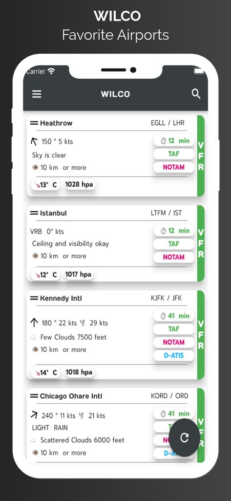
WilCo app screen showing a list of favorite airports with decoded weather data including wind speed, visibility, and sky conditions.
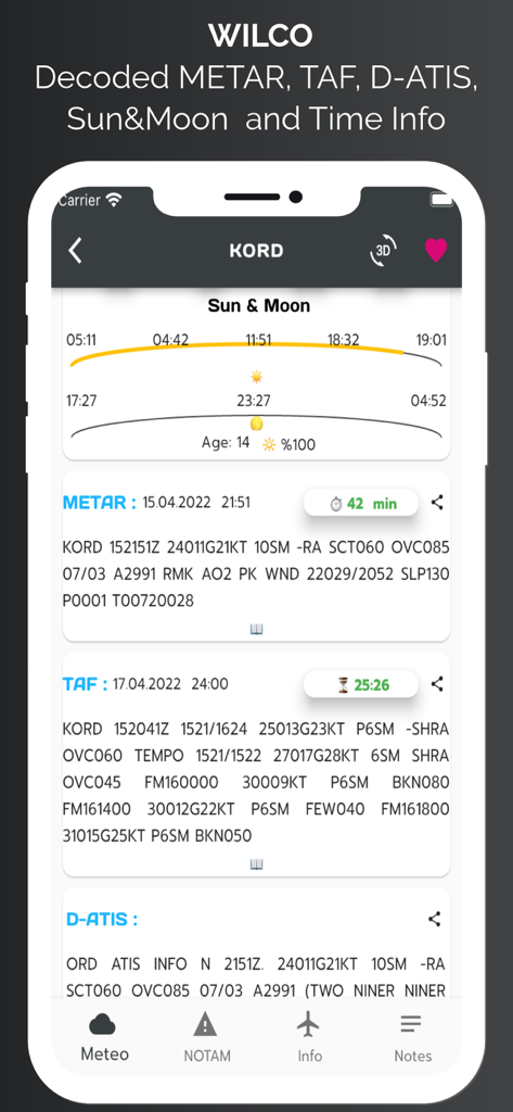
WilCo app interface showing aviation weather data including METAR, TAF, D-ATIS and sun and moon times for Chicago OHare airport.
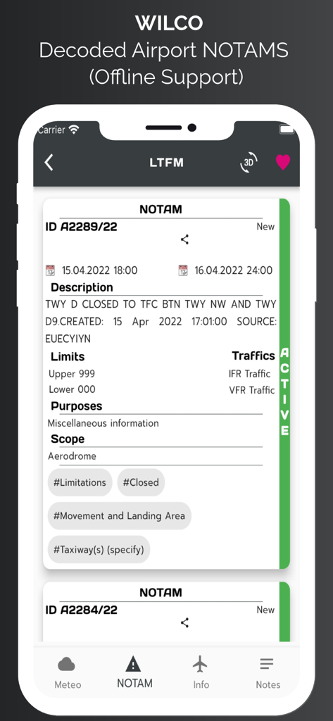
Smartphone screen displaying decoded airport NOTAM information in the WilCo aviation app
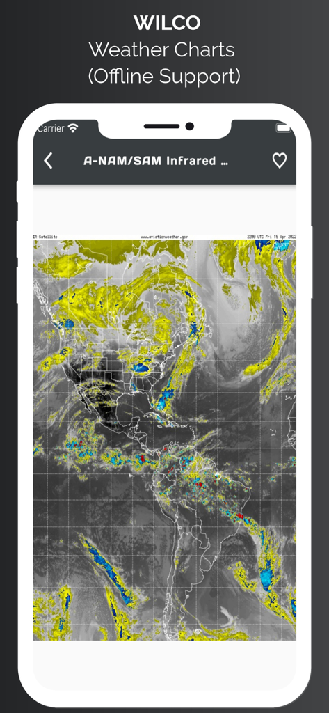
WilCo app showing an infrared satellite weather chart of North and South America with offline support
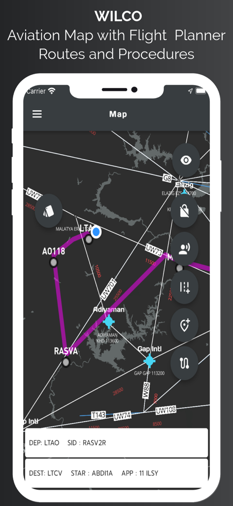
WilCo app aviation map interface showing flight routes waypoints and procedures
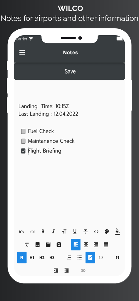
WilCo aviation app screen showing pilot notes for airports and a flight briefing checklist
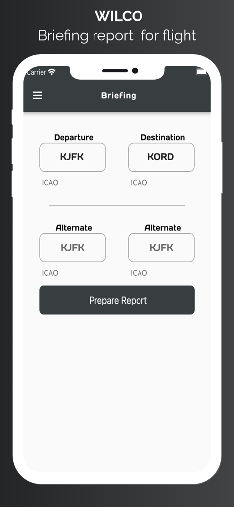
The briefing report page in the WilCo app where pilots enter departure and destination airport ICAO codes.
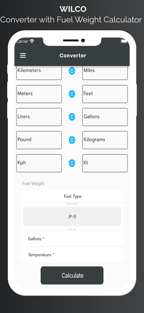
WilCo app unit converter and fuel weight calculator interface for pilots
Description
Download
More Like This
Top-ranked apps in the same category

墨迹天气-MojiWeather
Beijing MojiFengyun Technology Co.,Ltd.

The Weather Channel - Radar
The Weather Channel

Windy.com
Windyty, SE

天气预报-精准15日天气预报
Chongqing Caochen Technology Co., Ltd.

My Aurora Forecast & Alerts
JRustonApps B.V.

AccuWeather: Weather Forecast
AccuWeather International, Inc.

Weather & Radar - Storm radar
WetterOnline - Meteorologische Dienstleistungen GmbH

天气通
Weibo Internet Technology (China) Co.Ltd.

The Thermometer -Digital-
Vida Apps Incorporated
This page is not an official page of the app or its developer, but an independent editorial publication created for informational and commentary purposes. Unless expressly stated otherwise, neither the app nor its developer is affiliated with, endorsed by, sponsored by, authorized by, or otherwise officially connected with MWM, Apple, Google Play, the app publisher, or the app's developer, and nothing on this page implies that the app was developed using MWM's services. Any trademarks, logos, screenshots, and other content remain the property of their respective owners.