This page is not an official page of the app or its developer, but an independent editorial publication created for informational and commentary purposes. Unless expressly stated otherwise, neither the app nor its developer is affiliated with, endorsed by, sponsored by, authorized by, or otherwise officially connected with MWM, Apple, Google Play, the app publisher, or the app's developer, and nothing on this page implies that the app was developed using MWM's services. Any trademarks, logos, screenshots, and other content remain the property of their respective owners.

Wildfire Aware® | Fire Alerts
Protect your home and family with vetted data from NASA, NIFC, and CAL FIRE. Get instant notifications, satellite hotspots, and critical fire weather updates directly from official sources.
Downloads
0User Rating
Total Ratings
0Publisher
Category
WeatherLocales
1Latest Version
3.0Size
56.0 MBFirst Released
Nov 17, 2022Authoritative Intelligence for Your Safety
Designed by fire professionals to provide vetted, map-centric data. Eliminate the noise of social media with real-time alerts from the world's leading emergency agencies.
Verified Agency Data
Skip the social media rumors. Access raw data from NASA, NIFC, and CAL FIRE for a single, reliable source of truth vetted by GIS specialists.
Integrated Fire Weather
Understand fire behavior with real-time environmental overlays. Monitor wind speed, direction, and humidity to anticipate fire movement before it happens.
The following screenshots and description are sourced directly from the app's official store listing and are the property of the app developer.
App Store
Screenshots
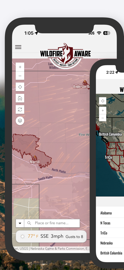
Wildfire Aware app interactive map tracking wildfires and weather conditions across North America
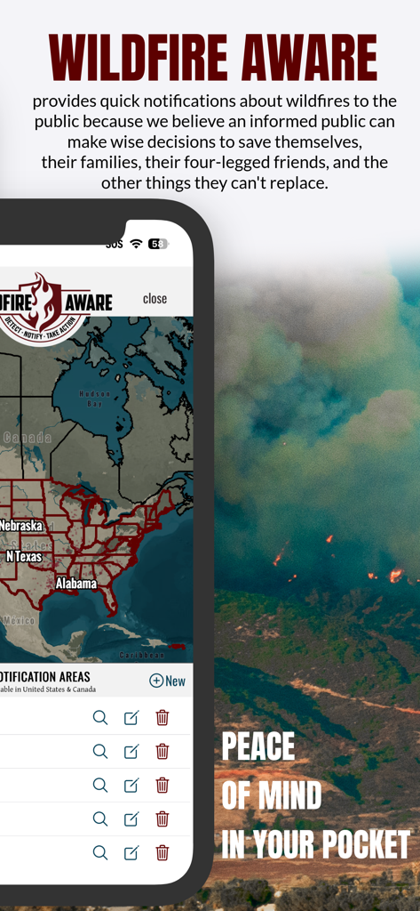
Wildfire Aware app interface showing a map of wildfire notification areas in North America with a smoke filled landscape background
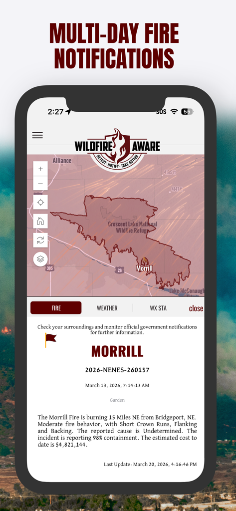
Wildfire Aware app interface displaying a wildfire perimeter map and detailed incident status for the Morrill fire
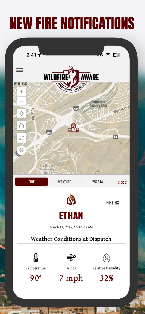
Wildfire Aware app interface showing a new fire notification with map location and weather conditions at dispatch
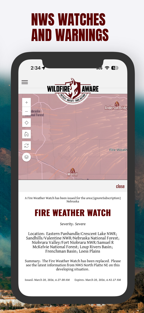
Wildfire Aware app interface showing an NWS fire weather watch alert with an interactive map.
Description
Download
More Like This
Top-ranked apps in the same category

墨迹天气-MojiWeather
Beijing MojiFengyun Technology Co.,Ltd.

The Weather Channel - Radar
The Weather Channel

Windy.com
Windyty, SE

天气预报-精准15日天气预报
Chongqing Caochen Technology Co., Ltd.

AccuWeather: Weather Forecast
AccuWeather International, Inc.

WeatherWise.app
Interactive Weather Limited

天气通
Weibo Internet Technology (China) Co.Ltd.

Weather & Radar USA
WetterOnline - Meteorologische Dienstleistungen GmbH

My Aurora Forecast & Alerts
JRustonApps B.V.
This page is not an official page of the app or its developer, but an independent editorial publication created for informational and commentary purposes. Unless expressly stated otherwise, neither the app nor its developer is affiliated with, endorsed by, sponsored by, authorized by, or otherwise officially connected with MWM, Apple, Google Play, the app publisher, or the app's developer, and nothing on this page implies that the app was developed using MWM's services. Any trademarks, logos, screenshots, and other content remain the property of their respective owners.