This page is not an official page of the app or its developer, but an independent editorial publication created for informational and commentary purposes. Unless expressly stated otherwise, neither the app nor its developer is affiliated with, endorsed by, sponsored by, authorized by, or otherwise officially connected with MWM, Apple, Google Play, the app publisher, or the app's developer, and nothing on this page implies that the app was developed using MWM's services. Any trademarks, logos, screenshots, and other content remain the property of their respective owners.

Yorkshire Three Peaks
No more guesswork. Users gain mastery over demanding terrain, transforming uncertainty into confident strides.
Downloads
10k+User Rating
Total Ratings
133Publisher
Category
TravelLocales
1Latest Version
1.7Size
32.9 MBFirst Released
Sep 11, 2013An Analytical Review for Outdoor Enthusiasts
Key Features of the Yorkshire Three Peaks App
Essential Safety & Conduct Guidelines
It provides critical information for hiker safety and promotes responsible behavior to protect the fragile environment and local communities.
GPS-guided Route Tracking
The app offers real-time location tracking and progress indication, providing reassurance while navigating chosen routes.
Comprehensive Route Details
It features detailed routes for the classic 24-mile challenge, individual peaks, and several shorter walks, catering to diverse hiking preferences.
Support for National Park Conservation
The app's proceeds directly contribute to the Yorkshire Dales National Park's efforts in maintaining and protecting the fragile Three Peaks environment.
The following screenshots and description are sourced directly from the app's official store listing and are the property of the app developer.
App Store
Screenshots

The app showcases a comprehensive list of walks, from the challenging 'Three Peaks' to individual summits like 'Ingleborough', each presented with evocative imagery.
Explore Iconic Routes
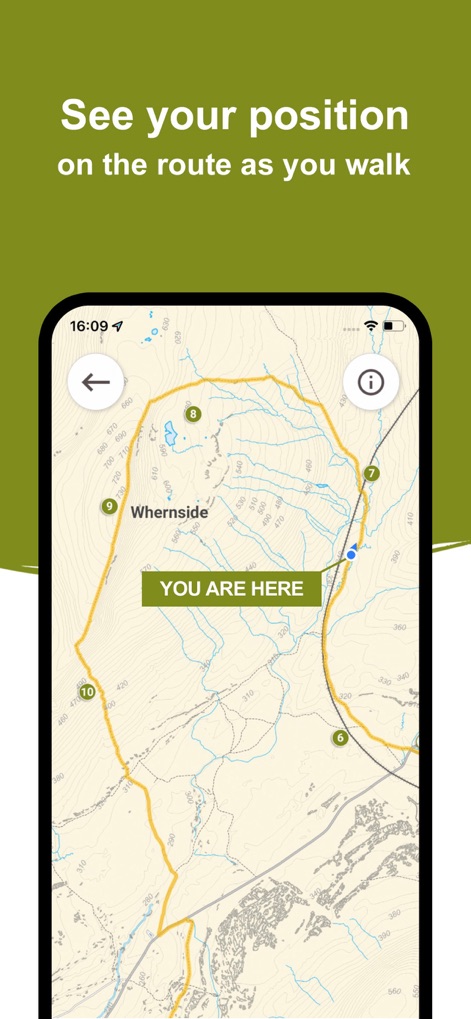
Users can confidently navigate trails with real-time GPS tracking, seeing their current position marked 'YOU ARE HERE' and following the clearly outlined route on the map.
Real-time Navigation

Discover fascinating details about landmarks like 'Pen-y-ghent' through interactive information cards, offering insights into its geological features and significance.
Enrich Your Journey
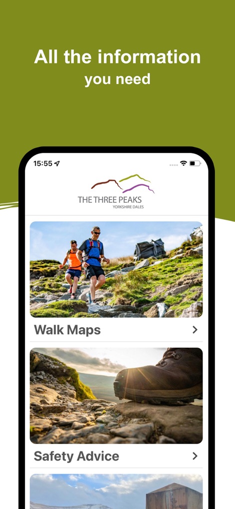
This tool provides crucial resources such as dedicated 'Safety Advice' sections and an overview of 'Walk Maps' to ensure users are well-prepared for their adventure.
Prepare & Stay Safe
Description
Download
More Like This
Top-ranked apps in the same category

Uber - Request a ride
Uber Technologies, Inc.

Airbnb
Airbnb, Inc.

铁路12306
ACADEMY OF RAILWAY SCIENCES CO., ltd.

Booking.com: Hotels & Travel
Booking.com B.V.

Grab: Taxi Ride, Food Delivery
GRABTAXI HOLDINGS PTE. LTD.

Trip.com: Book Flights, Hotels
Trip.com Travel Singapore Pte. Ltd.

DiDi China: Ride Hailing
Didi Chuxing (Beijing) Network Platform Technology Co., Ltd

去哪儿旅行-订酒店机票火车票
Beijing Qunar Information Technology Company Limit

Bolt: Request a Ride
BOLT TECHNOLOGY OU
This page is not an official page of the app or its developer, but an independent editorial publication created for informational and commentary purposes. Unless expressly stated otherwise, neither the app nor its developer is affiliated with, endorsed by, sponsored by, authorized by, or otherwise officially connected with MWM, Apple, Google Play, the app publisher, or the app's developer, and nothing on this page implies that the app was developed using MWM's services. Any trademarks, logos, screenshots, and other content remain the property of their respective owners.