This page is not an official page of the app or its developer, but an independent editorial publication created for informational and commentary purposes. Unless expressly stated otherwise, neither the app nor its developer is affiliated with, endorsed by, sponsored by, authorized by, or otherwise officially connected with MWM, Apple, Google Play, the app publisher, or the app's developer, and nothing on this page implies that the app was developed using MWM's services. Any trademarks, logos, screenshots, and other content remain the property of their respective owners.

指南针-实时高度表经纬度定位天气预报运动轨迹gps
The ultimate all-in-one outdoor toolkit for hikers and explorers. Track your exact coordinates, monitor mountain weather, and capture geo-tagged photos to document your journey across any terrain.
Downloads
100+User Rating
Total Ratings
0Publisher
Category
LifestyleLocales
1Latest Version
3.2Size
36.2 MBFirst Released
Feb 4, 2026Conquer Every Trail with Confidence
The all-in-one survival toolkit featuring a precision compass, real-time altimeter, and geo-tagged camera for the modern adventurer and professional.
Precision Navigation
Navigate the most rugged terrains with our high-accuracy compass and real-time GPS positioning that works where cell signals don't.
Geo-Tagged Documentation
Capture photos with embedded latitude, longitude, and elevation watermarks—perfect for social proof or professional field reporting.
The following screenshots and description are sourced directly from the app's official store listing and are the property of the app developer.
App Store
Screenshots
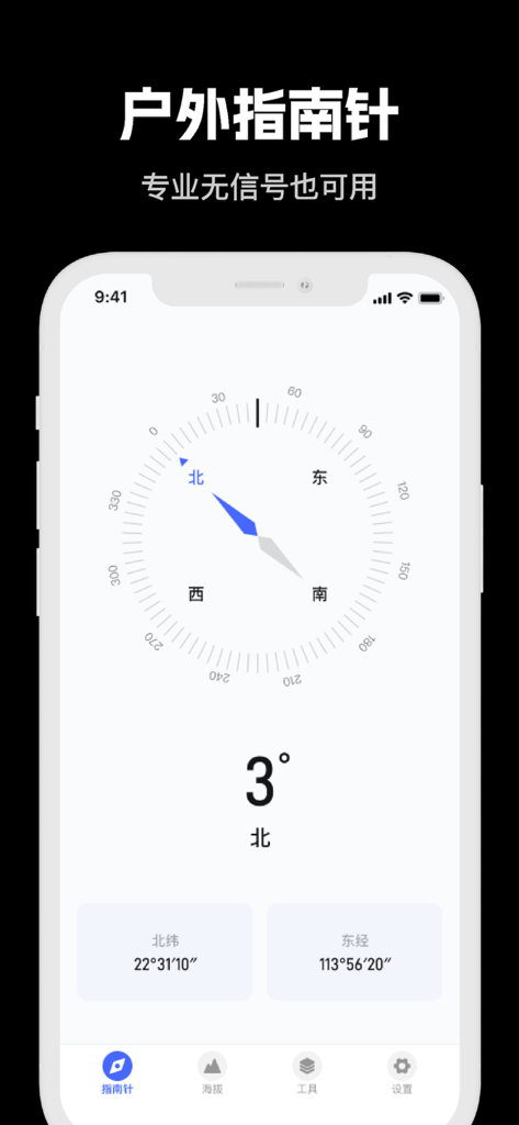
Digital compass app interface showing orientation and GPS coordinates for outdoor navigation
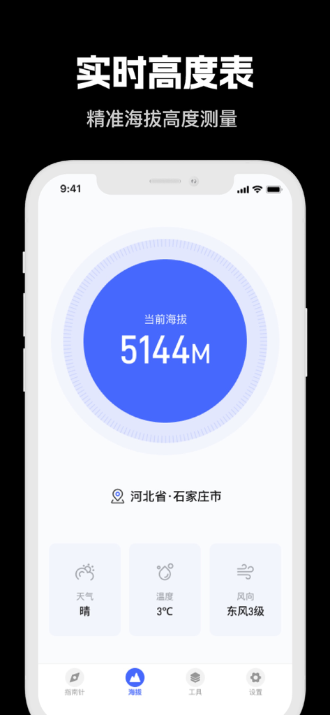
Real-time altimeter app interface displaying current elevation and weather conditions for outdoor enthusiasts.
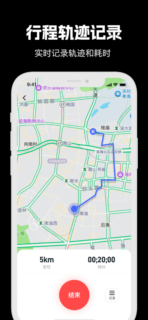
App screenshot showing a GPS trajectory tracking map with distance and time data
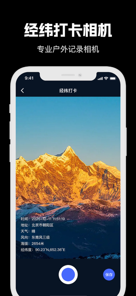
App interface showing a mountain landscape photo with embedded GPS coordinates, altitude, and weather data
Description
Download
More Like This
Top-ranked apps in the same category

Pinterest, Inc.

Alipay - Simplify Your Life
Alipay (Hangzhou) Technology Co., Ltd.

美团-美好生活小帮手
Sankuai Technology Co., Ltd.

58同城-求职招聘找工作租房二手车
Beijing Chengshi Wanglin Information Technology Co., Ltd.

Tinder Dating App: Date & Chat
Tinder LLC

Dianping: Discover Good Places
Hanhai Information Technology (Shanghai) Co.Ltd

Xiaomi Home
Beijing Xiaomi Co., Ltd

Lemon8 - Lifestyle Community
TIKTOK PTE. LTD.

安居客-新房二手房产卖房买房房价
RUITING NETWORK TECHNOLOGY
This page is not an official page of the app or its developer, but an independent editorial publication created for informational and commentary purposes. Unless expressly stated otherwise, neither the app nor its developer is affiliated with, endorsed by, sponsored by, authorized by, or otherwise officially connected with MWM, Apple, Google Play, the app publisher, or the app's developer, and nothing on this page implies that the app was developed using MWM's services. Any trademarks, logos, screenshots, and other content remain the property of their respective owners.