このページはアプリまたはその開発者の公式ページではなく、情報提供および論評を目的として作成された独立した編集出版物です。明示的に別段の記載がない限り、アプリおよびその開発者は、MWM、Apple、Google Play、アプリのパブリッシャー、またはアプリの開発者と提携、承認、後援、認可、またはその他の公式的な関係はなく、このページのいかなる内容も、アプリがMWMのサービスを使用して開発されたことを意味するものではありません。すべての商標、ロゴ、スクリーンショット、その他のコンテンツはそれぞれの所有者の財産です。

BigBlue Offshore Fishing
デッドウォーターで燃料を無駄にするのはやめましょう。リアルタイムSST、クロロフィルスキャン、高解像度海底地形図で競争力を高めましょう。すべて100%オフライン対応で、深海でも使用できます。
ダウンロード
41K+ユーザー評価
評価数
0開発元
カテゴリ
Weather対応言語
1最新バージョン
3.0.6サイズ
69.1 MBリリース日
2023年4月13日釣りの科学
デッドウォーターで燃料を無駄にするのはやめましょう。BigBlueは、プロ仕様の衛星スキャンと生息地インテリジェンスをポケットに入れられるようにするので、バイトをより速く見つけることができます。
高精度衛星スキャン
毎日のSSTとクロロフィルを9回更新して、大型ゲームフィッシュが集まる水温のブレイクと栄養豊富なエッジを特定します。
信号ゼロでも問題なし
深海のために作られました。Wi-Fiで高解像度のチャートをキャッシュし、携帯サービスなしで沖合100マイル以上でもGPS精度で完全にナビゲートできます。
以下のスクリーンショットと説明は、アプリの公式ストアリスティングから直接取得されたものであり、アプリ開発者の所有物です。
アプリストア
スクリーンショット
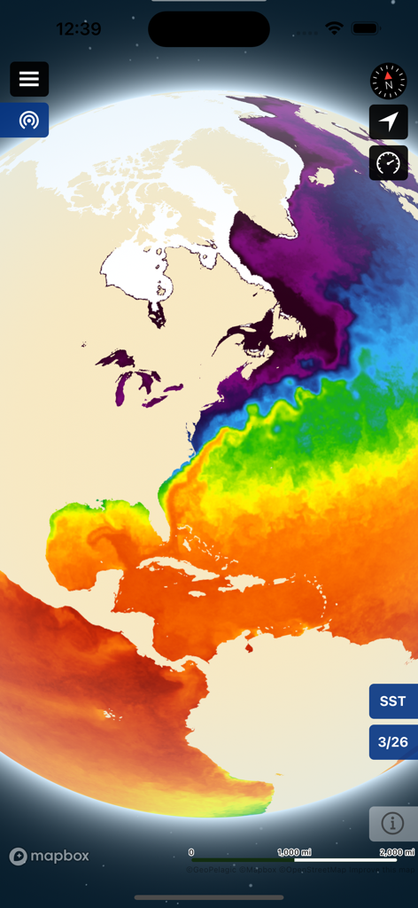
BigBlue Offshore Fishingアプリでの大西洋の海面水温ヒートマップ
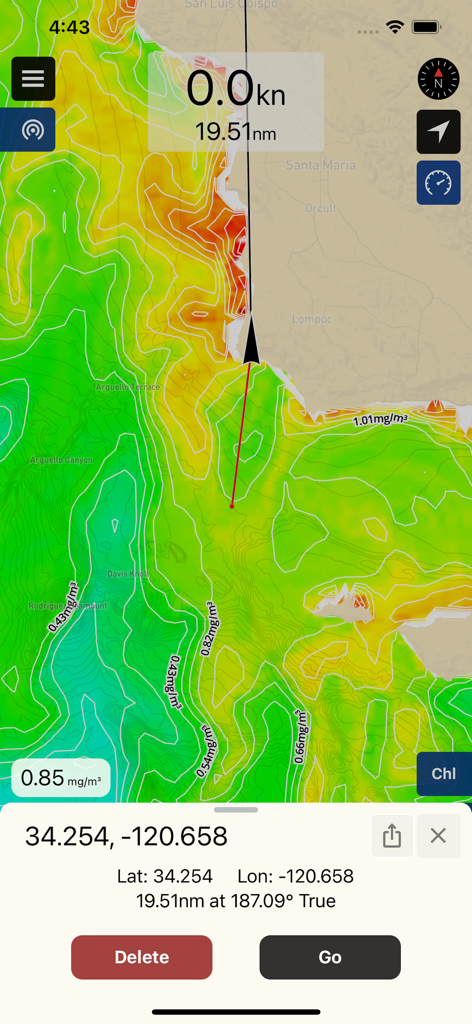
沖釣り用のクロロフィル濃度データとウェイポイント座標を示すBigBlueアプリのナビゲーションマップ
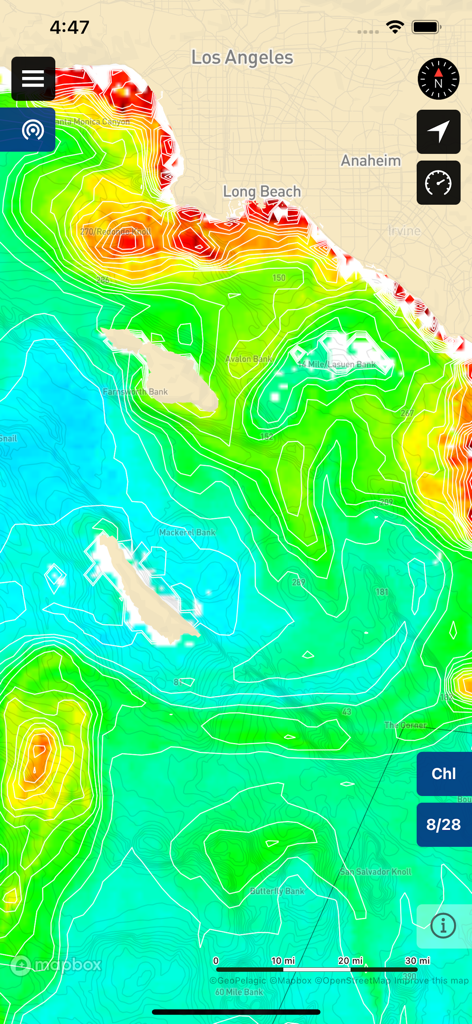
ロサンゼルス沖のクロロフィル濃度チャートと海底地形図を表示するBigBlueアプリ
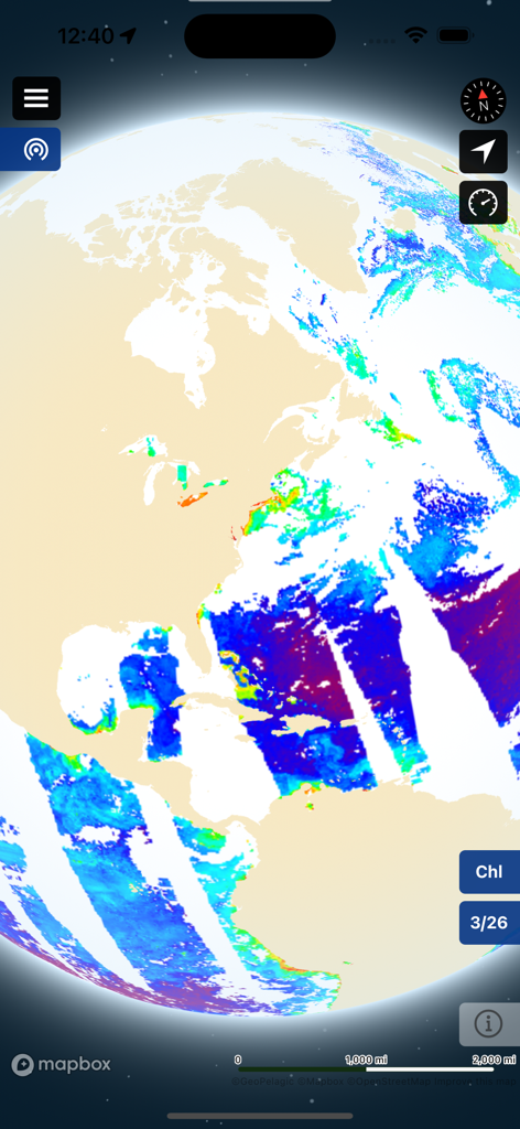
沖釣りの海洋状況を示すBigBlueアプリの衛星クロロフィルマップオーバーレイ。
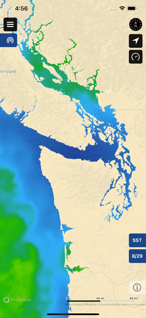
沖釣りのための海面水温SST衛星データを沿岸マップに表示するBigBlueアプリインターフェイス。
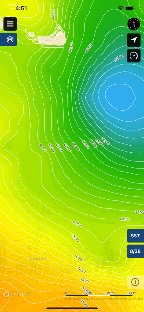
沖釣りのための華氏での水温ブレイクと等温線を示す海面水温マップ
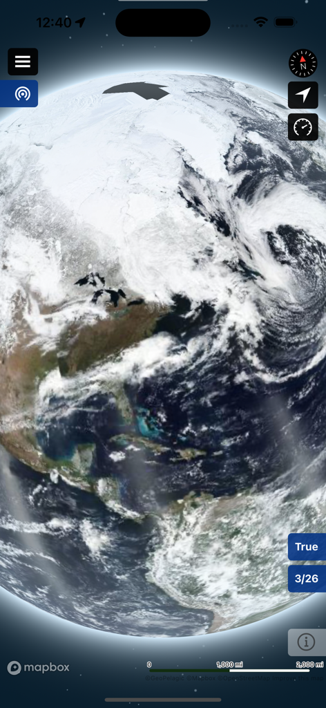
BigBlue offshore fishingアプリでの地球の真の色衛星画像。
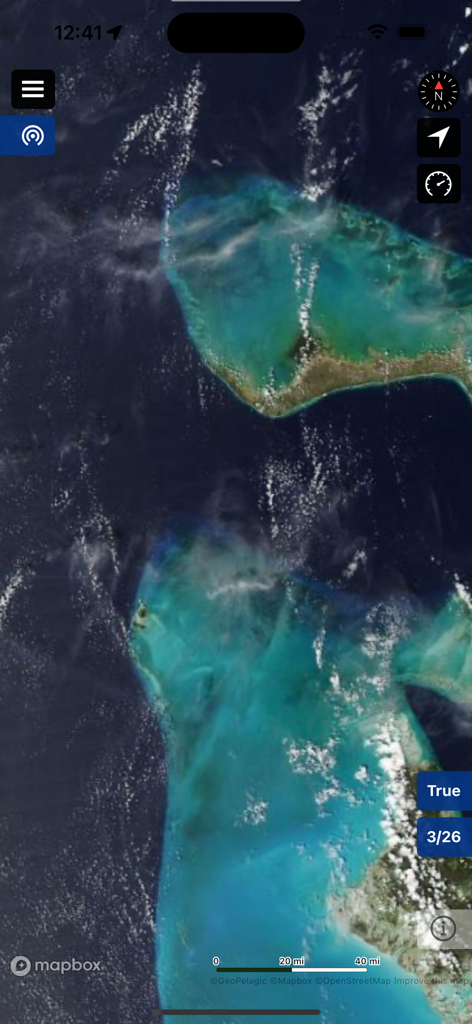
BigBlue Offshore Fishingアプリでの真の色海洋画像を表示する衛星マップビュー。
説明
Download
類似アプリ
似た機能とユーザー体験を持つアプリ

FishAngler - Fish Finder App
FishAngler, LLC

钓鱼天气预报
Hefei Sasha Technology Co., Ltd.

潮汐表-潮汐天气预报&钓鱼潮汐天气工具助手
荣虎 太

Fishbrain - Fishing App
FishBrain AB

Fishing Points: Map & Forecast
Fishing Points d.o.o.

onX Fish: Midwest Lake Finder
onXmaps, Inc.

Fishbox - Smart Fishing App
MEMS Group, Inc.

釣果記録FishRanker-フィッシュランカー,釣り,分析
SIIG Inc.

Fish Deeper - Fishing App
Deeper UAB
このページはアプリまたはその開発者の公式ページではなく、情報提供および論評を目的として作成された独立した編集出版物です。明示的に別段の記載がない限り、アプリおよびその開発者は、MWM、Apple、Google Play、アプリのパブリッシャー、またはアプリの開発者と提携、承認、後援、認可、またはその他の公式的な関係はなく、このページのいかなる内容も、アプリがMWMのサービスを使用して開発されたことを意味するものではありません。すべての商標、ロゴ、スクリーンショット、その他のコンテンツはそれぞれの所有者の財産です。