このページはアプリまたはその開発者の公式ページではなく、情報提供および論評を目的として作成された独立した編集出版物です。明示的に別段の記載がない限り、アプリおよびその開発者は、MWM、Apple、Google Play、アプリのパブリッシャー、またはアプリの開発者と提携、承認、後援、認可、またはその他の公式的な関係はなく、このページのいかなる内容も、アプリがMWMのサービスを使用して開発されたことを意味するものではありません。すべての商標、ロゴ、スクリーンショット、その他のコンテンツはそれぞれの所有者の財産です。

Directional Well Planning
掘削エンジニアおよび学生向けの必須モバイルツールキット。最小曲率法を使用して2Dおよび3D坑井計画をいつでもどこでも構築、計算、視覚化できます。
ダウンロード
600ユーザー評価
評価数
0開発元
カテゴリ
Productivity対応言語
1最新バージョン
1.2サイズ
11.3 MBリリース日
2023年3月9日手のひらに収まるプロフェッショナルグレードの坑井計画
精度と携帯性のために設計された当社のツールは、現場またはオフィスから即座に2Dおよび3D坑井軌跡を計算、プロット、共有するのに役立ちます。
モバイル2D/3D軌跡計画
最大20セクションで、業界標準の最小曲率法を使用して、タイプI、II、および水平坑井経路をオンザフライで構築します。
動的な垂直および平面表示
高解像度の2Dおよび3Dプロットを生成して、地下経路を視覚化し、セクション間の即時補間計算を実行します。
以下のスクリーンショットと説明は、アプリの公式ストアリスティングから直接取得されたものであり、アプリ開発者の所有物です。
アプリストア
スクリーンショット
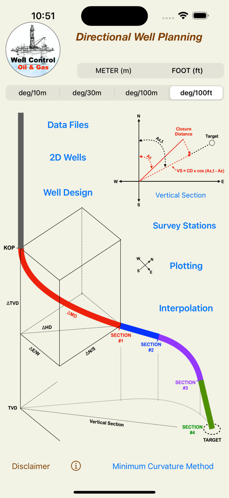
3D坑井軌跡図と技術的な掘削ツールを備えたDirectional Well Planningアプリのメインインターフェイス
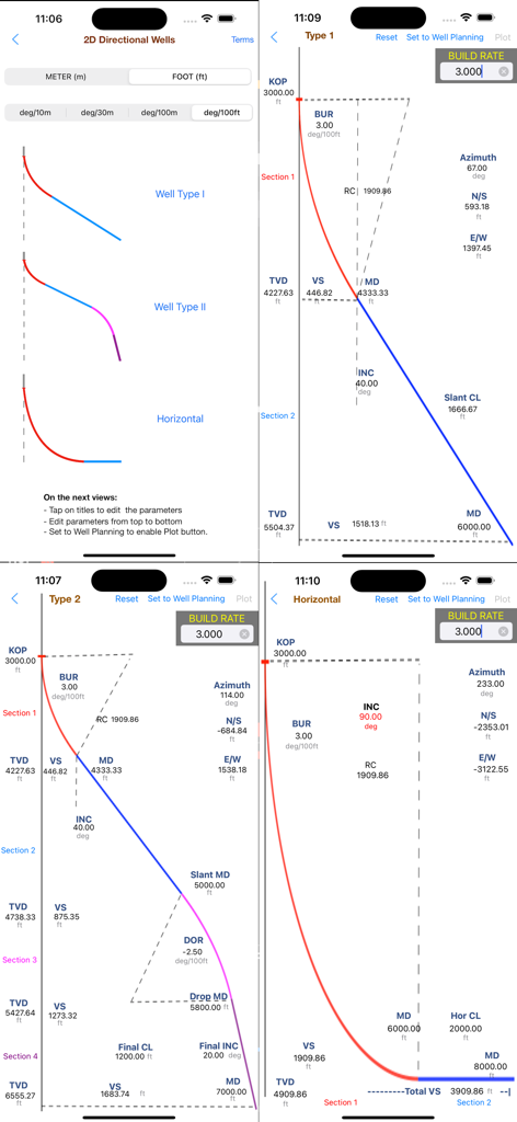
タイプ1、タイプ2、および水平坑井の2D軌跡プロットを示す指向性坑井計画アプリのスクリーンショット
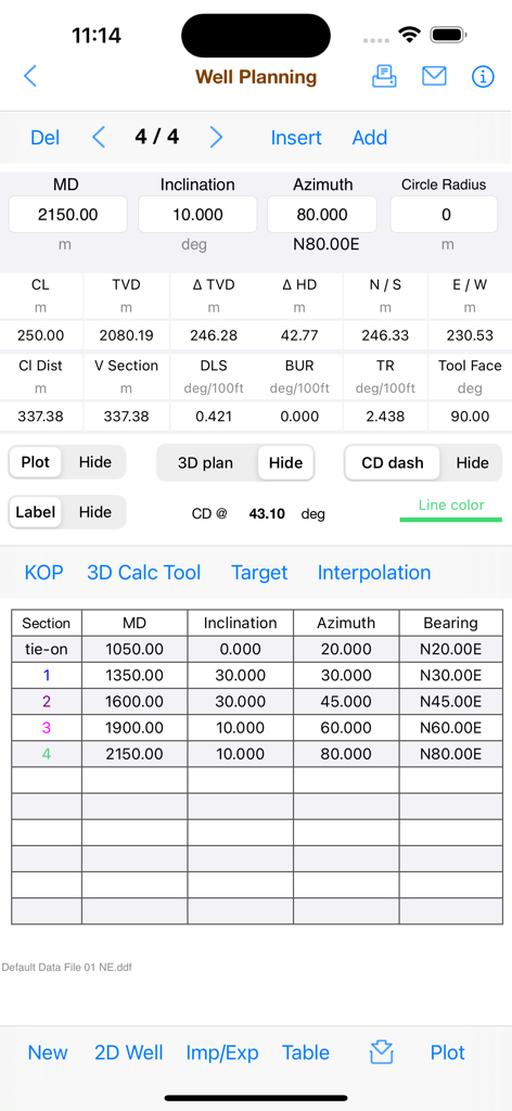
掘削調査データと軌跡計算を示すDirectional Well Planningアプリのスクリーンショット
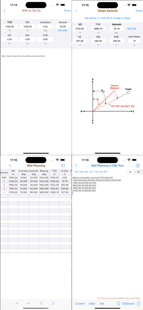
技術的な坑井計画データ、軌跡図、計算表、および石油工学向けのCSVデータインポートオプションを示すアプリ画面のコレクション。
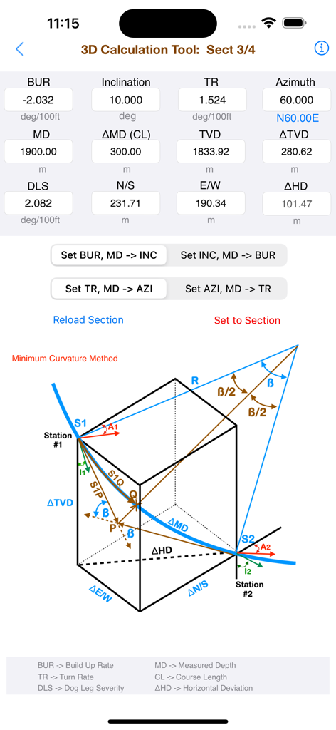
数値データと最小曲率法の図を示すDirectional Well Planningアプリの3D計算ツールの技術インターフェイス。
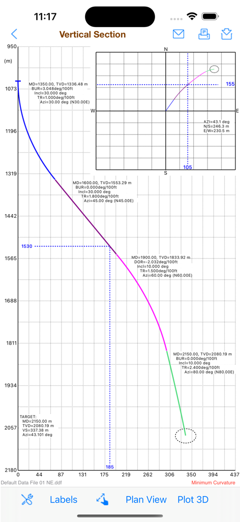
工学的なパラメータを持つ指向性坑井軌跡を示す垂直断面図と平面図プロット
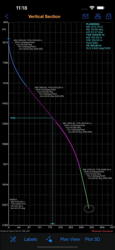
技術的なデータラベルを持つ指向性坑井軌跡を示す垂直断面図プロット
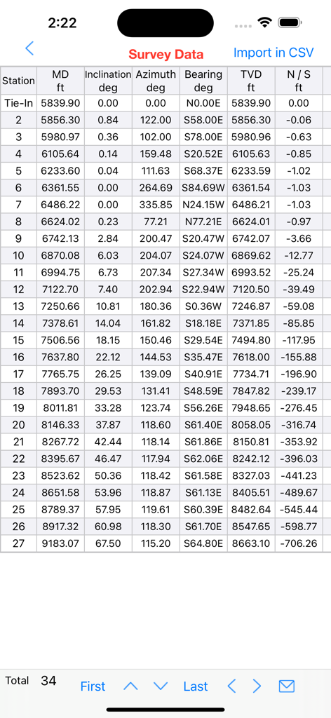
Directional Well Planningアプリで、深度、傾斜、方位などの掘削パラメータを示す調査データのテーブル
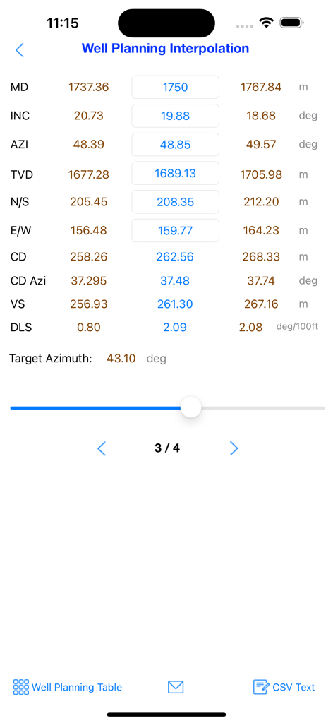
測定深度と傾斜値を持つ坑井計画補間計算を示すモバイルインターフェイス
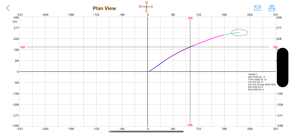
ターゲットデータとともに座標グリッド上の水平変位を示す指向性坑井計画軌跡の平面図。
説明
Download
類似アプリ
同じカテゴリのトップランクアプリ

ChatGPT
OpenAI OpCo, LLC

Google Gemini
Google LLC

Grok
X.AI Corporation

Gmail - Email by Google
Google LLC

千问 - 阿里最强大模型官方AI助手
Shanghai Zhixin Puhui Technology Co., Ltd.

Google Drive
Google LLC

Microsoft Authenticator
Microsoft Corporation

Google Sheets
Google LLC

Google Docs
Google LLC
このページはアプリまたはその開発者の公式ページではなく、情報提供および論評を目的として作成された独立した編集出版物です。明示的に別段の記載がない限り、アプリおよびその開発者は、MWM、Apple、Google Play、アプリのパブリッシャー、またはアプリの開発者と提携、承認、後援、認可、またはその他の公式的な関係はなく、このページのいかなる内容も、アプリがMWMのサービスを使用して開発されたことを意味するものではありません。すべての商標、ロゴ、スクリーンショット、その他のコンテンツはそれぞれの所有者の財産です。