このページはアプリまたはその開発者の公式ページではなく、情報提供および論評を目的として作成された独立した編集出版物です。明示的に別段の記載がない限り、アプリおよびその開発者は、MWM、Apple、Google Play、アプリのパブリッシャー、またはアプリの開発者と提携、承認、後援、認可、またはその他の公式的な関係はなく、このページのいかなる内容も、アプリがMWMのサービスを使用して開発されたことを意味するものではありません。すべての商標、ロゴ、スクリーンショット、その他のコンテンツはそれぞれの所有者の財産です。

DroneDeploy Flight App
DJIドローンフライトを高解像度データに変換します。ミッションを自動化し、体積を測定し、建設、農業、点検プロジェクト全体で調査グレードのマップをわずか2回のタップで共有できます。
ダウンロード
370K+ユーザー評価
評価数
14K+開発元
カテゴリ
Photo & Video対応言語
2最新バージョン
5.111.0サイズ
357.7 MBリリース日
2015年3月24日すべてのフライトからエンタープライズレベルのインサイトを取得
データ収集を自動化し、空撮画像を業界別にカスタマイズされた高解像度マップ、3Dモデル、および実用的なレポートに変換します。
高精度自動フライト
2回のタップで再現可能なミッションを計画し、複雑な自律フライトを実行して、常に一貫した高精度のデータキャプチャを保証します。
調査グレードの測定
体積、標高、表面積を即座に計算し、手作業なしで現場の進捗状況と資材コストを追跡します。
以下のスクリーンショットと説明は、アプリの公式ストアリスティングから直接取得されたものであり、アプリ開発者の所有物です。
アプリストア
スクリーンショット
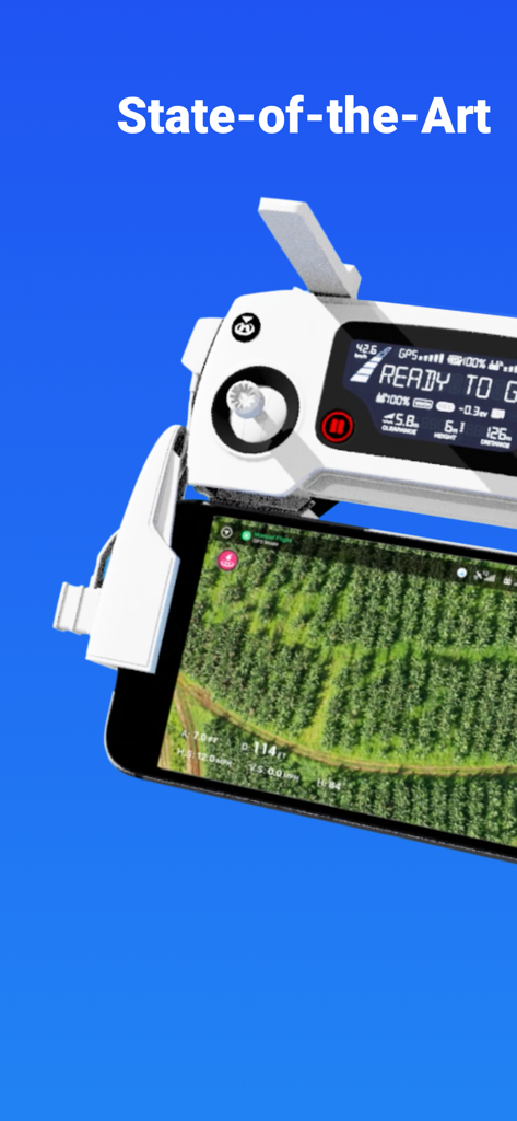
ドローンリモートコントローラーに取り付けられたスマートフォンに表示されているDroneDeployアプリの空撮フィールドマップ
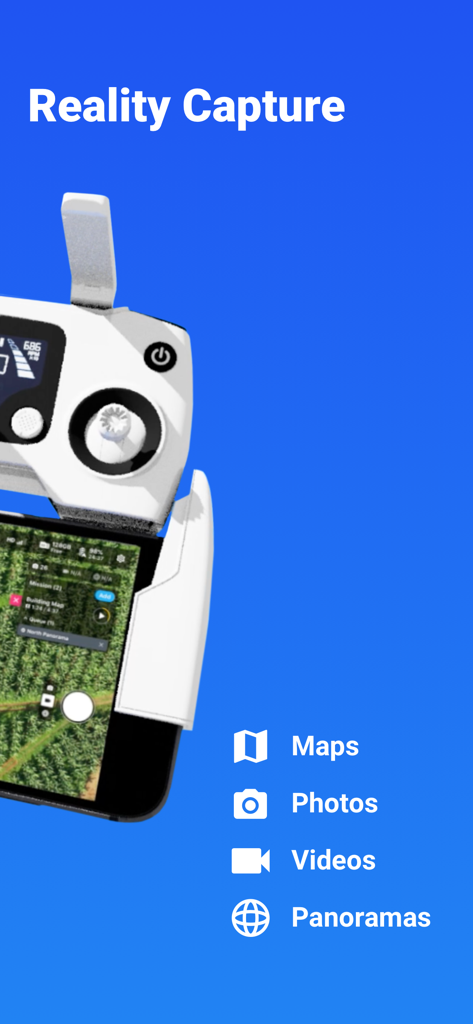
マップ、写真、ビデオを含むリアルキャプチャ機能を表示するドローンリモートコントローラーとスマートフォン
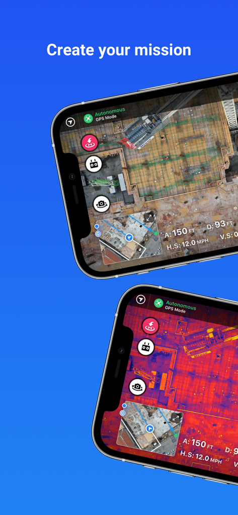
建設現場のマッピングと自律飛行ミッション用のサーマルイメージングを表示するDroneDeployアプリ画面
自律飛行ミッションとサーマル建設現場マッピングを示すDroneDeployアプリインターフェイス
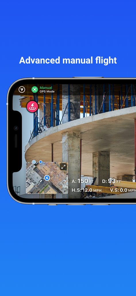
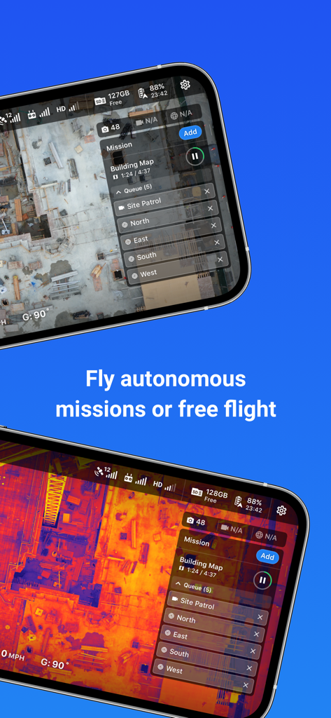
建設現場のライブビューを備えた高度なマニュアル飛行モードを紹介するDroneDeployアプリインターフェイス
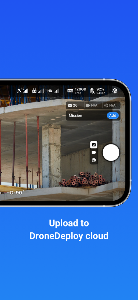
建設現場のドローンカメラビューとクラウドアップロードテキストを示すDroneDeployアプリのインターフェイス
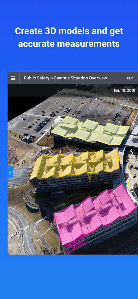
測定のために色分けされた屋根セグメントを備えた3Dビルディングモデルを示すDroneDeployインターフェイス
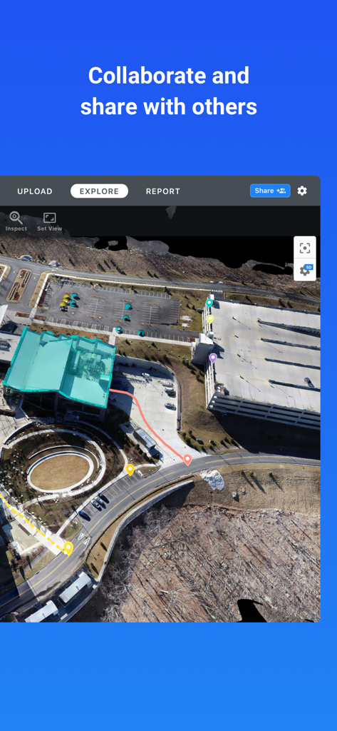
DroneDeployアプリでのチームコラボレーションのために建設現場を示す注釈付き空撮ドローンマップ
説明
Download
類似アプリ
同じカテゴリのトップランクアプリ

CapCut: Photo & Video Editor
BYTEDANCE PTE. LTD.

Instagram, Inc.

YouTube
Google LLC

Canva: AI Photo & Video Editor
Canva Pty Ltd

Snapchat
Snap, Inc.

快手
Beijing Kwai Technology Co., Ltd.

Edits: Video Editor
Instagram, Inc.

Meitu- AI Photo & Video Editor
Xiamen Meitu Technology Co., Ltd.

Google Photos: Backup & Edit
Google LLC
このページはアプリまたはその開発者の公式ページではなく、情報提供および論評を目的として作成された独立した編集出版物です。明示的に別段の記載がない限り、アプリおよびその開発者は、MWM、Apple、Google Play、アプリのパブリッシャー、またはアプリの開発者と提携、承認、後援、認可、またはその他の公式的な関係はなく、このページのいかなる内容も、アプリがMWMのサービスを使用して開発されたことを意味するものではありません。すべての商標、ロゴ、スクリーンショット、その他のコンテンツはそれぞれの所有者の財産です。