このページはアプリまたはその開発者の公式ページではなく、情報提供および論評を目的として作成された独立した編集出版物です。明示的に別段の記載がない限り、アプリおよびその開発者は、MWM、Apple、Google Play、アプリのパブリッシャー、またはアプリの開発者と提携、承認、後援、認可、またはその他の公式的な関係はなく、このページのいかなる内容も、アプリがMWMのサービスを使用して開発されたことを意味するものではありません。すべての商標、ロゴ、スクリーンショット、その他のコンテンツはそれぞれの所有者の財産です。

LandGlide: Find Property Lines
1億6000万件以上の物件に関する所有者情報、販売履歴、GISマップに即座にアクセス。不動産専門家、測量士、土地所有者が現場から全体像を把握するための信頼できるモバイルツール。
ダウンロード
2M+ユーザー評価
評価数
55K+開発元
カテゴリ
Navigation対応言語
1最新バージョン
5.4.1サイズ
85.0 MBリリース日
2014年4月6日土地専門家向けの比類なき精度
不動産業者、測量士、土地開発業者向けに設計された高度なGPSマッピングと詳細な物件インサイトを備えた1億6000万件の区画記録の力を活用します。
境界線の即時特定
高度なGPS測量技術を使用して、物件の境界線をリアルタイムで視覚化し、常に正確な位置を把握できます。
包括的な区画インサイト
米国人口の99%以上をカバーする、所有者名、販売履歴、税評価額、土地利用などの詳細データにアクセスできます。
よくある質問
について知っておくべきこと LandGlide: Find Property Lines
LandGlideとは何ですか?
LandGlideは、高度な区画データ、物件境界線マップ、衛星マップを提供する、最高の不動産データアプリです。不動産業者、測量士、物件所有者に包括的な物件インサイトを提供します。
LandGlideは無料で使用できますか?
いいえ、LandGlideは最初の無料トライアルの後、無料ではありません。7日間の無料トライアルを提供しており、その後は月額$9.99または年額$99.99のサブスクリプション料金がかかります。
LandGlideではどのような物件データが利用できますか?
LandGlideは、売買履歴、土地利用、所有者情報、販売価格、税額、平方フィート、建築年などの広範な区画属性を提供します。
LandGlideはいくつの区画レコードをカバーしていますか?
LandGlideは3229郡で1億6000万件の区画レコードをカバーし、米国の人口の99%以上を対象としており、全国的に包括的な物件情報を提供しています。
LandGlideを使用して物件の境界線を見つけるにはどうすればよいですか?
LandGlideは物件境界線ファインダーとして機能し、ユーザーはマップ上で正確な物件境界線を直接表示できます。ユーザーは物件にカーソルを合わせることで、即座に詳細を表示できます。
LandGlideを土地測量に使用できますか?
はい、LandGlideは土地測量専門家に最適です。正確な測定とGISマッピングのためのフィールド面積測定ツールとGPS測量機技術を提供します。
LandGlideは過去の物件データを提供できますか?
はい、LandGlideは過去のデータを提供します。ユーザーは、分析を支援するために、売買履歴、以前の所有者情報、その他の物件の過去のインサイトにアクセスできます。
LandGlideでお気に入りの場所やメモを保存できますか?
はい、LandGlideでは、お気に入りの場所を保存したり、メモを追加したり、特定の物件の写真をアップロードしたりできます。ユーザーはすべての物件データをエクスポートすることもできます。
以下のスクリーンショットと説明は、アプリの公式ストアリスティングから直接取得されたものであり、アプリ開発者の所有物です。
アプリストア
スクリーンショット
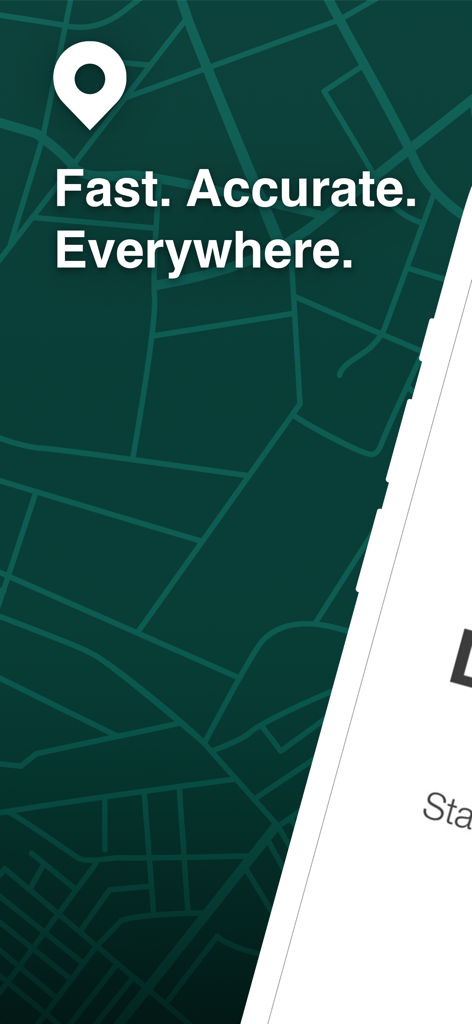
LandGlideアプリの紹介画面。物件境界線のマップグリッドと「速く、正確、どこでも」というスローガンが表示されています

LandGlideアプリのインターフェイスがスマートフォンに表示され、ロゴと7日間の無料トライアルオファーが表示されています
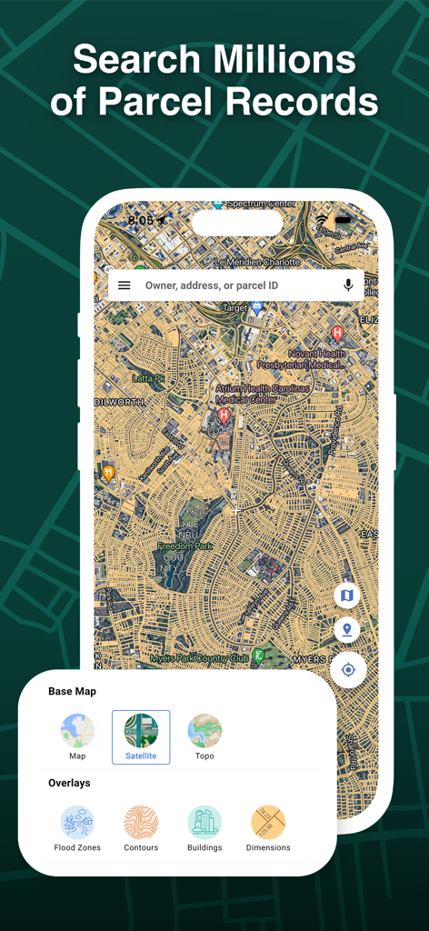
LandGlideアプリのインターフェイス。検索バーとマップレイヤーオプションを備えた物件区画マップが表示されています
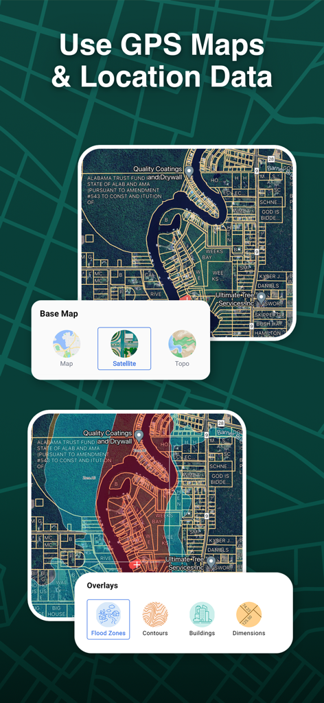
LandGlideアプリのインターフェイス。衛星マップと、洪水ゾーンおよび等高線データオプションを備えた物件境界線のオーバーレイが表示されています
LandGlideアプリのインターフェイス。強調表示された境界線と区画識別情報が表示された衛星物件マップが表示されています
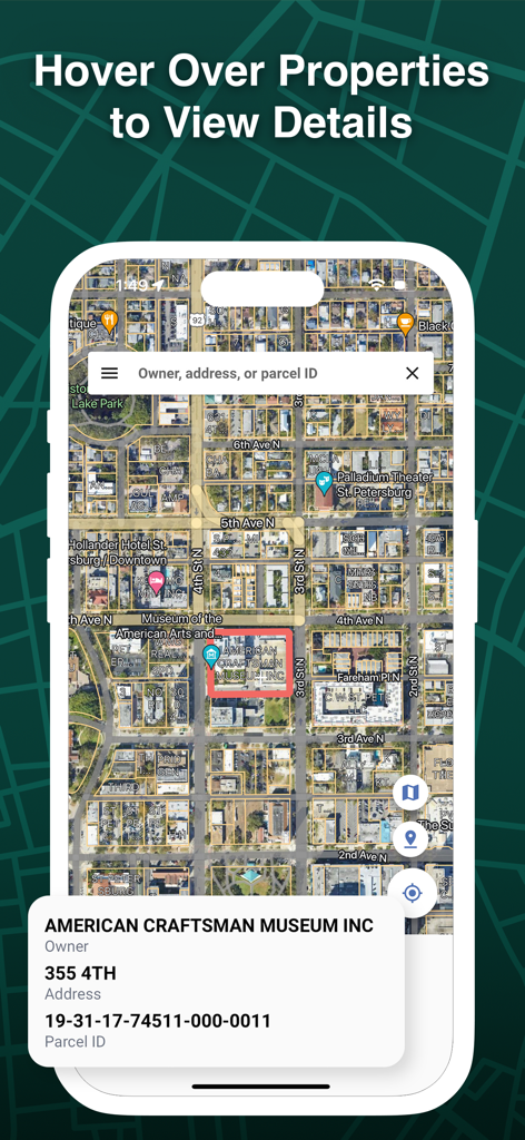
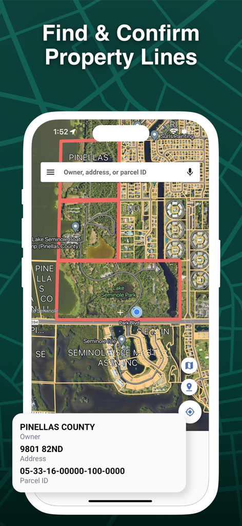
LandGlideアプリの衛星ビュー。物件境界線と所有者情報ポップアップが表示されています
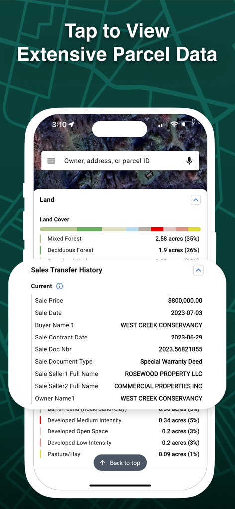
LandGlideアプリのインターフェイスのスクリーンショット。土地被覆タイプや過去の販売譲渡情報を含む、広範な物件区画データが表示されています
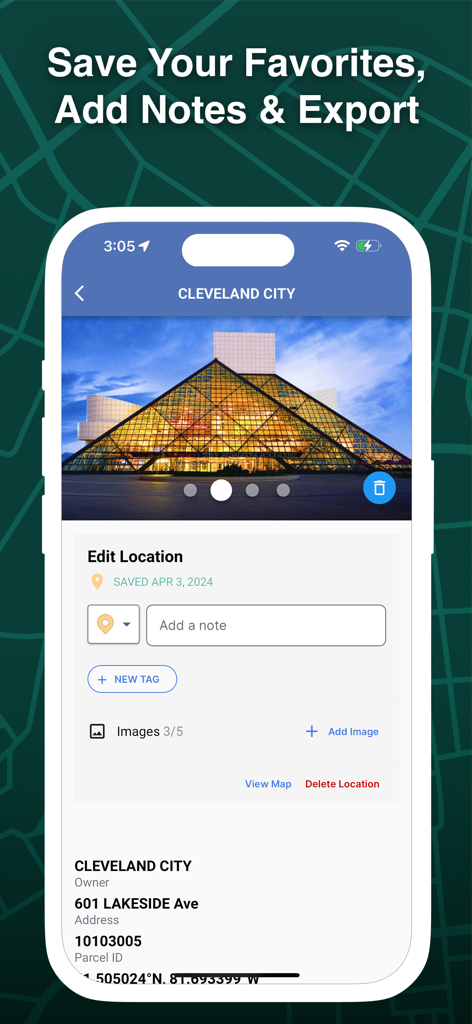
LandGlideアプリのインターフェイス。クリーブランド市の特定の区画の物件場所の編集、メモ、タグ、写真の追加方法を示しています。
説明
Download
類似アプリ
似た機能とユーザー体験を持つアプリ

Regrid Property App
Loveland Technologies, LLC

DealCheck: Analyze Real Estate
Fortnoff Financial LLC

Reventure App
Reventure App LLC

Land id®
MapRight, LLC

Acres: Land Data & Parcel Maps
AcreMaps, LLC

Tapusor
TUVIMER ARGE FAALIYETLERI VE TEKNOLOJI SISTEMLERITICARET ANONIM SIRKETI

Endeksa: Value & Sell Property
Endeksa Teknoloji Anonim Sirketi

Detector Maps
GOLD DISCOVERY SOLUTIONS PTY LTD

Parceled Land Map
Uri Nemirovsky
このページはアプリまたはその開発者の公式ページではなく、情報提供および論評を目的として作成された独立した編集出版物です。明示的に別段の記載がない限り、アプリおよびその開発者は、MWM、Apple、Google Play、アプリのパブリッシャー、またはアプリの開発者と提携、承認、後援、認可、またはその他の公式的な関係はなく、このページのいかなる内容も、アプリがMWMのサービスを使用して開発されたことを意味するものではありません。すべての商標、ロゴ、スクリーンショット、その他のコンテンツはそれぞれの所有者の財産です。