このページはアプリまたはその開発者の公式ページではなく、情報提供および論評を目的として作成された独立した編集出版物です。明示的に別段の記載がない限り、アプリおよびその開発者は、MWM、Apple、Google Play、アプリのパブリッシャー、またはアプリの開発者と提携、承認、後援、認可、またはその他の公式的な関係はなく、このページのいかなる内容も、アプリがMWMのサービスを使用して開発されたことを意味するものではありません。すべての商標、ロゴ、スクリーンショット、その他のコンテンツはそれぞれの所有者の財産です。

onWater Fish Maps & Forecast
推測はやめて、釣りを始めよう。リアルタイムの河川流量、正確な所有権境界、AIインテリジェンスにアクセスして、水辺での時間を最大限に効率化しましょう。
ダウンロード
223K+ユーザー評価
評価数
2K+開発元
カテゴリ
Navigation対応言語
1最新バージョン
3.0.2サイズ
189.1 MBリリース日
2021年7月5日推測ではなく、正確に釣る
データ主導のアングラーのための究極のツールキットで、水辺での時間を最大限に活用しましょう。リアルタイムの状況、合法的なアクセス、AI搭載のインサイトを統合します。
公共および民間のアクセスをマスターする
詳細な所有権境界を使用して、自信を持ってナビゲートします。隠れたボートランプや他の人が見逃す公共の釣り場を発見しながら、不法侵入を回避します。
リアルタイムの河川流量と水温
「氾濫した」川に無駄なドライブをすることはありません。ライブの水質と予報を追跡して、いつ、どこで釣りが最適になるかを正確に把握しましょう。
以下のスクリーンショットと説明は、アプリの公式ストアリスティングから直接取得されたものであり、アプリ開発者の所有物です。
アプリストア
スクリーンショット
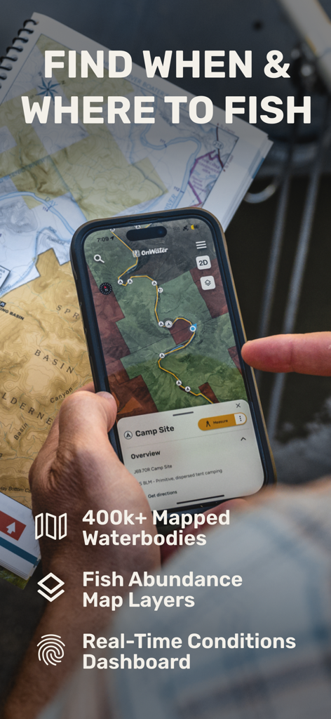
デジタルマップとリアルタイムデータを使用して釣り旅行を計画するためにonWaterアプリを使用している人
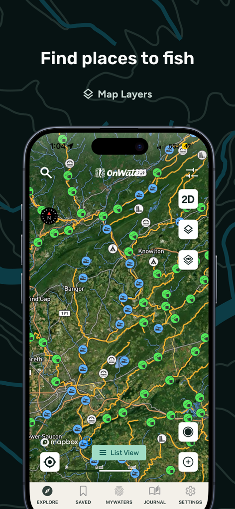
複数の釣り場マーカーとマップレイヤーオプションを備えた衛星マップを表示するonWaterアプリのスクリーンショット
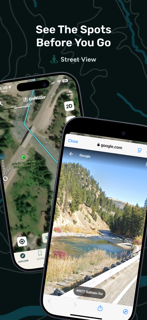
onWaterアプリは、川の釣りアクセスポイントの衛星マップとストリートビューを表示しています
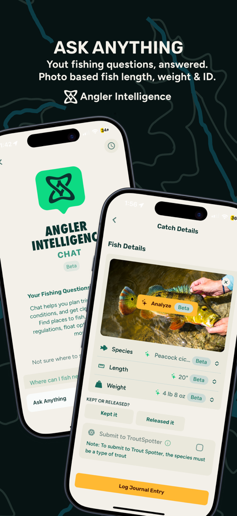
onWaterアプリのアングラーインテリジェンス機能は、AI魚種識別とキャッチ分析を表示します
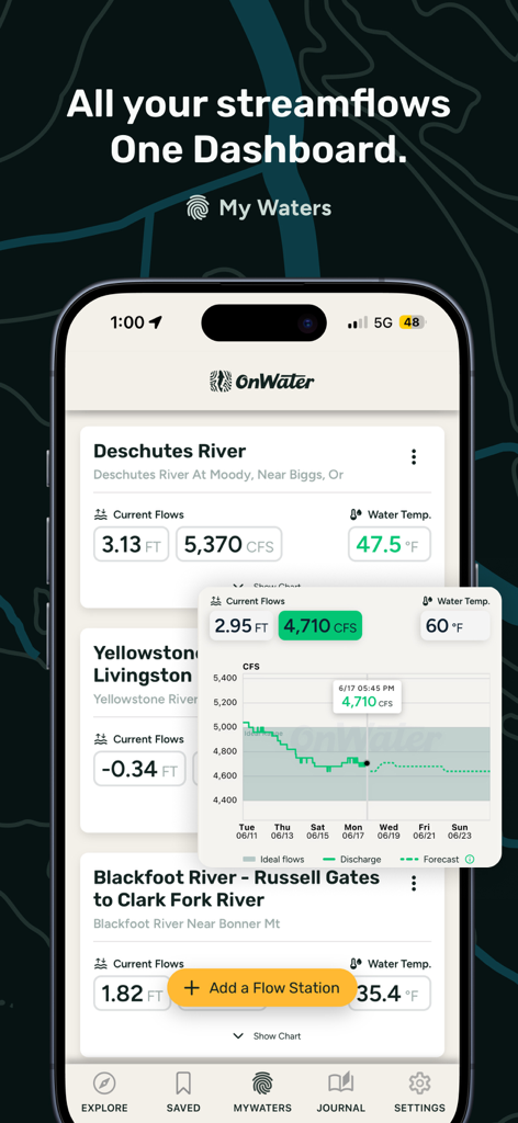
onWaterアプリのダッシュボードは、釣りのための河川流量レベルと水温データを表示します。
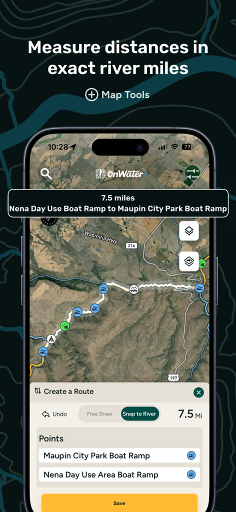
衛星マップでボートランプ間の距離を計算するための川測定ツールを示すモバイルアプリ画面。
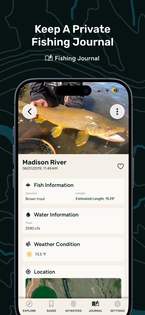
onWaterアプリの釣りジャーナルエントリには、河川流量と気象データを含むブラウントラウトのキャッチが表示されます
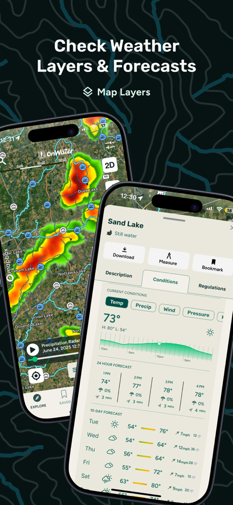
釣り天気レーダーと10日間の予報がモバイルデバイスに表示されます。
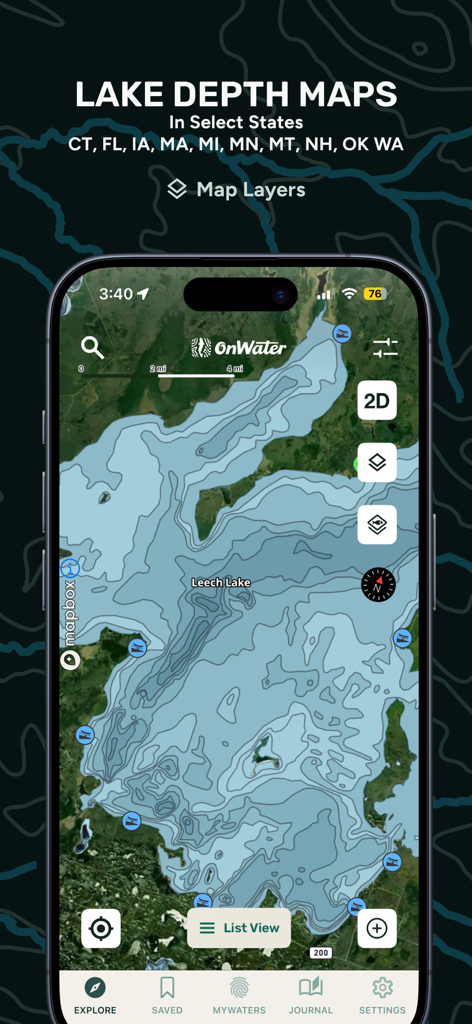
onWater釣りアプリインターフェイスの詳細な湖深度マップ。
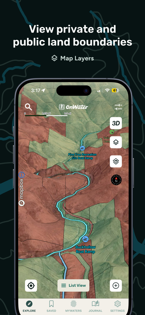
onWaterアプリのマップビューには、アングラー向けの公共および民間の土地境界とボートランプが表示されます
説明
Download
類似アプリ
似た機能とユーザー体験を持つアプリ

FishAngler - Fish Finder App
FishAngler, LLC

钓鱼天气预报
Hefei Sasha Technology Co., Ltd.

潮汐表-潮汐天气预报&钓鱼潮汐天气工具助手
荣虎 太

Fishbrain - Fishing App
FishBrain AB

Fishing Points: Map & Forecast
Fishing Points d.o.o.

onX Fish: Midwest Lake Finder
onXmaps, Inc.

Fishbox - Smart Fishing App
MEMS Group, Inc.

釣果記録FishRanker-フィッシュランカー,釣り,分析
SIIG Inc.

Fish Deeper - Fishing App
Deeper UAB
このページはアプリまたはその開発者の公式ページではなく、情報提供および論評を目的として作成された独立した編集出版物です。明示的に別段の記載がない限り、アプリおよびその開発者は、MWM、Apple、Google Play、アプリのパブリッシャー、またはアプリの開発者と提携、承認、後援、認可、またはその他の公式的な関係はなく、このページのいかなる内容も、アプリがMWMのサービスを使用して開発されたことを意味するものではありません。すべての商標、ロゴ、スクリーンショット、その他のコンテンツはそれぞれの所有者の財産です。