このページはアプリまたはその開発者の公式ページではなく、情報提供および論評を目的として作成された独立した編集出版物です。明示的に別段の記載がない限り、アプリおよびその開発者は、MWM、Apple、Google Play、アプリのパブリッシャー、またはアプリの開発者と提携、承認、後援、認可、またはその他の公式的な関係はなく、このページのいかなる内容も、アプリがMWMのサービスを使用して開発されたことを意味するものではありません。すべての商標、ロゴ、スクリーンショット、その他のコンテンツはそれぞれの所有者の財産です。

ダウンロード
10k+ユーザー評価
評価数
675開発元
カテゴリ
Photo & Video対応言語
3最新バージョン
1.5.2サイズ
38.6 MBリリース日
2017年6月27日アウトドア、風景、天体写真家のための精密な撮影計画ツール
Photographer's Ephemeris 3D: テックアナリストによる詳細分析
リアルな3D光シミュレーション
このアプリは、地球上のあらゆる場所で、昼夜を問わず、自然光が地形にどのように当たるかを正確に視覚化します。これにより、ユーザーは撮影地の照明条件を事前に詳細に把握できます。
太陽、月、天の川のイベントタイムライン
本ツールは、太陽、月、天の川の中心の昇降・通過イベントを含む継続的なタイムラインを提供し、特定の天体現象を捉えるための綿密な計画を可能にします。
高度な天の川シミュレーション
このアプリは、天の川の象徴的な表現や高解像度の星を表示し、天体写真家が天の川の理想的な位置と軌道を正確に予測し、構図を計画できるようにします。
高精度なシャドウ予測
ユーザーは、谷が直射日光を失う時間など、特定の地形における光と影の移り変わりを事前に予測し、完璧なタイミングでの撮影計画を立てることが可能です。
地理情報と座標入力
地点検索、緯度経度による座標入力、および既存のデータベースとの連携を通じて、撮影地の選定と管理を効率的に行えます。
焦点距離対応のカメラビュー制御
このツールは、シーン内をスムーズに移動し、焦点距離相当のズームを使用することで、実際のカメラからの視点をシミュレーションし、構図の検討を支援します。
高性能な地形レンダリングと詳細モード
本アプリは、GPUアクセラレーションによる高速な地形読み込みと、最大限の地形および影のディテールを提供する強化モードにより、没入感のあるリアルな計画体験を提供します。
正確な月齢レンダリング
シーン内に正確な月齢がレンダリングされるため、ユーザーは月の光の条件や外観を撮影計画に具体的に組み込むことができます。
以下のスクリーンショットと説明は、アプリの公式ストアリスティングから直接取得されたものであり、アプリ開発者の所有物です。
アプリストア
スクリーンショット
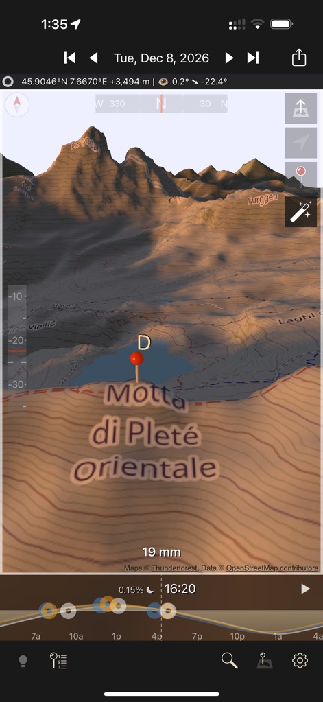
この画面では、リアルな3D地形に太陽光がどのように当たるかを視覚化し、現在の時刻(16:20)における影の伸び方と、ピンで指定された特定の場所の座標(45.9046°N 7.6670°E)を確認できます。
3D地形の光シミュレーション
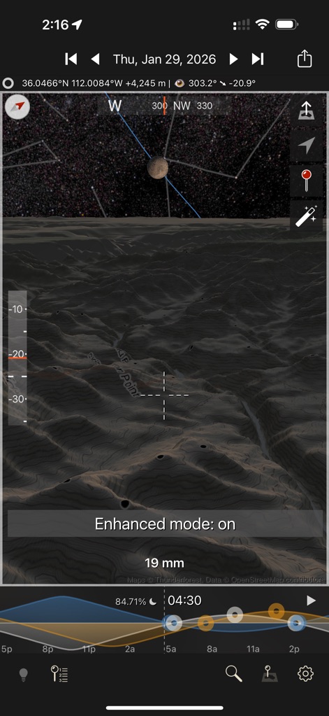
夜間撮影の計画に最適なこの表示では、エンハンストモードで詳細に表現された夜間地形と、正確な時刻(04:30)における月の満ち欠け(84.71%)および星空の位置を把握できます。
夜空と地形の視覚化
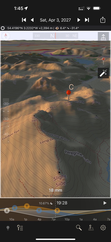
このビューでは、特定の場所(ピンC)における太陽光が地形に落とす詳細な影のパターンと、地形の起伏を明確に示す等高線によって、撮影地の特徴を詳細に分析できます。
太陽光と詳細地形
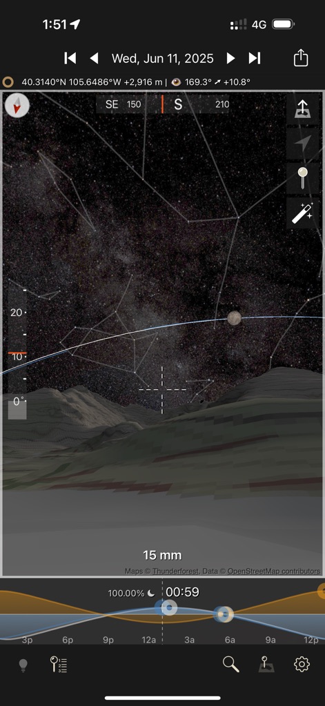
天体写真の計画に役立つこの画面では、リアルにシミュレートされた天の川の表示と、現在の時刻(00:59)における満月(100%)の位置や他の星々の配置を詳細に確認できます。
天の川と月の軌道
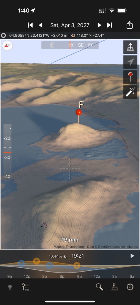
この画面は、水辺に立つ特徴的な丘(ピンF)を含む3D地形のシミュレーションを提供し、特定の時刻(19:21)における夕日の方向から伸びる長い影がどのように落ちるかを視覚的に確認できます。
撮影地点の地形予測
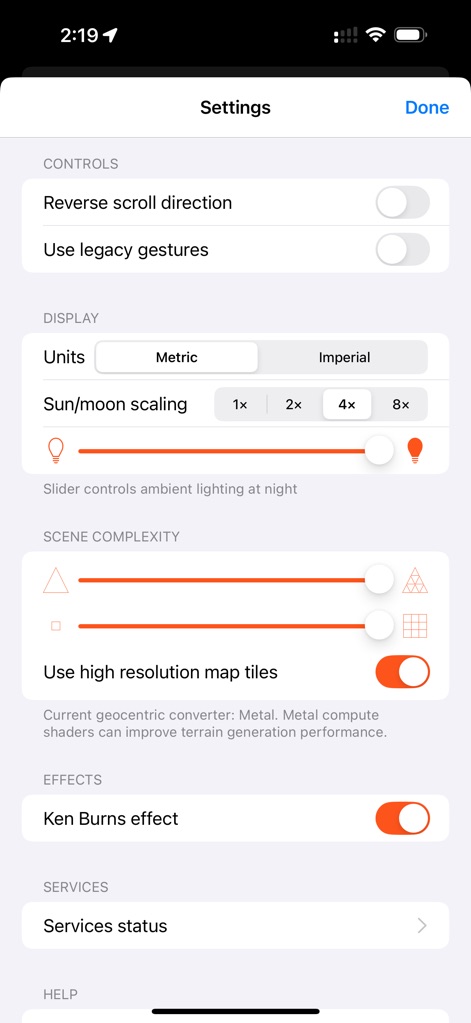
この設定画面では、ユーザーは高解像度マップタイルの使用を有効にするか選択でき、またシーンの複雑度を調整するスライダーを操作することで、表示の精細さとアプリのパフォーマンスを最適化できます。
アプリ設定のカスタマイズ
説明
Download
類似アプリ
同じカテゴリのトップランクアプリ

CapCut: Photo & Video Editor
BYTEDANCE PTE. LTD.

Instagram, Inc.

YouTube
Google LLC

Canva: AI Photo & Video Editor
Canva Pty Ltd

Snapchat
Snap, Inc.

快手
Beijing Kwai Technology Co., Ltd.

Edits: Video Editor
Instagram, Inc.

Meitu- AI Photo & Video Editor
Xiamen Meitu Technology Co., Ltd.

Google Photos: Backup & Edit
Google LLC
このページはアプリまたはその開発者の公式ページではなく、情報提供および論評を目的として作成された独立した編集出版物です。明示的に別段の記載がない限り、アプリおよびその開発者は、MWM、Apple、Google Play、アプリのパブリッシャー、またはアプリの開発者と提携、承認、後援、認可、またはその他の公式的な関係はなく、このページのいかなる内容も、アプリがMWMのサービスを使用して開発されたことを意味するものではありません。すべての商標、ロゴ、スクリーンショット、その他のコンテンツはそれぞれの所有者の財産です。