このページはアプリまたはその開発者の公式ページではなく、情報提供および論評を目的として作成された独立した編集出版物です。明示的に別段の記載がない限り、アプリおよびその開発者は、MWM、Apple、Google Play、アプリのパブリッシャー、またはアプリの開発者と提携、承認、後援、認可、またはその他の公式的な関係はなく、このページのいかなる内容も、アプリがMWMのサービスを使用して開発されたことを意味するものではありません。すべての商標、ロゴ、スクリーンショット、その他のコンテンツはそれぞれの所有者の財産です。

Planimeter: Area & Distance
衛星精度で面積、周囲長、距離を即座に計算。造園、建設、屋外プロジェクト計画に不可欠なツール。
ダウンロード
27K+ユーザー評価
評価数
400開発元
カテゴリ
Utilities対応言語
4最新バージョン
3.8サイズ
29.9 MBリリース日
2019年6月22日あらゆるプロジェクトに対応する高精度測定ツール
プロの現場調査から週末の造園まで、Planimeterは高度な衛星画像とGPS技術を使用して正確な面積と距離の計算を提供します。
即時面積・周囲長マッピング
地図上の点をマークして土地、芝生、建設現場の区画を簡単に測定し、資材に必要な正確な寸法を取得します。
プロの請負業者向けインサイト
屋根のサイズ、道路の長さ、区画の寸法をリモートで計算し、オフィスを離れることなく迅速かつ正確な見積もりを提供できます。
以下のスクリーンショットと説明は、アプリの公式ストアリスティングから直接取得されたものであり、アプリ開発者の所有物です。
アプリストア
スクリーンショット
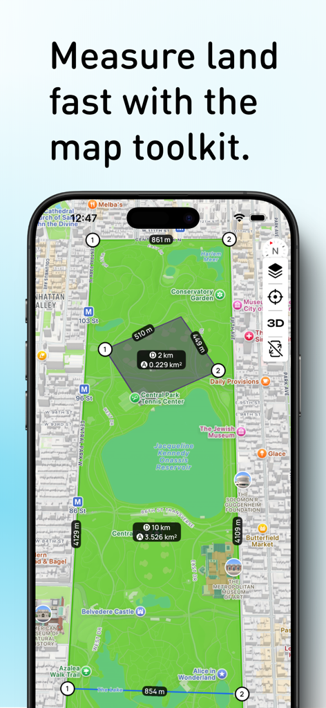
セントラルパークの地図上で面積と距離を測定するPlanimeterアプリを表示するスマートフォンの画面
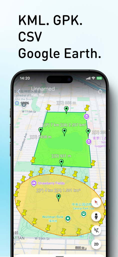
Planimeterアプリのインターフェースに、土地面積と周囲長の測定値が表示された3D衛星地図が表示されている
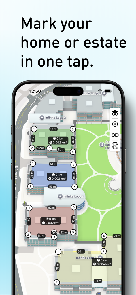
衛星地図上で土地面積と周囲長の測定値を表示するPlanimeterアプリの画面
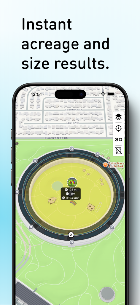
Planimeterアプリのインターフェースに、面積、距離、高さを測定するための衛星地図が表示されている
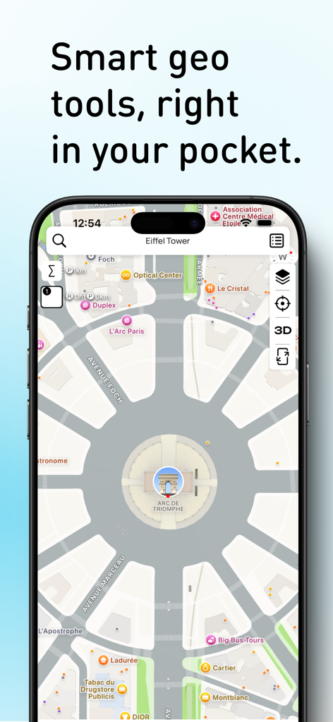
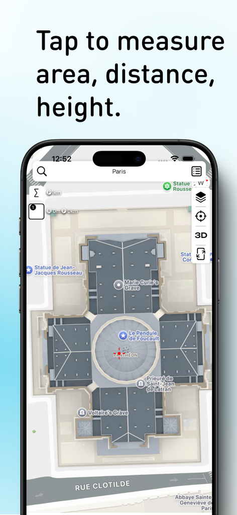
測定ツールが表示された凱旋門の地図を表示するスマートフォンのPlanimeterアプリのインターフェース
衛星地図上で面積と距離の計算を表示するPlanimeterアプリの画面
説明
Download
類似アプリ
同じカテゴリのトップランクアプリ

Google LLC

Google Chrome
Google LLC

中国移动(手机营业厅)
China Mobile Online Services Co., Ltd.

Google Authenticator
Google LLC

CNH do Brasil
Servicos e Informacoes do Brasil

Cleanup: Phone Storage Cleaner
DEEP FLOW SOFTWARE SERVICES - FZCO

gov.br
Servicos e Informacoes do Brasil

中国电信-全国统一官方服务平台
CHINA TELECOM Corporation Ltd.

Microsoft Edge: AI Browser
Microsoft Corporation
このページはアプリまたはその開発者の公式ページではなく、情報提供および論評を目的として作成された独立した編集出版物です。明示的に別段の記載がない限り、アプリおよびその開発者は、MWM、Apple、Google Play、アプリのパブリッシャー、またはアプリの開発者と提携、承認、後援、認可、またはその他の公式的な関係はなく、このページのいかなる内容も、アプリがMWMのサービスを使用して開発されたことを意味するものではありません。すべての商標、ロゴ、スクリーンショット、その他のコンテンツはそれぞれの所有者の財産です。