このページはアプリまたはその開発者の公式ページではなく、情報提供および論評を目的として作成された独立した編集出版物です。明示的に別段の記載がない限り、アプリおよびその開発者は、MWM、Apple、Google Play、アプリのパブリッシャー、またはアプリの開発者と提携、承認、後援、認可、またはその他の公式的な関係はなく、このページのいかなる内容も、アプリがMWMのサービスを使用して開発されたことを意味するものではありません。すべての商標、ロゴ、スクリーンショット、その他のコンテンツはそれぞれの所有者の財産です。

SW Maps
プロフェッショナル向けに設計された包括的なマッピングツールで、フィールドワークを強化します。外部GNSSレシーバーに接続し、複雑なShapefileを管理し、高精度な地理データを簡単に収集できます。すべて無料、広告なしです。
ダウンロード
32K+ユーザー評価
評価数
0開発元
カテゴリ
Productivity対応言語
1最新バージョン
1.2.4サイズ
17.2 MBリリース日
2022年11月17日プロフェッショナルなフィールドデータ収集
エンタープライズ価格なしで信頼性の高いデータを必要とする測量士、エンジニア、研究者のために設計された、完全な高精度GISツールキット。
センチメートルレベルの精度
Bluetooth経由で外部GNSS/RTKレシーバーに接続し、モバイルデバイスで直接プログレードの精度を実現します。
信頼性の高いオフラインマッピング
ベースマップをキャッシュし、カスタムmbtilesまたはKMLオーバーレイをインポートすることで、どこでも作業できます。リモートフィールドでの全機能に対応します。
以下のスクリーンショットと説明は、アプリの公式ストアリスティングから直接取得されたものであり、アプリ開発者の所有物です。
アプリストア
スクリーンショット
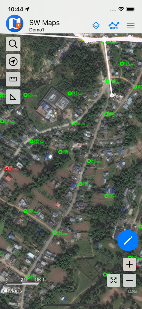
SW Mapsインターフェイスに衛星背景上にGIS測量ポイントが表示されています
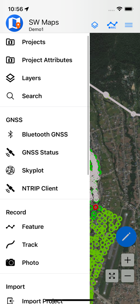
SW MapsモバイルアプリのメニューにGISデータ収集とGNSS測量オプションが表示されています
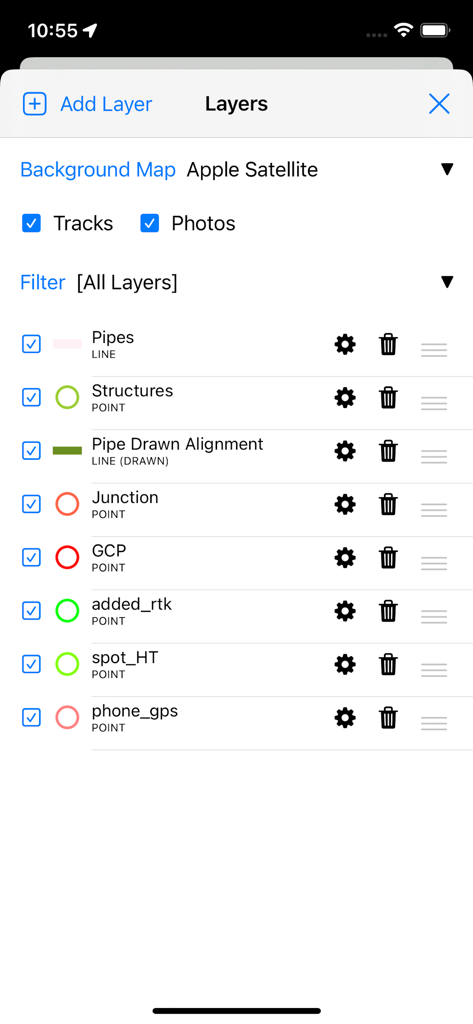
SW Mapsアプリのインターフェイスに、測量とマッピングのためのプロフェッショナルGISデータレイヤー管理が表示されています
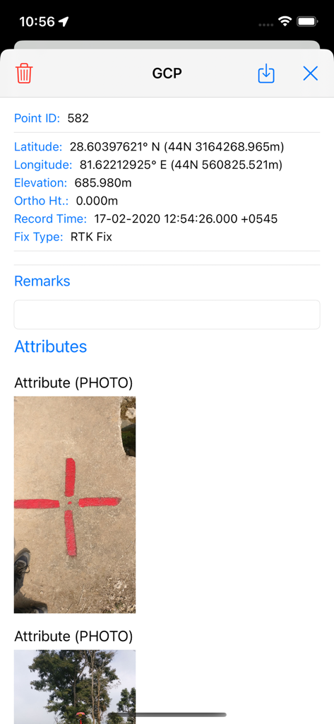
SW Mapsでの地籍管理点の詳細ビュー。座標と物理的な測量マーカーの写真が表示されます
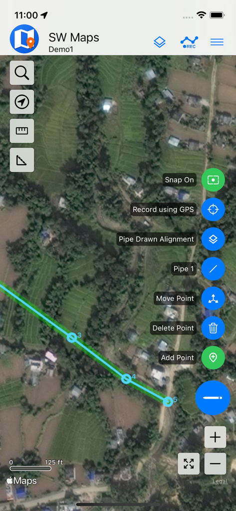
SW MapsでのモバイルGISマッピング。衛星画像上にパイプラインが表示されています
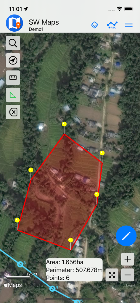
SW Mapsアプリの衛星マップビュー。面積と周囲長が計算された赤いポリゴンが表示され、土地測量用です
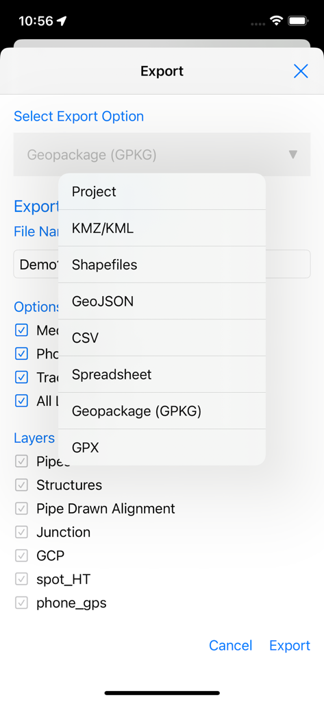
SW Mapsのエクスポート画面に、プロフェッショナルGISファイル形式のリストとレイヤー選択オプションが表示されています
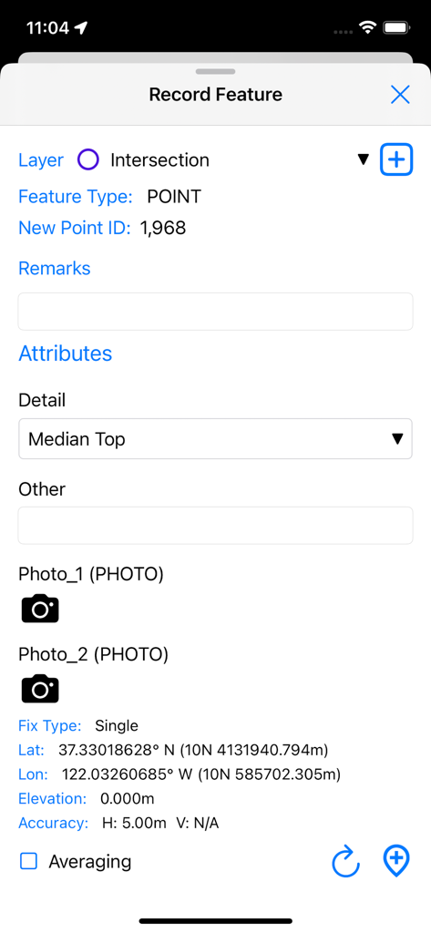
SW MapsでGPS座標とカスタム属性を持つ新しいGISポイントフィーチャーを記録するためのインターフェイス
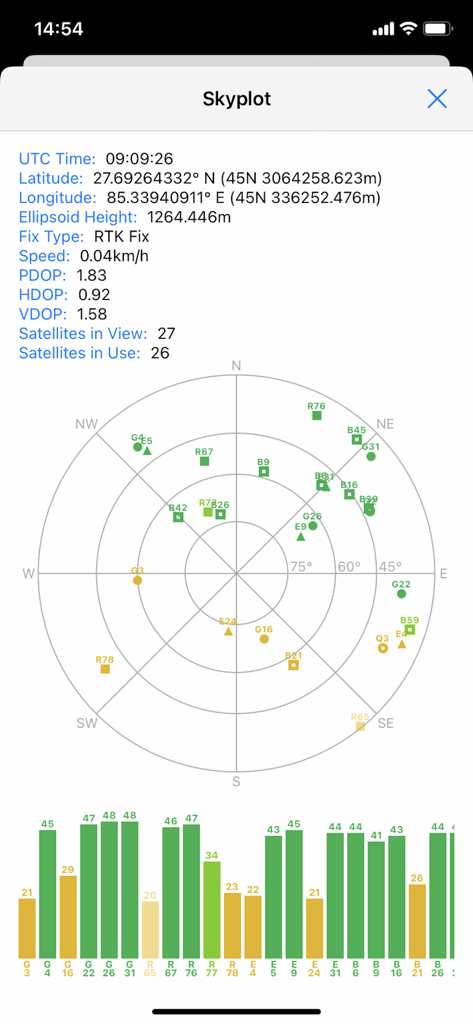
SW Mapsのスカイプロット画面。プロフェッショナルマッピングプロジェクトの衛星位置とGNSS信号品質が表示されています
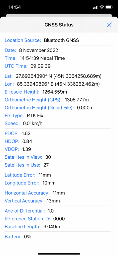
SW MapsのGNSSステータス画面。高精度RTKフィックスと精度メトリックが表示されています
説明
Download
類似アプリ
同じカテゴリのトップランクアプリ

ChatGPT
OpenAI OpCo, LLC

Google Gemini
Google LLC

Grok
X.AI Corporation

Gmail - Email by Google
Google LLC

千问 - 阿里最强大模型官方AI助手
Shanghai Zhixin Puhui Technology Co., Ltd.

Google Drive
Google LLC

Microsoft Authenticator
Microsoft Corporation

Google Sheets
Google LLC

Google Docs
Google LLC
このページはアプリまたはその開発者の公式ページではなく、情報提供および論評を目的として作成された独立した編集出版物です。明示的に別段の記載がない限り、アプリおよびその開発者は、MWM、Apple、Google Play、アプリのパブリッシャー、またはアプリの開発者と提携、承認、後援、認可、またはその他の公式的な関係はなく、このページのいかなる内容も、アプリがMWMのサービスを使用して開発されたことを意味するものではありません。すべての商標、ロゴ、スクリーンショット、その他のコンテンツはそれぞれの所有者の財産です。