This page is not an official page of the app or its developer, but an independent editorial publication created for informational and commentary purposes. Unless expressly stated otherwise, neither the app nor its developer is affiliated with, endorsed by, sponsored by, authorized by, or otherwise officially connected with MWM, Apple, Google Play, the app publisher, or the app's developer, and nothing on this page implies that the app was developed using MWM's services. Any trademarks, logos, screenshots, and other content remain the property of their respective owners.

VegViseren
Master the Norwegian road network with real-time NVDB data integration, precise asset-level navigation, and reliable offline performance for field engineers and logistics specialists.
Downloads
0User Rating
Total Ratings
0Publisher
Category
NavigationLocales
1Latest Version
2025.2.0Size
85.7 MBFirst Released
Dec 3, 2014Precision Field Tools for Norwegian Infrastructure
The essential professional toolkit for US-based engineers and consultants requiring 100% accurate, official NVDB road data in the field.
Live NVDB Integration
Access the 'Single Source of Truth' with real-time road references and coordinates pulled directly from the Norwegian National Road Data Bank.
Asset-Specific Navigation
Go beyond street addresses. Navigate directly to specific bridges, tunnels, or maintenance points using precise road references and point-data.
The following screenshots and description are sourced directly from the app's official store listing and are the property of the app developer.
App Store
Screenshots
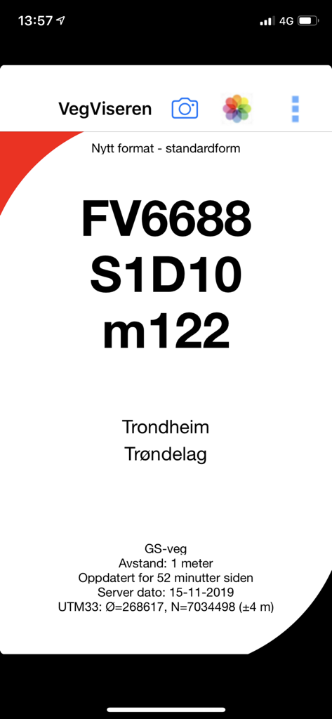
VegViseren app screenshot showing technical road reference data and location information for Trondheim
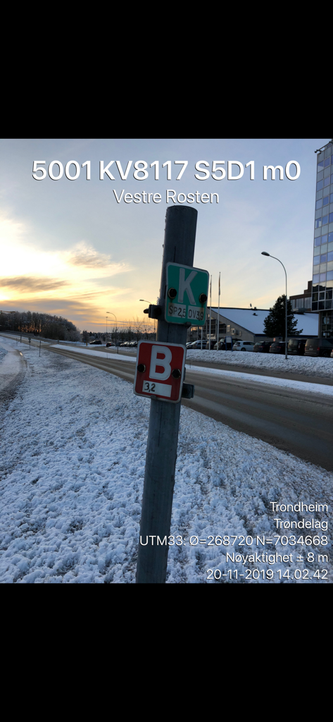
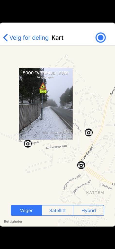
A photo of a Norwegian road sign in a snowy winter landscape with technical data such as road references and UTM coordinates overlaid by the VegViseren app.
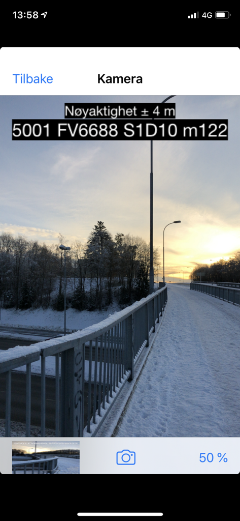
VegViseren app camera interface showing a precise Norwegian road reference and accuracy data overlay on a photo of a snowy bridge
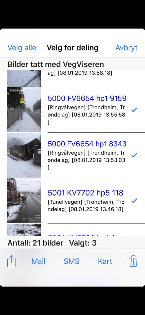
VegViseren app interface showing a list of professional field photos with road reference data and sharing options
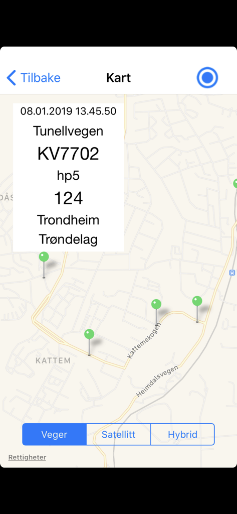
VegViseren app map interface displaying a geotagged road maintenance photo with technical metadata overlay
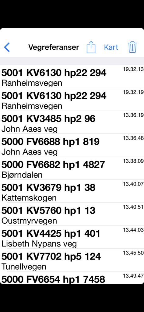
A list of technical road references and Norwegian street names displayed within the VegViseren mobile application.
VegViseren mobile app showing a map with road reference data for Trondheim Norway
Description
Download
More Like This
Top-ranked apps in the same category

Google Maps
Google LLC

AMap Global
AutoNavi Information Technology Co. Ltd.

Waze Navigation & Live Traffic
waze

百度地图-路线规划,出行必备
Beijing Baidu Netcom Science & Technology Co.,Ltd

Moovit: Bus & Transit Tracker
Moovit App Global LTD

Transit • Subway & Bus Times
9280-0366 Quebec inc.

MapXplorer: Map Radar Navigate
GOLDLAB APPLICATIONS YAZILIM VE BILISIM ANONIM SIRKETI

ParkMobile: Park. Pay. Go.
Parkmobile USA, Inc

腾讯地图-路线规划,导航地铁打车出行
Shenzhen Tencent Computer Systems Company Limited
This page is not an official page of the app or its developer, but an independent editorial publication created for informational and commentary purposes. Unless expressly stated otherwise, neither the app nor its developer is affiliated with, endorsed by, sponsored by, authorized by, or otherwise officially connected with MWM, Apple, Google Play, the app publisher, or the app's developer, and nothing on this page implies that the app was developed using MWM's services. Any trademarks, logos, screenshots, and other content remain the property of their respective owners.