This page is not an official page of the app or its developer, but an independent editorial publication created for informational and commentary purposes. Unless expressly stated otherwise, neither the app nor its developer is affiliated with, endorsed by, sponsored by, authorized by, or otherwise officially connected with MWM, Apple, Google Play, the app publisher, or the app's developer, and nothing on this page implies that the app was developed using MWM's services. Any trademarks, logos, screenshots, and other content remain the property of their respective owners.

ジャパンエコトラック公式アプリ
Plan your human-powered adventure with official offline GPS maps, elevation tracking, and digital achievement badges. Discover curated hiking, cycling, and paddling routes across rural Japan, powered by Mont-bell.
Downloads
0User Rating
Total Ratings
0Publisher
Category
SportsLocales
1Latest Version
3.3.0Size
76.2 MBFirst Released
Jun 30, 2021Master Your Japanese Wilderness Adventure
From expert-curated cycling routes to high-precision topographic maps, get the official tool designed for the serious outdoor explorer in rural Japan.
Expert-Curated Route Planning
Filter hundreds of certified Japan Eco Track trails by activity, elevation gain, and physical level to find your perfect off-the-beaten-path challenge.
Pro-Grade Offline GPS Maps
Navigate safely with high-resolution 1/25,000 topographic maps from the Geospatial Information Authority of Japan that work perfectly without cell service.
The following screenshots and description are sourced directly from the app's official store listing and are the property of the app developer.
App Store
Screenshots
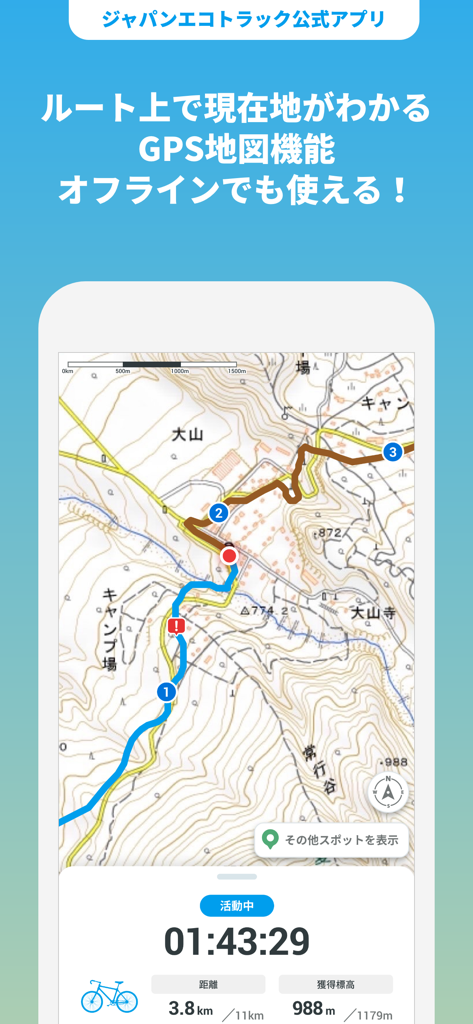
GPS topographic map in Japan Eco Track app showing a cycling route with distance and elevation stats
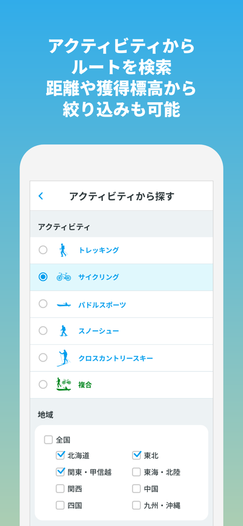
Route search interface by activity and region in Japan
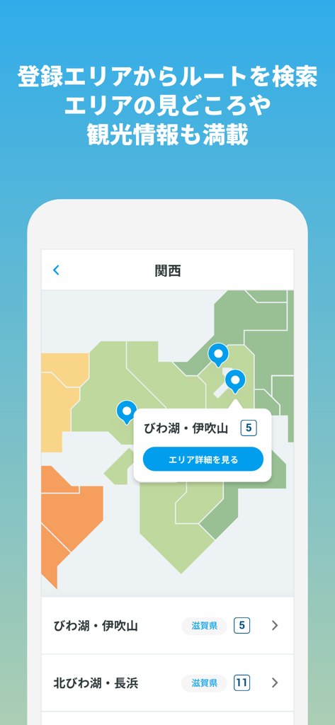
Map interface of the Japan Eco Track app showing outdoor route options in the Kansai region
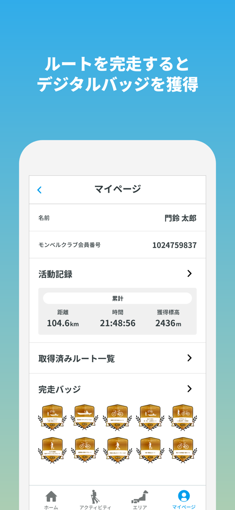
The My Page screen of the Japan Eco Track app showing activity statistics and digital achievement badges for hiking and cycling
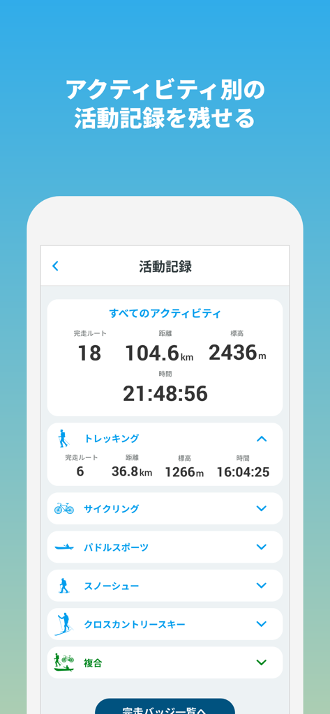
Activity record screen in the Japan Eco Track app showing trekking distance and elevation stats.
Description
Download
More Like This
Top-ranked apps in the same category

得物 - 得到美好事物
Shanghai Dewu Information Group Co., Ltd.

虎扑-评分篮球足球游戏影视
Shanghai Kuanghui Network Technology Co., LTD

Paralympic Games™
International Olympic Committee

滑呗 - 1000万雪友的选择
Pow Snow Technology Co., Ltd.

懂球帝 - 足球篮球体坛数据
Hainan Football-Loving Girl Network Technology Co., Ltd.

GameChanger
GameChanger Media, Inc.

Flashscore: Live Scores & News
Livesport s.r.o.

DAZN: Stream Live Sports
DAZN Limited

PrizePicks - Sports Picks
SidePrize, LLC
This page is not an official page of the app or its developer, but an independent editorial publication created for informational and commentary purposes. Unless expressly stated otherwise, neither the app nor its developer is affiliated with, endorsed by, sponsored by, authorized by, or otherwise officially connected with MWM, Apple, Google Play, the app publisher, or the app's developer, and nothing on this page implies that the app was developed using MWM's services. Any trademarks, logos, screenshots, and other content remain the property of their respective owners.