이 페이지는 앱이나 개발자의 공식 페이지가 아니며, 정보 제공 및 논평을 목적으로 작성된 독립 편집 간행물입니다. 명시적으로 달리 언급되지 않는 한, 해당 앱이나 개발자는 MWM, Apple, Google Play, 앱 퍼블리셔 또는 앱 개발자와 제휴, 보증, 후원, 승인 또는 공식적으로 연결되어 있지 않으며, 이 페이지의 어떤 내용도 해당 앱이 MWM의 서비스를 사용하여 개발되었음을 의미하지 않습니다. 모든 상표, 로고, 스크린샷 및 기타 콘텐츠는 해당 소유자의 자산입니다.

Airports
27,000개 이상의 공항에 대한 즉각적인 METAR, TAF 및 NOTAM 보고서로 비행 가방을 갖추십시오. ICAO 검색부터 FDP 계산기까지, 항공 커뮤니티에서 신뢰하는 기술 참조 자료로 필요한 상황 인식 능력을 확보하세요.
다운로드
405K+사용자 평점
총 평가 수
12K+개발사
카테고리
Reference지원 언어
1최신 버전
4.1.6크기
47.6 MB출시일
2008년 12월 20일모든 조종사의 비행 가방을 위한 정밀 도구
전문가 수준의 계산 도구와 결합된 실시간 METAR, TAF 및 NOTAM 보고서를 갖춘 27,000개 이상의 공항 글로벌 데이터베이스에 액세스하여 조종석에 맞게 설계되었습니다.
실시간 상황 인식
48시간 오프라인 저장을 특징으로 하는 즉각적인 METAR, TAF 및 디코딩된 SNOWTAM 보고서로 날씨보다 앞서 나가세요. 비행 중 안정적인 액세스를 제공합니다.
개인화된 공항 브리핑
사진, PDF 및 사용자 지정 메모를 모든 공항에 첨부하여 나만의 지식 기반을 구축하세요. 클라우드 동기화는 iPhone 및 iPad에서 데이터를 일관되게 유지합니다.
다음 스크린샷과 설명은 앱의 공식 스토어 목록에서 직접 가져온 것이며 앱 개발자의 자산입니다.
앱 스토어
스크린샷
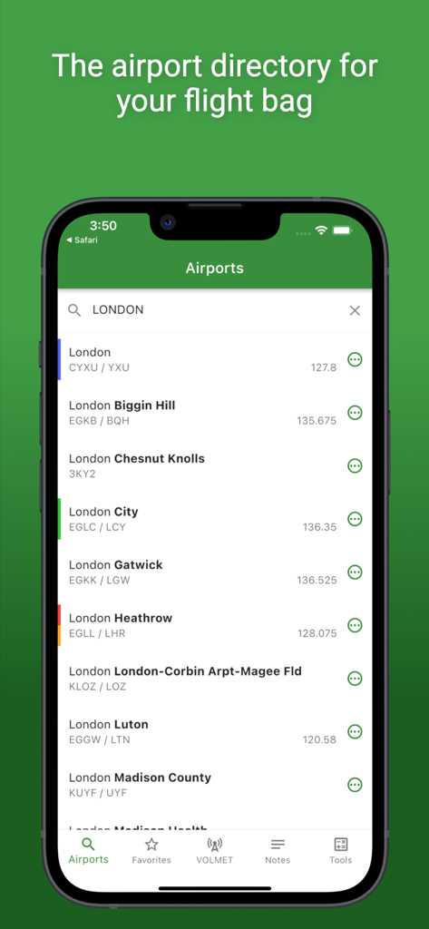
항공권과 주파수가 있는 런던 공항 목록을 표시하는 공항 앱
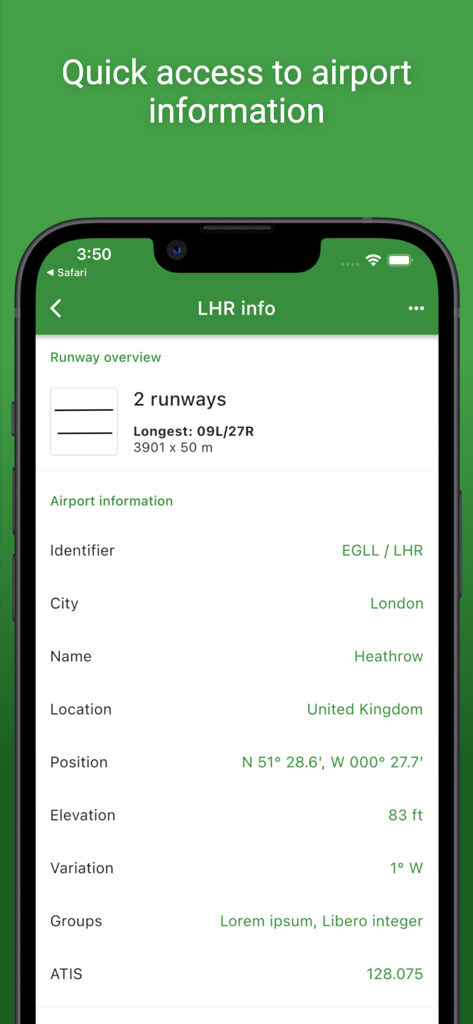
조종사를 위한 공항 앱에 표시되는 런던 히드로 공항의 기술 공항 데이터
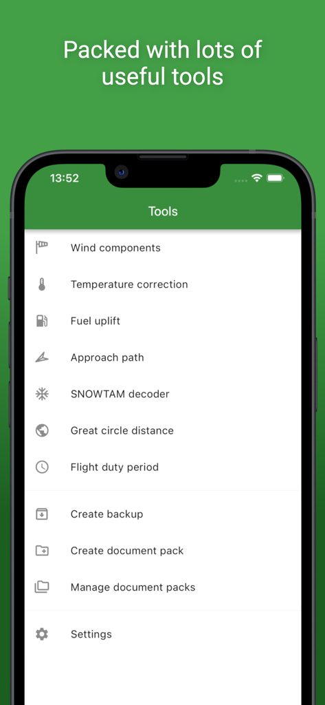
공항 모바일 앱 내 조종사를 위한 기술 항공 도구 및 계산기 목록
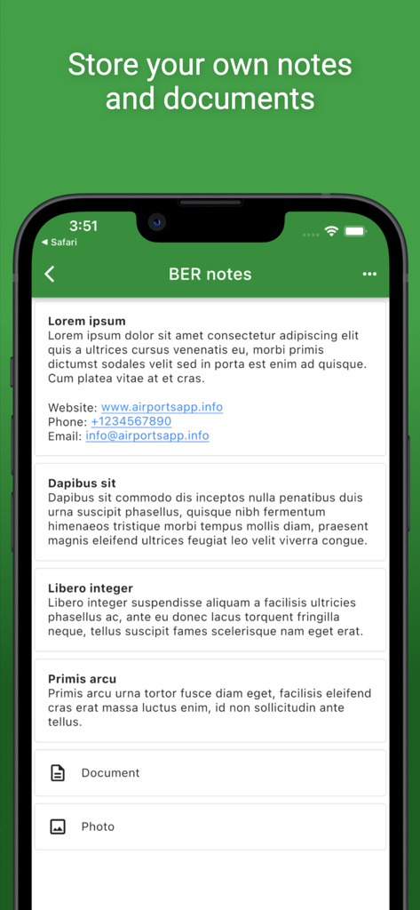
조종사를 위한 사용자 지정 메모 및 문서 저장 기능을 보여주는 공항 앱 스크린샷
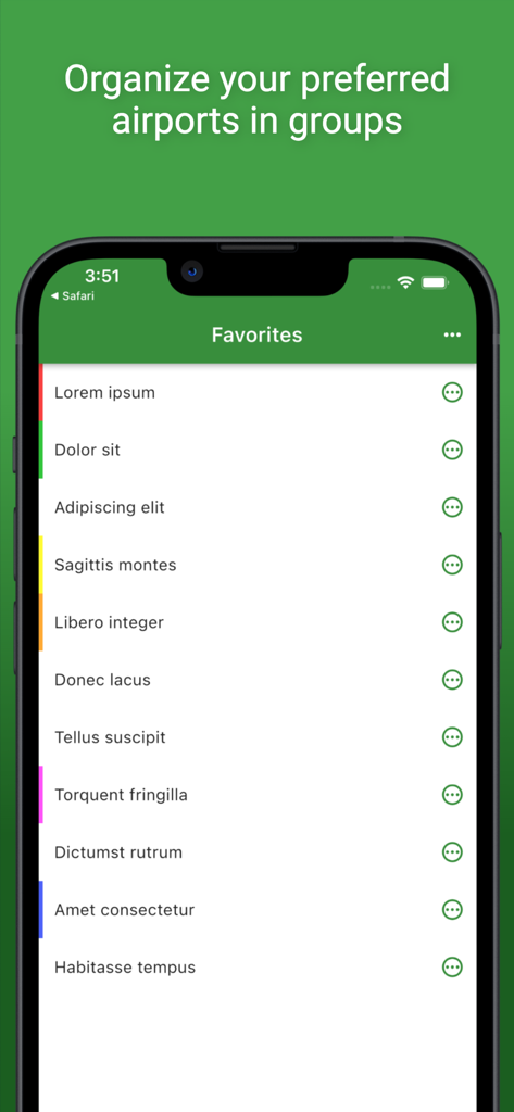
사용자 지정 그룹으로 구성된 즐겨찾기 공항 목록을 보여주는 모바일 앱 화면
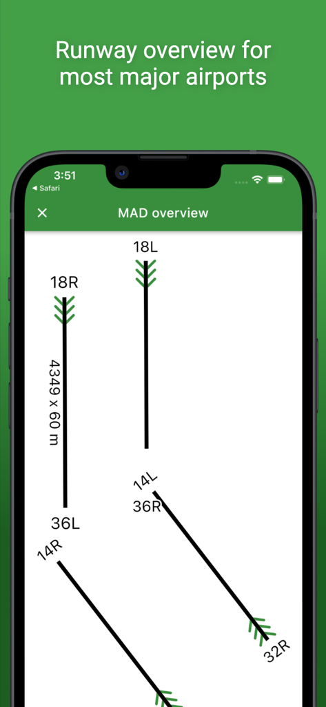
공항 앱의 방향과 방위를 보여주는 마드리드 공항의 기술 활주로 개요 다이어그램

조종사를 위한 SNOWTAM 디코더가 있는 METAR TAF 및 NOTAM 보고서를 표시하는 공항 앱
설명
Download
비슷한 앱
유사한 기능과 사용자 경험을 가진 앱

Navigraph Charts
Navigraph KB

SkyDemon
Divelements Limited

OzRunways EFB
OzRunways Pty. Ltd.

fDeck: flight instruments
Darren Yeates

Noisy Goose
Automata Solutions Ltd.

StationWeather - METAR and TAF
Oliver Puetz

Drone UAV Fly Forecast: AirMap
MONIQ TAP COMPANY LIMITED

Airmate
Myriel Aviation SA

AvPlan EFB
BJA Consulting Pty Ltd
이 페이지는 앱이나 개발자의 공식 페이지가 아니며, 정보 제공 및 논평을 목적으로 작성된 독립 편집 간행물입니다. 명시적으로 달리 언급되지 않는 한, 해당 앱이나 개발자는 MWM, Apple, Google Play, 앱 퍼블리셔 또는 앱 개발자와 제휴, 보증, 후원, 승인 또는 공식적으로 연결되어 있지 않으며, 이 페이지의 어떤 내용도 해당 앱이 MWM의 서비스를 사용하여 개발되었음을 의미하지 않습니다. 모든 상표, 로고, 스크린샷 및 기타 콘텐츠는 해당 소유자의 자산입니다.