이 페이지는 앱이나 개발자의 공식 페이지가 아니며, 정보 제공 및 논평을 목적으로 작성된 독립 편집 간행물입니다. 명시적으로 달리 언급되지 않는 한, 해당 앱이나 개발자는 MWM, Apple, Google Play, 앱 퍼블리셔 또는 앱 개발자와 제휴, 보증, 후원, 승인 또는 공식적으로 연결되어 있지 않으며, 이 페이지의 어떤 내용도 해당 앱이 MWM의 서비스를 사용하여 개발되었음을 의미하지 않습니다. 모든 상표, 로고, 스크린샷 및 기타 콘텐츠는 해당 소유자의 자산입니다.

Avenza Maps: Offline Mapping
National Geographic, USGS, USFS가 포함된 세계 최대 규모의 디지털 지도 스토어에 액세스하세요. 정밀 GPS로 길을 찾고, 트랙을 기록하며, 셀 신호 없이도 오프라인 상태에서 탐험하세요.
다운로드
5M+사용자 평점
총 평가 수
218K+개발사
카테고리
Navigation지원 언어
12최신 버전
262크기
182.6 MB출시일
2010년 9월 19일어디든 자신 있게 탐색하세요
휴대폰 신호가 닿지 않는 세계의 가장 외딴 지역에서도 길을 잃지 않도록 설계된 전문가급 지도와 고정밀 도구에 액세스하세요.
100% 오프라인 GPS 네비게이션
셀룰러 데이터나 Wi-Fi 없이 실시간으로 자신의 위치를 파악하고 트랙을 기록하여 오프라인 상태에서도 길을 잃지 않도록 합니다.
세계적 수준의 지도 스토어
National Geographic, 미국 산림청, NOAA의 수천 가지 전문 지도를 다운로드하여 특정 활동에 맞게 사용하세요.
자주 묻는 질문
에 대해 알아야 할 모든 것 Avenza Maps: Offline Mapping
Avenza Maps는 무엇인가요?
Avenza Maps는 하이킹, 자전거 타기, 모든 트레일에 대한 최고의 앱으로, 내셔널 지오그래픽과 국립 공원의 지도를 제공합니다. 오프라인 모바일 지도를 사용하여 GPS 내비게이션으로 야외 모험을 즐길 수 있습니다.
Avenza Maps는 인터넷 연결 없이 사용할 수 있나요?
네, Avenza Maps는 오프라인 사용을 지원합니다. 지도가 다운로드되어 있다면 오프라인 상태에서도 GPS로 경로를 추적하고 실시간 위치를 파악할 수 있습니다.
Avenza Maps는 무료인가요?
네, Avenza Maps는 레크리에이션 목적으로 무료로 다운로드하고 사용할 수 있습니다. 인앱 지도 스토어에서는 무료 및 유료 지도를 모두 제공합니다.
Avenza 지도 스토어에는 어떤 종류의 지도가 있나요?
Avenza 지도 스토어는 내셔널 지오그래픽, 국립 공원 관리청, 미국 산림청과 같은 발행사의 하이킹, 지형, 자전거, 도시, 항해, 여행 및 트레일 지도를 제공합니다.
Avenza Maps에 사용자 지정 지도를 가져오려면 어떻게 해야 하나요?
Avenza Maps는 사용자 지정 지리 공간 PDF, GeoPDF®, GeoTIFF 지도를 가져올 수 있습니다. 무제한 가져오기에는 Avenza Maps Plus 또는 Pro 구독이 필요합니다.
Avenza Maps는 GPS 트랙을 기록하나요?
네, Avenza Maps는 활동 중에 GPS 트랙을 기록합니다. 또한 실시간 GPS 위치를 표시하고, 나침반 내비게이션 도구를 제공하며, 위치에 사진/메모를 추가할 수 있습니다.
Avenza Maps Plus 구독에는 무엇이 포함되나요?
Avenza Maps Plus 구독은 사용자 지정 지리 공간 PDF, GeoPDF®, GeoTIFF 지도를 무제한으로 가져올 수 있습니다. 또한 최대 50개의 개별 기능에 대한 지오펜스를 생성할 수 있습니다.
Avenza Maps Pro의 기능은 무엇인가요?
Avenza Maps Pro는 무제한 사용자 지정 지도 가져오기, GPS 평균, 추가 좌표 형식, 고정밀 GPS 장치 연결 기능을 포함합니다. 또한 무제한 지오펜스, 쉐이프 파일 가져오기/내보내기, 우선 기술 지원을 제공합니다.
Avenza Maps에서 지도에 위치를 표시할 수 있나요?
네, Avenza Maps를 사용하면 지도에 장소 표시를 추가하고 레크리에이션 기호로 사용자 지정할 수 있습니다. 사용자는 특정 위치에 사진과 메모를 추가할 수도 있습니다.
Avenza Maps 구독은 어떻게 작동하나요?
Avenza Maps Plus 및 Pro는 자동 갱신되는 연간 구독입니다. 현재 기간이 종료되기 24시간 이내에 갱신 요금이 청구됩니다. 단, iTunes 계정 설정에서 자동 갱신을 비활성화한 경우는 제외됩니다.
다음 스크린샷과 설명은 앱의 공식 스토어 목록에서 직접 가져온 것이며 앱 개발자의 자산입니다.
앱 스토어
스크린샷
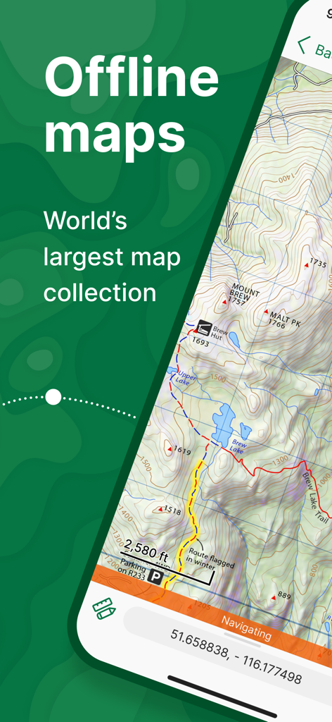
Avenza Maps 앱이 네비게이션 도구가 포함된 상세한 오프라인 지형도를 표시하고 있습니다.
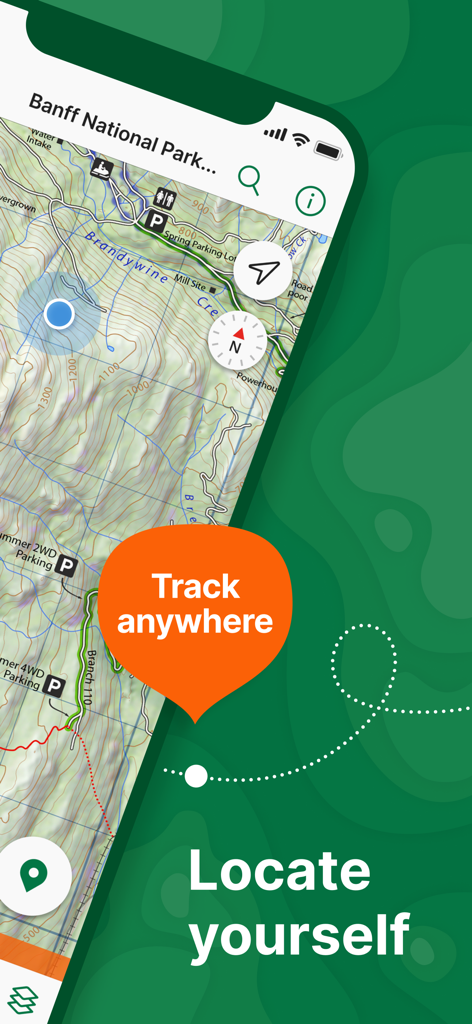
Avenza Maps 앱에 표시된 밴프 국립공원 지형도가 오프라인 GPS 추적 및 위치 기능을 보여줍니다.
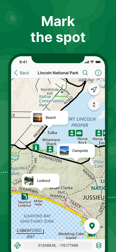
Avenza Maps 인터페이스에 링컨 국립공원의 지형도와 캠핑장 및 전망대 위치 표시기가 표시됩니다.
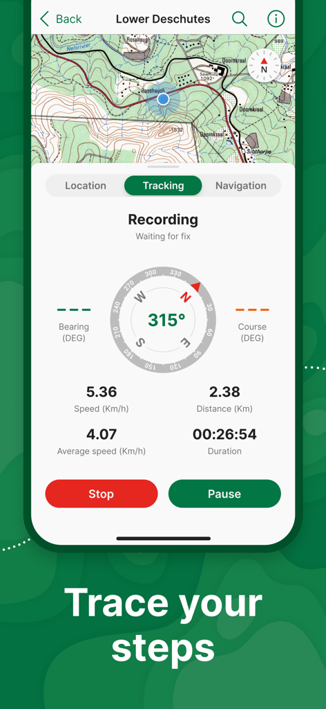
Avenza Maps 앱 인터페이스에 나침반 및 네비게이션 데이터가 포함된 지형도에서 GPS 추적이 표시됩니다.
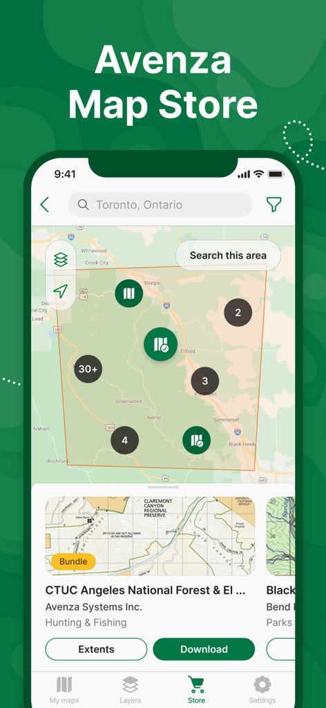
Avenza Maps 모바일 앱 스토어 인터페이스에 사용 가능한 지도 및 위치 검색이 표시됩니다.

프리미엄 지도 헤더 아래 National Geographic, Michelin, Garmin, USGS 로고
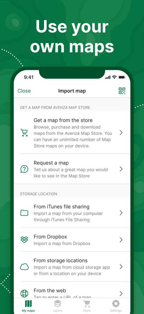
Avenza Maps 앱 인터페이스에 스토어, 클라우드 스토리지, 웹에서 지도 가져오기 옵션이 표시됩니다.
설명
Download
비슷한 앱
유사한 기능과 사용자 경험을 가진 앱

AllTrails: Hike, Bike & Run
AllTrails, Inc.

Pedometer++
Cross Forward Consulting, LLC

Organic Maps: Offline Map
Organic Maps OU

Gaia GPS: Mobile Trail Maps
Trailbehind, INC.

Offline hiking maps: Mapy.com
Seznam.cz a.s.

Hiking Map Poland
Mapa Turystyczna sp. z o.o.

MapOut
Valnova GmbH

FarOut: Offline GPS Trail Maps
Atlas Guides DE, Inc.

Norgeskart
Norgeskart AS
이 페이지는 앱이나 개발자의 공식 페이지가 아니며, 정보 제공 및 논평을 목적으로 작성된 독립 편집 간행물입니다. 명시적으로 달리 언급되지 않는 한, 해당 앱이나 개발자는 MWM, Apple, Google Play, 앱 퍼블리셔 또는 앱 개발자와 제휴, 보증, 후원, 승인 또는 공식적으로 연결되어 있지 않으며, 이 페이지의 어떤 내용도 해당 앱이 MWM의 서비스를 사용하여 개발되었음을 의미하지 않습니다. 모든 상표, 로고, 스크린샷 및 기타 콘텐츠는 해당 소유자의 자산입니다.