이 페이지는 앱이나 개발자의 공식 페이지가 아니며, 정보 제공 및 논평을 목적으로 작성된 독립 편집 간행물입니다. 명시적으로 달리 언급되지 않는 한, 해당 앱이나 개발자는 MWM, Apple, Google Play, 앱 퍼블리셔 또는 앱 개발자와 제휴, 보증, 후원, 승인 또는 공식적으로 연결되어 있지 않으며, 이 페이지의 어떤 내용도 해당 앱이 MWM의 서비스를 사용하여 개발되었음을 의미하지 않습니다. 모든 상표, 로고, 스크린샷 및 기타 콘텐츠는 해당 소유자의 자산입니다.

Hiking Map Poland
여러분의 유산을 다시 경험하고 자신 있게 폴란드 공식 트레일을 탐험하세요. 경로를 계획하고 오프라인 지도를 다운로드하며 전문가용 GPS 및 Apple Watch 지원을 통해 진행 상황을 추적할 수 있습니다.
다운로드
276K+사용자 평점
총 평가 수
19K+개발사
카테고리
Travel지원 언어
2최신 버전
2.0.20크기
84.0 MB출시일
2016년 6월 29일현지인처럼 폴란드 산맥을 정복하세요
정확성과 신뢰성을 요구하는 등산객을 위해 설계된 타트라, 베스키디, 수데티 산맥을 가로지르는 유산 여행을 위한 최고의 경로 플래너입니다.
신뢰할 수 있는 오프라인 내비게이션
국제 데이터 로밍 요금을 걱정하지 마세요. 상세한 지형도를 다운로드하여 인터넷이 연결되지 않는 곳에서도 공식 트레일을 찾아갈 수 있습니다.
정통 트레일 계획
정확한 고도 프로필과 산장(Schronisko) 간 예상 소요 시간이 포함된 공식 PTTK 트레일 네트워크를 확인하세요.
다음 스크린샷과 설명은 앱의 공식 스토어 목록에서 직접 가져온 것이며 앱 개발자의 자산입니다.
앱 스토어
스크린샷
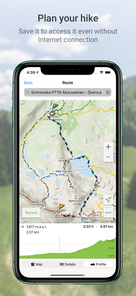
고도 프로필과 지도 세부 정보가 포함된 타트라 산맥의 계획된 트레일 경로를 보여주는 폴란드 하이킹 지도 앱의 인터페이스
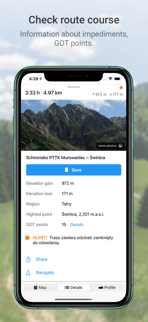
고도 및 GOT 포인트를 포함한 폴란드 타트라 산맥의 하이킹 경로 상세 정보를 보여주는 스마트폰 화면
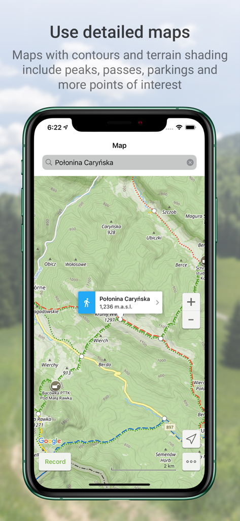
폴로니나 카린스카(Polonina Carynska)의 하이킹 트레일과 등고선을 보여주는 폴란드 하이킹 지도 앱의 상세 지형도
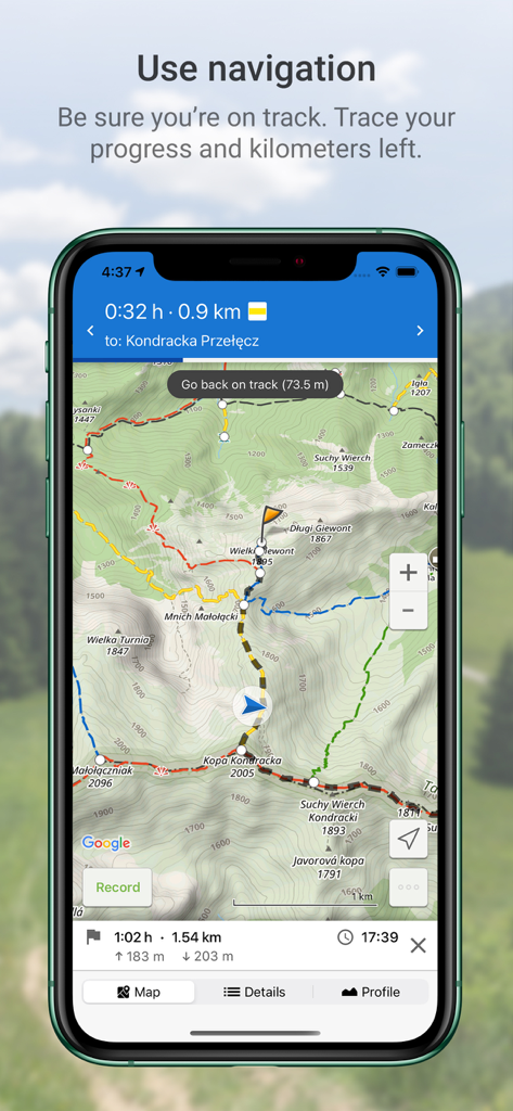
폴란드 산맥의 지형 하이킹 트레일 지도에서 GPS 내비게이션을 보여주는 모바일 앱 화면
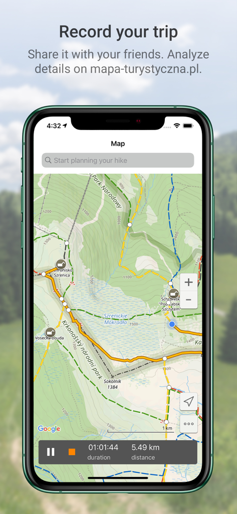
거리 및 시간 데이터와 함께 기록된 하이킹 트랙을 보여주는 폴란드 하이킹 지도 앱의 인터페이스
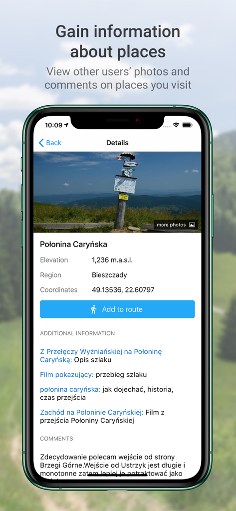
폴란드 폴로니나 카린스카의 사진, 고도 및 댓글을 보여주는 하이킹 앱의 상세 화면
설명
Download
비슷한 앱
유사한 기능과 사용자 경험을 가진 앱

AllTrails: Hike, Bike & Run
AllTrails, Inc.

Pedometer++
Cross Forward Consulting, LLC

Organic Maps: Offline Map
Organic Maps OU

Gaia GPS: Mobile Trail Maps
Trailbehind, INC.

Offline hiking maps: Mapy.com
Seznam.cz a.s.

MapOut
Valnova GmbH

FarOut: Offline GPS Trail Maps
Atlas Guides DE, Inc.

Norgeskart
Norgeskart AS

GPX viewer - map
Lucas den Otter
이 페이지는 앱이나 개발자의 공식 페이지가 아니며, 정보 제공 및 논평을 목적으로 작성된 독립 편집 간행물입니다. 명시적으로 달리 언급되지 않는 한, 해당 앱이나 개발자는 MWM, Apple, Google Play, 앱 퍼블리셔 또는 앱 개발자와 제휴, 보증, 후원, 승인 또는 공식적으로 연결되어 있지 않으며, 이 페이지의 어떤 내용도 해당 앱이 MWM의 서비스를 사용하여 개발되었음을 의미하지 않습니다. 모든 상표, 로고, 스크린샷 및 기타 콘텐츠는 해당 소유자의 자산입니다.